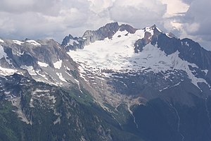
Boston Peak
| Boston Peak | ||
|---|---|---|
|
Boston Peak and Quien Sabe Glacier |
||
| height | 2711 m Sea Level Date of 1929 | |
| location | Skagit County , Washington , USA | |
| Mountains | Northern Cascade Range | |
| Notch height | 260 m | |
| Coordinates | 48 ° 29 '44 " N , 121 ° 2' 10" W | |
|
|
||
| First ascent | 1938 by Calder Bressler, Ray Clough, Bill Cox and Tom Myers | |
| Normal way | Easy snow and ice climbing | |

The Boston Peak is a higher peaks of the North Cascades in the State of Washington . It is located in the North Cascades National Park . At 8,894 ft (2,711 m) in height, it is ranked 26th on Washington's list of tallest mountains. The closest higher mountain is Buckner Mountain , located 1.66 mi (2.7 km) east.
description
Boston Peak is just north of the border between Chelan and Skagit Counties . It is connected to the east with Buckner Mountain by the sharp ridge of Ripsaw Ridge, which follows the county line. The Sahale Mountain , just south of Boston Peak; both are connected by a short ridge. A longer ridge to the northwest connects Boston Peak with Forbidden Peak . The northern slopes of Boston Peak and Ripsaw Ridge are covered by the Boston Glacier , the largest glacier in the North Cascades. The west side of Boston Peak is covered by the Quien Sabe Glacier . The Davenport Glacier occupies the southeast side of Boston Peak. East of the high peaks of Forbidden Peak, Boston Peak and Sahale Mountain, the land descends into the vast cirque of the Boston Basin. Numerous headwaters of the Cascade River flow down the slopes of the Boston Basin. The Cascade Pass , a major mountain pass in the North Cascades, located approximately 2.2 mi (3.5 km) south of Boston Peak. South of the high peaks and ridges between Sahale Mountain, Boston Peak, Ripsaw Ridge, and Buckner Mountain, there is another massive cirque, the Horseshoe Basin, from which some of the headwaters of the Stehekin River drain.
The Boston Peak lies on the border of the catchment areas of the Skagit River in the west with the Cascade River and other tributaries and the Columbia River in the east with the Stehekin River and other tributaries.
history
Boston Peak is named after the Boston Mine that operated on the south-east side of the mountain in the late 19th century. The first mining rights of the later Cascade Mining District were registered in 1889 by George Rowse and John Rouse, who called their claims "Boston" and "Chicago" respectively.
Boston Peak was first climbed in 1938 by Calder Bressler, Ray Clough, Bill Cox and Tom Myers. The ascent is a difficult scramble because the slope is steep and the rock is very loose and crumbly.
See also
- Commons : Boston Peak album with pictures, videos, and audio files
Individual evidence
- ↑ a b Boston Peak, Washington . peakbagger.com. Retrieved July 9, 2018.
- ↑ a b c d Boston Peak . peakware.com. Retrieved June 6, 2009.
- ^ Washington State 8200-foot Peaks . peakbagger.com. Retrieved July 9, 2018.
- ^ Boston Peak . peakware.com. Retrieved June 6, 2009.
- ↑ USGS . Cascade Pass quadrangle, Washington [map], 1: 24000, topographic maps, 7.5 minutes.
- ^ North Cascades National Park: Marketing the Wilderness: Development of Commercial Enterprises . National Park Service. Retrieved December 28, 2010.
Web links
- Boston Peak ( English ) In: Geographic Names Information System . United States Geological Survey .
- Boston Peak . summitpost.org. Retrieved June 6, 2009.
- Boston Peak . NOAA . Retrieved July 9, 2018.

