Brackenberg (Weserbergland)
| Brackenberg | ||
|---|---|---|
|
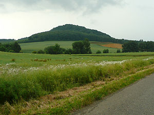
View from the northeast to the Brackenberg |
||
| height | 461 m above sea level NHN | |
| location | at Meensen ; District of Göttingen , Lower Saxony ( Germany ) | |
| Coordinates | 51 ° 25 '59 " N , 9 ° 44' 51" E | |
|
|
||
| particularities | Brackenburg castle ruins | |
The Brackenberg is 461 m above sea level. NHN high mountain of the Solling foreland in the Weser-Leine-Bergland . It is located near Meensen in the southern Lower Saxony district of Göttingen ( Germany ). The Brackenburg castle ruins are located on the mountain .
geography
Location and geology
The Brackenberg rises in the central part of the Münden Nature Park 1.3 km southwest of Meensen (southeastern part of the municipality of Scheden ), 2.5 km east-northeast of Wiershausen and 2.3 km (as the crow flies ) northeast of Lippoldshausen (the latter are eastern districts of Hann. Münden ). In the direction of Wiershausen or Lippoldshausen, the terrain of the mountain slopes down into the Werra valley.
The mountain consists of basalt and shell limestone .
Natural allocation
The Brackenberg belongs in the natural spatial main unit group Weser-Leine-Bergland (No. 37), in the main unit Solling foreland (371) and in the subunit southern Solling foreland (371.1) to the natural area of Dransfeld plateaus (371.15). The landscape drops to the southwest, west and northwest into the natural area of Schedener Rötsenke (371.11).
Protected areas
On the wooded Brackenberg there are parts of the landscape protection areas beech forests and limestone grasslands between Dransfeld and Hedemünden ( CDDA no. 555547221; designated 2011; 16 km² in size), Leinebergland (CDDA no. 322560; 1986; 25.706 km²) and Weserbergland-Kaufunger Wald (CDDA No. 325317; 1989; 285.0180 km²) as well as those of the fauna-flora-habitat area beech forests and limestone grasslands between Dransfeld and Hedemünden (FFH No. 4524-302; 14.96 km²).
Brackenburg castle ruins
The Brackenburg castle ruins are located in the forest on the top of the Brackenberg . The castle was built between 1303 and 1353 and has been in decline since 1486. There are still remains of moats, walls and walls. The ruin is freely accessible.
Individual evidence
- ↑ a b c Map services of the Federal Agency for Nature Conservation ( information )
- ^ Hans-Jürgen Klink: Geographical land survey: The natural space units on sheet 112 Kassel. Federal Institute for Regional Studies, Bad Godesberg 1969. → Online map (PDF; 6.9 MB)

