California State Route 4

|
|
|---|---|
| map | |

|
|
| Basic data | |
| Overall length: | 317 km (197 miles ) |
| Opening: | 1934 |
| Starting point: |
|
| End point: |
|
| Counties: |
Contra Costa San Joaquin Stanislaus Calaveras Alpine |
| Important cities: |
Hercules Concord Pittsburg Antioch Stockton |
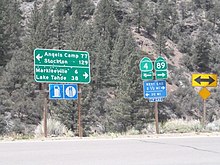
The California State Route 4 (short- CA 4 ) is a state highway in the state of California of the United States , which runs from west to east direction. The road connects the town of Hercules on San Pablo Bay with California State Route 89 in the east of the state for a distance of approximately 191 miles.
course
CA 4 begins with four lanes with two separate lanes on Interstate 80 in the San Francisco Bay Area and heads east from there. It then crosses I-680 and runs north of the town of Concord along Suisun Bay . After the city of Antioch , the road turns south for a few kilometers to bypass the Sacramento-San Joaquin River Delta before heading east again. From Brentwood the CA 4 will only have two lanes. At Stockton it crosses the San Joaquin River and Interstate 5 . From here, California State Route 4 continues through a more rural area to the west side of the Sierra Nevada . From there the road swings in a northeasterly direction and leads over the Ebbets Pass over the mountains, where it reaches an altitude of 2661 m . After the pass, the road joins California State Route 89 near the Nevada border south of Lake Tahoe .

