
California State Route 49

|
|
|---|---|
| map | |

|
|
| Basic data | |
| Overall length: | 474.9 km (295.1 mi) |
| Starting point: |
|
| End point: |
|
| Counties: |
Madera Mariposa Tuolumne Calaveras Amador El Dorado Placer Nevada Yuba Sierra Plumas |
The California State Route 49 ( CA 49 for short , also known as the Golden Chain Highway or Gold Country Highway ) is an approximately 475 km long state route in the US state of California that runs in a north-south direction.
It connects numerous places on the west side of the Sierra Nevada that were created in the course of the California gold rush and still have an often historic city center. Based on the "49ers", the prospectors who reached this area in 1849, the highway was given the number 49.
course
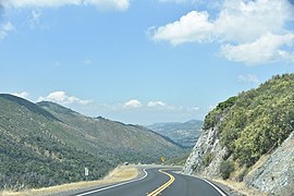
The State Route begins south on State Route 41 in the village of Oakhurst, south of Yosemite National Park . From there it leads to the northwest through the hilly foothills between the Californian long valley and the Sierra Nevada, whereby the route is comparatively curvy for almost the entire route according to the terrain. At Mariposa the California State Route 140 is crossed and at Coulterville the State Route 132 joins from the west . Further to the northwest, at the village of Moccasin , the California State Route 120 leads east over the Tioga Pass in Yosemite National Park over the mountains. Route 120 follows the same route as CA 49 to Chinese Camp . After Chinese Camp, the road meets State Route 108 for a short stretch , from which it separates before Sonora . After crossing the New Melones Lake crosses in Angels Camp , the CA 4 and Mokelumne Hill , the California State Route 26 . State Route 88 is crossed further north , while State Route 16 joins north of it. At Placerville, the State Route crosses US Highway 50 , which leads from the California capital Sacramento to the east of the country. To the north you will pass through Coloma , where gold was first found in 1848 and the California gold rush was triggered.
In Auburn which is Interstate 80 crossed. From there, the road swings north and has four lanes to Nevada City . From Grass Valley the CA 20 leads for about 8 km to Nevada City on the CA 49 and the State Route 174 joins. From around the town of Camptonville , California State Route 49 turns east and crosses the northern part of the Sierra Nevada. Between Sattley and Sierraville east of the mountains it is synonymous with the SR 89 . From there the highway heads northeast and ends at Chilcoot-Vinton on State Route 70 .

on Lake McClure
in Mariposa County

on the American River

Junction with Route 89


See also
Web links
Individual evidence
- ↑ a b c State Route 49 - Mother Lode Highway , aaroads.com, accessed July 22, 2019
- ↑ State Route 49 , cahighways.org, accessed July 22, 2019.