Carhuaz
| Carhuaz | |||
|---|---|---|---|
|
|
|||
| Coordinates | 9 ° 17 ′ S , 77 ° 39 ′ W | ||
| Symbols | |||
|
|||
| Basic data | |||
| Country | Peru | ||
| Ancash | |||
| province | Carhuaz | ||
| ISO 3166-2 | PE-ANC | ||
| District | Carhuaz | ||
| height | 2688 m | ||
| Residents | 7020 (2017) | ||
| politics | |||
| mayor | Pablo Pedro Julca Chávez (2019-2022) |
||
|
Plaza de Armas and Catedral de Carhuaz
|
|||
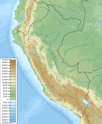
Carhuaz is the capital of the Carhuaz Province in the Ancash region of Peru . It is located in the valley of the Río Santa in the Andes high mountains in the northwest of the country.
location
Carhuaz is located in the central part of the Callejón de Huaylas in the densely populated and fertile valley of the Santa River, at the foot of the Nevado Huascarán , at 6768 m the highest mountain in Peru. The name "Carhuaz" comes from "cea huash" (yellow) and refers to the yellow color of the heather on the slopes of the surrounding mountains.
The city is located at an altitude of 2650 m above sea level between the Cordillera Blanca in the east and the Cordillera Negra in the west. The closest cities are Huaraz 20 miles upstream and Yungay 14 miles downstream.
From Carhuaz a road connection leads in an easterly direction up the Ulta brook over the pass Punta Olimpica ( 4890 m ) between Contrahierbas ( 6036 m ) and Ulta ( 5875 m ) through to Chacas ( 3360 m ) on the other side of the Cordillera Blanca.
history
Carhuaz was badly damaged in the earthquake on May 31, 1970 .
population
The population at the 2017 census was 7,020, 10 years earlier it was 5,960.
meaning
Carhuaz is an agricultural and tourist center and the city is also known for its ice cream. Ten kilometers south of Carhuaz along the Santa River is the runway of Anta Airport. Twelve kilometers south of Carhuaz is the health resort of Chacos, known for its mineral bath "The Fountain of Youth" ("Fountain of Youth"). A few kilometers from Carhuaz in a westerly direction, on the slopes of the Cordillera Negra, lies the Guitarrero Cave , with traces of human settlement from around 10,000 BC. Have been found.
Individual evidence
- ↑ Rosa Muñoz Lima: 50 años tras el terremoto de Áncash: ¿qué aprendió Perú? In: dw.com May 28, 2020, accessed on July 7, 2020 (Spanish; information in caption 7).
- ↑ Peru: Áncash Region - Provinces & Places . www.citypopulation.de. Retrieved December 19, 2019.


