Cetingrad
| Cetingrad | ||
|
||
|
|
||
| Basic data | ||
|---|---|---|
| State : |
|
|
| County : |
|
|
| Area : | 140 km² | |
| Residents : | 2,027 (2011) | |
| Population density : | 14 inhabitants per km² | |
| Telephone code : | (+385) 047 | |
| Postal code : | 47 222 | |
| License plate : | KA | |
| Structure and administration (status: 2013, cf. ) |
||
| Community type : | local community | |
| Mayor : | Milan Gašparin ( HDZ ) | |
| Postal address : | Trg hrvatskih branitelja 2 47222 Cetingrad |
|
| Website : | ||
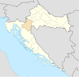
Cetingrad is a municipality in central Croatia , in the Karlovac County .
location
Cetingrad is not far from Velika Kladuša and Slunj on the Bosnian border and has 2,027 inhabitants (2011 census). In the vicinity of Cetingrad there is the castle ruin Cetin , the place where the Croatian Sabor elected the Habsburg Ferdinand I to the Croatian king in 1527 . This was documented in the Cetingrad Charter . In the background was the hope of military help in the defense of Croatia against the advancing Ottomans .
Localities
The municipality Cetingrad detected 36 places, which are: Batnoga , Begovo Brdo , Bilo , Bogovolja , Buhača , Cetin degree Cetinski Varoš , Delić Poljana , Donja Žrvnica , Donje Gnojnice , Djurin Potok , Glinice , Gnojnice , Gojkovac , Gornja Žrvnica , Gornje Gnojnice , Grabarska , Kapljuv , Kestenje , Komesarac , Kruškovača , Kuk , Luke , Maljevac , Maljevačko Selište , Pašin Potok , Podcetin , Polojski Varos , Ponor , Ruševica Sadikovac , Srednje Selo , Strmačka , Šiljkovača , Tatar Varoš and Trnovi .
population
According to the 2011 census, 2,027 people lived in the area politically belonging to the municipality of Cetingrad, including:
- Croatians - 1,510 (74.49%)
- Bosniaks - 314 (15.49%)
- Serbs - 101 (4.98%)
- Macedonians - 2nd
- Others - 100
Web links
View of Cetingrad from Cetin Castle


