
Charagua
| Charagua | |||
|---|---|---|---|
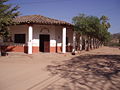
 San Miguel Church in Plaza Principal |
|||
| Basic data | |||
| Residents (state) | 3496 pop. (2012 census) | ||
| rank | Rank 123 | ||
| height | 800 m | ||
| Post Code | 07-0702-0100-1001 | ||
| Telephone code | (+591) | ||
| Coordinates | 19 ° 48 ′ S , 63 ° 12 ′ W | ||
|
|||
| politics | |||
| Department | Santa Cruz | ||
| province | Cordillera Province | ||
| climate | |||
 Climate diagram Camiri |
|||

Charagua is a country town in the Santa Cruz Department in the South American Andean state of Bolivia .
Location in the vicinity
Charagua is the central place of the Municipio Charagua in the Cordillera province . The city is located at an altitude of 800 m on the eastern edge of the Sierra Charagua , which rises five kilometers west of the city to heights of 1400 m. At Charagua, the Río Charagua breaks through the north-south ridge of the Serranía Charagua and flows east towards the Río Parapetí , but its water seeps away a few kilometers before it reaches the river.
geography
Charagua is part of the tropical climate in the South American Gran Chaco , the six-month wet season extends from November to April and the dry season from May to October.
The annual average temperature is 23 ° C (see Camiri climate diagram), with 17 to 18 ° C from June to July and over 26 ° C from November to December. The annual precipitation is almost 900 mm, the wettest months are December and January with 175 mm and the driest months July and August with almost 10 mm.
Transport network
Charagua is 260 kilometers by road south of Santa Cruz , the capital of the department.
From Santa Cruz the paved national road Ruta 9 leads over 142 kilometers in a southerly direction via Cabezas to Abapó . There the Ruta 36 continues in a southerly direction and reaches the city of Charagua via San Isidro del Espino and continues to Boyuibe .
The city is connected to the national air traffic via a runway east of the city, which has a length of 1200 m. In addition, the railway line from Santa Cruz to Yacuiba passes east of Charagua and has a stop in the Estación Charagua , seven kilometers away . From there there are passenger train connections to the north and south, which take passengers to Santa Cruz and Yacuiba in around eight and a half hours.
population
The city's population has increased by more than a third in the past two decades:
| year | Residents | source |
|---|---|---|
| 1992 | 2,486 | census |
| 2001 | 2,737 | census |
| 2013 | 3,496 | census |
Due to the historically evolved population distribution, the region has a significant proportion of Guaraní population, in the municipality of Charagua 48.8 percent of the population speak Guaraní . Since 2010, representatives of the ethnic group have been trying to work out an autonomous statute to create a self-governing Indian territory ( territorio indígena originario campesino ): Autonomía Indígena Charagua Iyambae .
photos

Military parade after Sunday mass
Charagua Municipality

Street in Charagua

Shopping street in Charagua


Individual evidence
- ↑ Bolivia: passenger train connections
- ↑ INE - Instituto Nacional de Estadística Bolivia 1992 ( Memento of the original from April 23, 2014 in the Internet Archive ) Info: The archive link was inserted automatically and has not yet been checked. Please check the original and archive link according to the instructions and then remove this notice.
- ↑ INE - Instituto Nacional de Estadística Bolivia 2001 ( Memento of the original from June 10, 2015 in the Internet Archive ) Info: The archive link has been inserted automatically and has not yet been checked. Please check the original and archive link according to the instructions and then remove this notice.
- ↑ INE - Instituto Nacional de Estadística Bolivia 2012 ( Memento of the original from July 22, 2011 in the Internet Archive ) Info: The archive link has been inserted automatically and has not yet been checked. Please check the original and archive link according to the instructions and then remove this notice.
- ↑ INE social data Santa Cruz 2001 ( Memento of the original from September 25, 2013 in the Internet Archive ) Info: The archive link has been inserted automatically and has not yet been checked. Please check the original and archive link according to the instructions and then remove this notice. (PDF; 5.2 MB)
- ↑ Ministerio de Autonomías ( Memento of the original of June 30, 2015 in the Internet Archive ) Info: The archive link was automatically inserted and not yet checked. Please check the original and archive link according to the instructions and then remove this notice. 23rd June 2015
Web links
- BoliviaBella: Charagua (English)
- Relief map of the Charagua region 1: 250,000 (PDF; 6.23 MB)
- In Bolivia vote, Indian power a central issue December 4, 2009 (English)
- Municipio Charagua - General Maps No. 70702
- Municipio Charagua - detailed map and population data (PDF; 4.28 MB) ( Spanish )
- Province of Cordillera South - road map (PDF; 677 kB)
- Department Santa Cruz - Social data of the municipalities (PDF; 4.99 MB) ( Spanish )