Chicksands Station

Chicksands Station is a former military base of the British Royal Air Force (RAF) ( Royal Air Force ). It is located 13 km southeast of Bedford in the English county of Bedfordshire and was called the Royal Air Force Chicksands (short: RAF Chicksands ). During the Second World War , there was an important listening point for the British secret service .
history
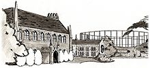
Central building is the order in 1152 built former Gilbertine - Monastery Chicksands Priory . At the beginning of World War II, in 1939, it was initially by the Royal Navy ( Navy of the United Kingdom ) and shortly afterwards by the RAF requisitioned and a radio listening station ( station Y ) of the British Government Code and Cypher School (GC & CS) ( German about "Staatliche Code- und Chiffrenschule") converted. One of the British War Office Y Groups (WOYG) (radio eavesdropping groups of the War Ministry) was stationed here, whose task it was to intercept and record the enemy, especially German radio traffic. For example, with the German Enigma machine encrypted and Morse code sent secret texts and using the Lorenz cipher encrypted secret German radio teletype (British code name Fish ) were collected in Chicksands, recorded and sent by dispatch rider ( despatch rider ) over the nearly 30 km route drove to Bletchley . There, the British Codebreakers succeeded in deciphering and evaluating the intelligence service . The German radio messages often contained important war information, which the British grouped under the code name Ultra and used for their own planning.
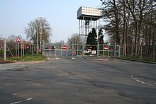
After the war, from 1950 to 1995, the station was also used by the air forces of the United States ( USAF ) also as a listening post used. Among other things, a Wullenwever antenna with a diameter of 440 m was installed in 1962 for radio direction finding . In 1997 the RAF station was closed and taken over by the Intelligence Corps of the British Army .
Web links
- Defense Intelligence and Security Center (English). Retrieved March 20, 2017.
- The Friends of Chicksands Priory (English) ( Memento from February 28, 2009 in the Internet Archive )
- Photo of the Chicksands Priory. Retrieved March 23, 2017.
- Photo of the Wullenwever antenna in Chicksands. Retrieved March 20, 2017.
- Aerial view of the base (with the Wullenwever antenna in the background). Retrieved March 20, 2017.
Individual evidence
- ↑ Defense Intelligence and Security Center (English). Retrieved March 20, 2017.
Coordinates: 52 ° 2 ′ 36 ″ N , 0 ° 21 ′ 19 ″ W.


