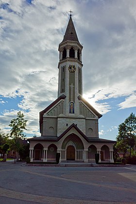
Chippis
| Chippis | |
|---|---|
| State : |
|
| Canton : |
|
| District : | Sierre |
| BFS no. : | 6235 |
| Postal code : | 3965 |
| UN / LOCODE : | CH CPS |
| Coordinates : | 608 154 / 125620 |
| Height : | 532 m above sea level M. |
| Height range : | 519–1124 m above sea level M. |
| Area : | 1.97 km² |
| Residents: | 1617 (December 31, 2018) |
| Population density : | 821 inhabitants per km² |
| Website: | www.chippis.ch |
|
Main street in Chippis |
|
| Location of the municipality | |
Chippis (Franco-Provencal [tsi'pis] , after which German Zippis used to be ) is a municipal and civic community in the district of Sierre in the French-speaking part of the Swiss canton of Valais . At the same time it forms a parish of the Deanery of Sierre .
population
| Population development | |||||||||||
|---|---|---|---|---|---|---|---|---|---|---|---|
| year | 1798 | 1850 | 1900 | 1910 | 1950 | 1990 | 2000 | 2010 | 2012 | 2014 | 2016 |
| Residents | 67 | 166 | 282 | 887 | 978 | 1635 | 1491 | 1602 | 1667 | 1651 | 1615 |
Attractions
Personalities
- Robert Dill-Bundi (* 1958), Swiss cyclist
literature
- Danielle Allet-Zwissig: Chippis. In: Historical Lexicon of Switzerland . 2009 .
Web links
Commons : Chippis - collection of pictures, videos and audio files
- Chippis on the ETHorama platform
- Official website of the municipality of Chippis (French)
Individual evidence
- ↑ Permanent and non-permanent resident population by year, canton, district, municipality, population type and gender (permanent resident population). In: bfs. admin.ch . Federal Statistical Office (FSO), August 31, 2019, accessed on December 22, 2019 .


