Columbia ice field
| Columbia ice field | ||
|---|---|---|
|
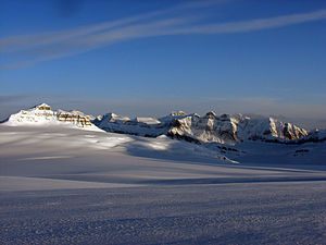
View from the Columbia Ice Field to the south, Mount Castleguard to the left |
||
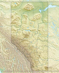
| location | Alberta , British Columbia (Canada) | |
| Mountains | Canadian Rockies | |
| surface | 325 km² | |
| Coordinates | 52 ° 9 ′ N , 117 ° 19 ′ W | |
|
|
||
|
Snowcoach on the Athabasca Glacier |
||
|
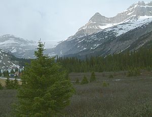
View of the edge of the Columbia Icefield (background top left) from the Icefields Parkway |
||
|
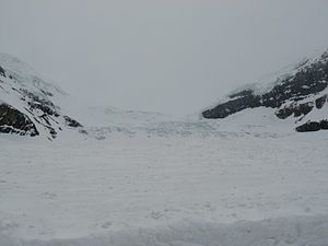
On the Athabasca Glacier |
||
The Columbia Icefield ( English Columbia Icefield ) is an extensive ice field in the Canadian Rockies in Banff and Jasper National Park .
It is one of the largest accumulations of ice south of the Arctic Circle . Its area is 325 km², the thickness 100 to 365 m and the annual amount of snowfall up to seven meters.
The ice rink is the accumulation zone of eight major glaciers , including Athabasca , the Castleguard- , the Columbia , the dome , the Stutfield- and the Saskatchewan Glacier .
In the vicinity of the ice field are some of the highest mountains in the Canadian Rockies: Mount Columbia ( 3747 m ), North Twin Peak ( 3684 m ), South Twin Peak ( 3566 m ), Mount Bryce ( 3507 m ), the Mount Kitchener ( 3505 m ), the Mount Athabasca ( 3,491 m ), the Mount King Edward ( 3490 m ), the Snow Dome ( 3456 m ), the Mount Andromeda ( 3450 m ), the Stutfield peak ( 3450 m ) and the Mount Castleguard ( 3090 m ).
The Columbia Ice Field feeds the source of several rivers, including the Athabasca River and the North Saskatchewan River . Since it is located on the watershed point of the North American continental divide , the various rivers flow into the Arctic Ocean (to the north), into the Hudson Bay and thus the Atlantic (to the east) and into the Pacific (to the south and west).
The Columbia Icefield was first reported in 1898 by J. Norman Collie and Hermann Woolley after their first ascent of Mount Athabasca.
Part of the Columbia Icefield (the Athabasca and parts of the Dome and Stutfield Glaciers) is visible from the Icefields Parkway . At this point is the Columbia Icefield Center , a tourist center from which guided tours with special buses (the Snowcoaches ) can be taken on the Athabasca Glacier in summer .
Web links
- Columbia Ice Field ( English, French ) In: The Canadian Encyclopedia .
- Columbia Icefield Area and the Athabasca Glacier on Parks Canada . engl.


