Combeauté
| Combeauté | ||
|
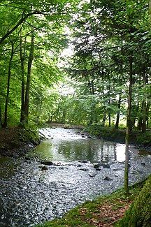
One of the arms of the river in the lower reaches of the river |
||
| Data | ||
| Water code | FR : U0450500 | |
| location | France , Grand Est and Bourgogne-Franche-Comté regions | |
| River system | Rhône | |
| Drain over | Sémouse → Lanterne → Saône → Rhône → Mediterranean | |
| source | in the municipality of Girmont-Val-d'Ajol 47 ° 58 ′ 27 ″ N , 6 ° 35 ′ 44 ″ E |
|
| Source height | approx. 670 m | |
| muzzle | in the municipality of Ainvelle in the Sémouse coordinates: 47 ° 51 ′ 15 ″ N , 6 ° 14 ′ 8 ″ E 47 ° 51 ′ 15 ″ N , 6 ° 14 ′ 8 ″ E |
|
| Mouth height | approx. 230 m | |
| Height difference | approx. 440 m | |
| Bottom slope | approx. 12 ‰ | |
| length | 37 km | |
The Combeauté is a river in France that runs in the Grand Est and Bourgogne-Franche-Comté regions. It rises in the western part of the Regional Nature Park Ballons des Vosges , in the municipality of Girmont-Val-d'Ajol and generally drains in a south-westerly direction. Below Fougerolles , the river reaches a wide alluvial floor , where the river forks in several places and divides into parallel flowing watercourses, the islands of which are mostly covered with alluvial forest . After 37 kilometers the river finally flows into the Sémouse as a left tributary in the municipality of Ainvelle . On its way, the Combeauté crosses the Vosges and Haute-Saône departments .
Places on the river
Remarks
- ↑ a b geoportail.fr (1: 16,000)
- ↑ a b The information on the length of the river is based on the information about the Combeauté at SANDRE (French), accessed on November 14, 2010, rounded to full kilometers.
