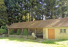
Ainvelle (Haute-Saône)
| Ainvelle | ||
|---|---|---|
|
|
||
| region | Bourgogne-Franche-Comté | |
| Department | Haute-Saône | |
| Arrondissement | Lure | |
| Canton | Saint-Loup-sur-Semouse | |
| Community association | Haute Comté | |
| Coordinates | 47 ° 51 ′ N , 6 ° 15 ′ E | |
| height | 228-298 m | |
| surface | 6.75 km 2 | |
| Residents | 148 (January 1, 2017) | |
| Population density | 22 inhabitants / km 2 | |
| Post Code | 70800 | |
| INSEE code | 70008 | |
 Mairie and Church of the Assumption |
||
Ainvelle is a commune in the French department of Haute-Saône in the region Bourgogne Franche-Comté .
geography
Ainvelle is located at an altitude of 275 m above sea level, ten kilometers west-northwest of Luxeuil-les-Bains and about 26 kilometers north-northeast of the city of Vesoul (as the crow flies). The village extends in the northern part of the department, on the plateau between the lowlands of Lanterne in the south and Sémouse in the north.
The area of the municipal area of 6.75 km² comprises a section in the gently undulating landscape north of the Lanterne valley plain. The northwestern border runs partly along the Sémouse, which flows here through an alluvial lowland to the southwest to the Lanterne. The valley level lies at an average of 230 m and has a width of around two kilometers. It is partly used for agriculture, partly with alluvial forest. The Combeauté flows from the east below Ainvelle .
From the course of the river, the community area extends southeast over the valley floodplain and an approximately 40 m high step to the adjacent plateau of Ainvelle. It consists of an alternating layer of sandy-marly and calcareous sediments that were deposited during the Lias ( Lower Jurassic ). The plateau is subdivided by several valleys that open towards the Sémouse. The highest point of Ainvelle is reached at 298 m on the Derrière les Maisons hill north of the village. The eastern boundary runs in the Bois de Varenne .
Ainvelle's neighboring municipalities are Saint-Loup-sur-Semouse in the north, Francalmont in the east, Briaucourt in the south and Plainemont and La Pisseure in the west.
history
The municipality of Ainvelle was already populated in prehistoric times. The remains of a Gallo-Roman manor and a burial ground from the Merovingian era were found on the Champ-Leclerc corridor . The church of Ainvelle is mentioned as early as the 9th century, which was under the protection of the Luxeuil monastery . In the Middle Ages, the village belonged to the Free County of Burgundy and in that part of the Bailliage d'Amont . Local rule was held by the noble von Ainvelle family, whose existence has been documented since 1208. Together with Franche-Comté , the place finally came to France with the Peace of Nijmegen in 1678.
Attractions

The village church of Ainvelle has a choir in the Gothic flamboyant style , a nave and facade built in the 18th century and a tower from the 19th century. It houses a wooden statue of Christ (16th century), a baptismal font and a ciborium from the 17th century and an altar from the 18th century. Close to the church is a manor house with two turrets (early 18th century). Also worth seeing are the Maison Chalot, the oldest parts of which date from the Renaissance , and the Notre-Dame de la Grotte. Ainvelle is the site of an archaeological museum.
population
| Population development | |
|---|---|
| year | Residents |
| 1962 | 164 |
| 1968 | 157 |
| 1975 | 155 |
| 1982 | 191 |
| 1990 | 206 |
| 1999 | 219 |
| 2006 | 169 |
With 148 inhabitants (January 1, 2017), Ainvelle is one of the small communities in the Haute-Saône department. After the population had decreased significantly in the first half of the 20th century (301 people were still counted in 1886), population growth was recorded again from 1975 to 2000. Since then, a downward trend has been observed again.
Economy and Infrastructure
Until well into the 20th century, Ainvelle was a village dominated by agriculture (arable farming, fruit growing and cattle breeding) and forestry. Today there are some local small businesses, including a sawmill. In the last few decades the village has transformed into a residential community. Many workers are therefore commuters who work in the larger towns in the area.
The village is located off the major thoroughfares near a department road that leads from Vesoul to Saint-Loup-sur-Semouse. Other road connections exist with Briaucourt, Francalmont and La Pisseure.
