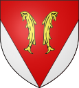
Vyans-le-Val
| Vyans-le-Val | ||
|---|---|---|

|
|
|
| region | Bourgogne-Franche-Comté | |
| Department | Haute-Saône | |
| Arrondissement | Lure | |
| Canton | Héricourt-2 | |
| Community association | Pays d'Héricourt | |
| Coordinates | 47 ° 33 ' N , 6 ° 46' E | |
| height | 339-463 m | |
| surface | 3.32 km 2 | |
| Residents | 453 (January 1, 2017) | |
| Population density | 136 inhabitants / km 2 | |
| Post Code | 70400 | |
| INSEE code | 70579 | |
 Mairie Vyans-le-Val |
||
Vyans-le-Val is a municipality in the French department of Haute-Saône in the region Bourgogne Franche-Comté .
geography
Vyans-le-Val is at an altitude of 353 m above sea level, three kilometers south of Héricourt and about five kilometers north-northwest of the city of Montbéliard (as the crow flies). The village extends to the west of the Burgundian Gate , northwest of the Montbéliard basin in a niche on the western edge of the Lizaine valley.
The area of the 3.32 km² municipal area includes a section in the area of the Burgundian Gate. The central part of the area is occupied by the basin of Vyans-le-Val, which opens to the east to the valley of the Lizaine. However, the municipal soil does not reach down into the valley floodplain. To the west, a 50 to 80 m high step leads over to the adjacent high plateaus, which are made up of limestone from the upper Jurassic period . They are partly used for agriculture, but also show larger forest areas. At 463 m, the highest point in Vyans-le-Val is reached in the Grand Bois .
Neighboring communities of Vyans-le-Val are Héricourt in the north and east, Montbéliard in the south and Laire and Tavey in the west.
history
The village of Vyans (formerly written Vians ) has been under the collegiate church of Saint-Maimboeuf of Montbéliard since 1196. Through an exchange of territory and goods, it came to the Counts of Montbéliard in 1332, who placed Vyans under the rule of Héricourt. The counts introduced the Reformation and the village church in Vyans became Lutheran in 1565 .
The place was hit several times by plague epidemics, which claimed many victims especially in the years 1578 and 1662. With the annexation of the county of Württemberg-Mömpelgard (Montbéliard) , Vyans finally came into French hands in 1793. To avoid confusion with other municipalities of the same name, Vyans was officially renamed Vyans-le-Val in 1969. Since 2001, Vyans-le-Val has been a member of the Communauté de communes du Pays d'Héricourt, which comprises 20 localities .
Attractions
The Lutheran village church of Vyans-le-Val (Temple) was rebuilt in the 19th century and replaced a previous building. Other sights include the La Cure house (16th century) and the Fontaine- Lavoir from 1888, which served as a fountain, wash house and cattle trough.
population
| Population development | |
|---|---|
| year | Residents |
| 1962 | 164 |
| 1968 | 239 |
| 1975 | 311 |
| 1982 | 384 |
| 1990 | 400 |
| 1999 | 419 |
With 453 inhabitants (January 1, 2017), Vyans-le-Val is one of the small communities in the Haute-Saône department. After the population in the first half of the 20th century had always been between 140 and 170 people, there has been a marked increase in population since the early 1960s. Since then the number of inhabitants has almost tripled.
Economy and Infrastructure
Until well into the 20th century, Vyans-le-Val was a village dominated by agriculture (arable farming, fruit growing and cattle breeding) and forestry. In addition, there are now some local small businesses. In the meantime, the village has also turned into a residential community. Many employed people are therefore commuters who work in the agglomerations of Montbéliard and Belfort .
The village is well developed in terms of traffic. It is on the main road from Montbéliard to Héricourt. The closest connection to the A36 motorway is around 8 km away.
Web links
Individual evidence
- ↑ a b See "Vyans le Val: le temple" , on: Les temples ou églises luthériennes de France , accessed on January 24, 2016.


