
Genevrey
| Genevrey | ||
|---|---|---|
|
||
| region | Bourgogne-Franche-Comté | |
| Department | Haute-Saône | |
| Arrondissement | Lure | |
| Canton | Lure-1 | |
| Community association | Triangle Vert | |
| Coordinates | 47 ° 43 ′ N , 6 ° 19 ′ E | |
| height | 289-453 m | |
| surface | 11.97 km 2 | |
| Residents | 243 (January 1, 2017) | |
| Population density | 20 inhabitants / km 2 | |
| Post Code | 70240 | |
| INSEE code | 70263 | |
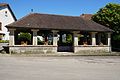
 Mairie Genevrey |
||

Genevrey is a municipality in the French department of Haute-Saône in the region Bourgogne Franche-Comté .
geography
Genevrey is located at an altitude of 315 m above sea level, five kilometers northeast of Saulx and about 17 kilometers northeast of the city of Vesoul (as the crow flies). The village extends in the central part of the department, northeast of the basin of Saulx, on a slope inclined slightly to the west in the headwaters of the Durgeon , west of the heights of Mont d'Ahie .
The area of the 11.97 km² large municipal area includes a section in the area of the Saulx basin. The main part of the area is taken up by a plateau, which is an average of 300 m and is mainly used for agriculture. It is drained to the west by the Durgeon. To the east, the terrain rises to the ridge of the Grand Bois de Genevrey, which is drawn out in a north-south direction . At this wooded height, the highest point of Genevrey is reached at 453 m. To the north a saddle leads over to the plains of Luxeuil. In the far north, the municipal area extends into the Bois la Derrière (360 m). The southern boundary runs in the area of the sources of the Ruisseau de Châteney (tributary of the Colombine ).
From a geological and tectonic point of view, the area is divided up by several fault lines running in a north-south direction. The terrain consists of alternating layers of sandy-marl and calcareous sediments that were deposited during the Lias ( Lower Jurassic ). Red sandstone and shell limestone from the Triassic period also come to light in some places .
The Bellevue settlement (316 m) on the plateau north of the Durgeon lowland belongs to Genevrey . Neighboring municipalities of Genevrey are Brotte-lès-Luxeuil and Betoncourt-lès-Brotte in the north, Ailloncourt , Dambenoît-lès-Colombe and Adelans-et-le-Val-de-Bithaine in the east, Châteney and Saulx in the south and Servigney in the west.
history
Finds from the Gallo-Roman period show that the area was settled very early. Genevrey is mentioned for the first time in 1294. In the Middle Ages the village belonged to the Free County of Burgundy and in it to the area of the Bailliage d'Amont . Local rule was held by the Lords of Faucogney. Together with Franche-Comté , the place finally came to France with the Peace of Nijmegen in 1678. In 1808 Genevrey was incorporated into Servigney. As early as 1832 it was regained its communal autonomy. Today Genevrey is a member of the community association Communauté de communes du Pays de Saulx, which comprises 17 villages .
Attractions
The Saint-Valbert church with an imperial style tower was built in the 18th century. The furnishings include furniture, paneling and paintings from this period as well as several grave slabs. The Fontaine Laveau, built in 1824, is one of the earliest covered lavoirs in Franche-Comté. It once served as a wash house and cattle trough. There is a manor house in the hamlet of Bellevue.

Saint-Valbert Church
another lavoir

Fountain

Joan of Arc statue and two Calvaires


population
| Population development | |
|---|---|
| year | Residents |
| 1962 | 232 |
| 1968 | 209 |
| 1975 | 177 |
| 1982 | 187 |
| 1990 | 197 |
| 1999 | 208 |
| 2006 | 208 |
With a population of 243 (January 1, 2017), Genevrey is one of the small communes of the Haute-Saône department. After the population had decreased significantly in the first half of the 20th century (570 people were still counted in 1881), slight population growth has been recorded since the mid-1970s.
Economy and Infrastructure
Until well into the 20th century, Genevrey was mainly a village characterized by agriculture (arable farming, fruit growing and cattle breeding) and forestry. There used to be two brickworks and a lime kiln in the hamlet of Bellevue . Today there are some local small businesses, including one in the field of feed processing. In the last few decades the village has transformed into a residential community. Many employed people are therefore commuters who work in the larger towns in the area and in the agglomeration of Vesoul. Genevrey has a golf course (Golf de Luxeuil-Bellevue).
The village is well developed in terms of traffic. It is close to the main road N57 that goes from Vesoul to Luxeuil-les-Bains . There are other road connections with Châteney, Servigney and Betoncourt-lès-Brotte.