Échavanne
| Échavanne | ||
|---|---|---|

|
|
|
| region | Bourgogne-Franche-Comté | |
| Department | Haute-Saône | |
| Arrondissement | Lure | |
| Canton | Héricourt-1 | |
| Community association | Rahin et Cherimont | |
| Coordinates | 47 ° 39 ′ N , 6 ° 44 ′ E | |
| height | 351-444 m | |
| surface | 3.21 km 2 | |
| Residents | 205 (January 1, 2017) | |
| Population density | 64 inhabitants / km 2 | |
| Post Code | 70400 | |
| INSEE code | 70205 | |
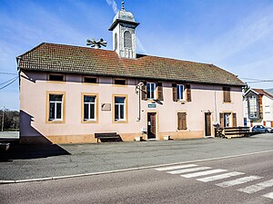
 Mairie Échavanne |
||
Échavanne is a municipality in the French department of Haute-Saône in the region Bourgogne Franche-Comté .
geography
Échavanne is located at an altitude of 364 m above sea level, about eleven kilometers west of the city of Belfort (as the crow flies). The village extends in the southern foothills of the Vosges , in a basin of the Lizaine , on the Ruisseau des Noriandes and on the eastern edge of the Chérimont .
The area of the 3.21 km² large municipality covers a section in the southern Vosges foothills. The main part of the area is occupied by a wide valley basin, which averages 360 m. It is traversed from north to south by the Lizaine, which forms the eastern boundary of the municipality and provides drainage to the Allan . The northern border marks its right tributary Ruisseau des Noriandes . In hollows and valleys there are various ponds that were once created for fish farming. The community area extends to the west to the wooded foothills of the Chérimont, on which the highest elevation of Échavanne is reached at 444 m. These elevations are part of the hill country, which forms the southwestern continuation of the Vosges and in the vicinity of Échavanne is made up partly of red sandstone and partly of Permian layers.
Neighboring municipalities of Échavanne are Champagney in the north, Frahier-et-Chatebier in the east and Chenebier in the south and west.
history
The municipality of Échavanne was already settled in Gallo-Roman times, as evidenced by the remains of a villa discovered in 1835. The place is mentioned for the first time under the Latinized name Cavennacum . In the Middle Ages, Échavanne belonged to the Counts of Montbéliard, who placed the place under the rule of Héricourt in 1346 . When the Guisen invaded (1587) and during the Thirty Years War (1636), Échevanne was pillaged and sacked. In 1748 the village finally came under contract to the French crown. Since 2003, Échavanne has been a member of the Communauté de communes de Rahin et Chérimont, which comprises nine localities . Échavanne does not have its own church; it belongs to the Catholic parish of Frahier and the Reformed parish of Chenebier.
population
| Population development | |
|---|---|
| year | Residents |
| 1962 | 116 |
| 1968 | 124 |
| 1975 | 125 |
| 1982 | 181 |
| 1990 | 205 |
| 1999 | 200 |
| 2017 | 205 |
With 205 inhabitants (January 1, 2017) Échavanne is one of the small communities in the Haute-Saône department. After the population had decreased in the first half of the 20th century (184 people were still counted in 1886), a significant increase in population has been recorded again since the mid-1970s.
Economy and Infrastructure
Until well into the 20th century, Échavanne was mainly characterized by agriculture (arable farming, fruit growing and cattle breeding), fish farming and forestry. In addition, there are now various local small businesses. In the meantime, the village has also turned into a residential community. Many employed people are therefore commuters who go to work in the larger towns in the vicinity and in the Belfort-Montbéliard agglomeration.
The village is well developed in terms of traffic. It is close to the main road N19 which leads from Belfort to Lure . The closest connection to the A36 motorway is around 14 kilometers away. Other road connections exist with Chagey and Chenebier.
