Mollans
| Mollans | ||
|---|---|---|
|
|
||
| region | Bourgogne-Franche-Comté | |
| Department | Haute-Saône | |
| Arrondissement | Lure | |
| Canton | Lure-2 | |
| Community association | Triangle Vert | |
| Coordinates | 47 ° 39 ′ N , 6 ° 22 ′ E | |
| height | 282-358 m | |
| surface | 13.45 km 2 | |
| Residents | 234 (January 1, 2017) | |
| Population density | 17 inhabitants / km 2 | |
| Post Code | 70240 | |
| INSEE code | 70351 | |

|
||
Mollans is a municipality in the French department of Haute-Saône in the region Bourgogne Franche-Comté .
geography
Mollans is located at an altitude of 303 m above sea level, ten kilometers west-southwest of Lure and about 17 kilometers east of the city of Vesoul (as the crow flies). The village extends in the central part of the department, in the basin of the Ruisseau de la Prairie on the southern edge of the height of the Bois de Venet.
The area of the municipality of 13.45 km² covers a section in the undulating landscape between the basin of Vesoul in the west and the plain of Lure in the east. The western part of the area is taken up by the alluvial lowlands of the Lauzin, which provides drainage to the south to the Ognon . From the north it takes on the Ruisseau de la Prairie (Dorfbach von Mollans). The valley is on average 290 m and is up to three kilometers wide. It is mainly used for agriculture.
To the northeast, the terrain rises slightly to a plateau (around 320 m). This is flanked by the wooded heights of the Grand Bois de Mollans (at 358 m the highest elevation in Mollans) and the Bois du Fays . The north-eastern boundary is marked by the Razou brook . From a geological and tectonic point of view, the terrain consists mainly of alternating layers of sandy-marly and calcareous sediments that were deposited during the Lias (Lower Jurassic). In some places in the Grand Bois de Mollans, shell limestone from the Middle Triassic also emerges.
Neighboring municipalities of Mollans are Genevreuille and Amblans-et-Velotte in the north, Vy-lès-Lure in the east, Arpenans and Montjustin-et-Velotte in the south and Liévans and Pomoy in the west.
history
Remains of a Roman traffic route indicate an early inspection and settlement of the area. In the Middle Ages Mollans belonged to the Free County of Burgundy and in it to the area of the Bailliage d'Amont . The existence of a noble family called Mollans has been documented since the 11th century. Together with Franche-Comté , the place finally came to France with the Peace of Nijmegen in 1678. After the French Revolution, Mollans became the capital of the canton of the same name, which, however, was incorporated into the canton of Lure as early as 1801. Today Mollans is a member of the communal association Communauté de communes des Franches-Communes, which comprises 14 localities .
Attractions
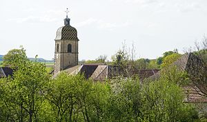
The village church of Mollans was built in the 17th and 18th centuries. The remarkable furnishings include a statue of the Virgin Mary (18th century), wood paintings (17th century), furniture and paintings from the 18th and 19th centuries. Century, including two beautiful confessionals and several grave slabs. The iron cross on the rectory was erected in thanks for sparing the village from a plague epidemic. On the north-western outskirts there is a mansion from the 19th century. The three wash houses (see wash house Burio and wash house (Mollans) ) from the 19th century, whose roofs are supported by numerous columns, are also worth seeing . They once served as a wash house and cattle trough.
population
| Population development | |
|---|---|
| year | Residents |
| 1962 | 260 |
| 1968 | 236 |
| 1975 | 240 |
| 1982 | 216 |
| 1990 | 233 |
| 1999 | 226 |
| 2006 | 245 |
With 234 inhabitants (January 1, 2017), Mollans is one of the small communities in the Haute-Saône department. After the population had decreased significantly in the first half of the 20th century (614 people were still counted in 1906), only relatively minor fluctuations have been recorded since the beginning of the 1970s.
Economy and Infrastructure
Mollans was a village dominated by agriculture (arable farming, fruit growing and cattle breeding) and forestry until well into the 20th century. Today there are some local small businesses. In the last few decades the village has transformed into a residential community. Many employed people are therefore commuters who work in the larger towns in the area and in the agglomeration of Vesoul.
The village is well developed in terms of traffic. It is located near the main road N19, which leads from Vesoul via Lure to Belfort . There are other road links with Noroy-le-Bourg , Pomoy, Vy-lès-Lure and Arpenans.
