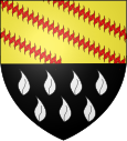
Malbouhans
| Malbouhans | ||
|---|---|---|

|
|
|
| region | Bourgogne-Franche-Comté | |
| Department | Haute-Saône | |
| Arrondissement | Lure | |
| Canton | Lure-1 | |
| Community association | Pays de Lure | |
| Coordinates | 47 ° 43 ' N , 6 ° 35' E | |
| height | 310-517 m | |
| surface | 7.80 km 2 | |
| Residents | 335 (January 1, 2017) | |
| Population density | 43 inhabitants / km 2 | |
| Post Code | 70200 | |
| INSEE code | 70328 | |

|
||
Malbouhans is a municipality in the French department of Haute-Saône in the region Bourgogne Franche-Comté .
geography
Malbouhans is located at an altitude of 322 m above sea level, seven kilometers east-northeast of Lure and about 33 kilometers east-northeast of the city of Vesoul (as the crow flies). The village extends in the eastern part of the department, on the eastern edge of the plain of Lure, east of the lowland of the Ognon , at the foot of the Vosges .
The area of the 7.80 km² large municipal area includes a section of the plain of Lure. The alluvial plain on the edge of the Vosges averages 320 m. The plain consists of sand and gravel sediments that were deposited during the Pleistocene in the run-up to the Vosges glaciers. The predominantly agricultural area is drained via the Ruisseau de l'Étang de Malbouhans south to the Rahin . In the west, Malbouhans has a share in the runway systems of the former Lure-Malbouhans airfield. The site is currently being used for a new purpose.
The southern boundary runs in the forest of Le Fays with the hill of the Bémont (346 m). To the east, the community area extends up the steep slope of Mont de Vannes . On this forest-covered ridge, which is one of the south-western outposts of the Vosges, the highest point of Malbouhans is reached at 617 m. From a geological and tectonic point of view, the lower parts consist of crystalline bedrock, and in higher areas of red sandstone from the lower Triassic .
The La Verrerie (327 m) settlement at the foot of Mont de Vannes belongs to Malbouhans . Neighboring municipalities of Malbouhans are Saint-Barthélemy in the north, Ronchamp in the east, La Côte in the south and La Neuvelle-lès-Lure in the west.
history
Remains of the Roman traffic route that led from Luxeuil to Mandeure point to a very early inspection and settlement of the area. Malbouhans is first mentioned in the 12th century under the name Malboens . The names Malboans and Maboens (1187) have been handed down from a later period , and the current spelling has been documented since 1279. The place name goes back to the Germanic personal name Madalbod . Together with the suffix -ans it means something like that of the people of Madalbod .
In the Middle Ages Malbouhans belonged to the Free County of Burgundy and in it to the area of the Bailliage d'Amont . Local rule was held by the Lords of Faucogney. Together with Franche-Comté , the place finally came to France with the Peace of Nijmegen in 1678. Malbouhans became known nationwide in the 19th century thanks to its two glass factories that produced, among other things, glass for stained church windows and a semi-transparent, porcelain-like glass for sugar bowls and fruit bowls. Today Malbouhans is a member of the community association Communauté de communes du Pays de Lure, which comprises 22 localities .
Attractions
Malbouhans Church was built in the neo-Romanesque style and consecrated in 1901. It houses gilded statues of Mary and Joseph from the 18th century. The buildings of the former La Saulnaire glassworks date from the 19th century and have served as an orphanage since 1877. There is a chapel next to it.
population
| Population development | |
|---|---|
| year | Residents |
| 1962 | 347 |
| 1968 | 333 |
| 1975 | 343 |
| 1982 | 335 |
| 1990 | 356 |
| 1999 | 339 |
| 2006 | 378 |
With 335 inhabitants (January 1, 2017) Malbouhans is one of the smaller municipalities in the Haute-Saône department. After the population had decreased significantly in the first half of the 20th century (592 people were counted in 1881), slight population growth has been recorded since the beginning of the 1980s.
Economy and Infrastructure
In addition to the glass industry, Malbouhans was mainly a village characterized by agriculture (arable farming, fruit growing and cattle breeding) and forestry until well into the 20th century. Today there are some local small businesses, mainly in the wood processing and precision engineering industries. In the last few decades the village has transformed into a residential community. Many workers are therefore commuters who work in the larger towns in the area.
The village is located off the major thoroughfares on a department road that leads from Ronchamp to Mélisey. Further road connections exist with La Côte and La Neuvelle-lès-Lure.
