Crieu
| Crieu | ||
|
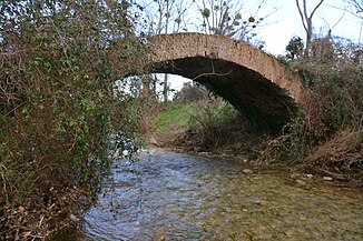
Old bridge over the river at Verniolle |
||
| Data | ||
| Water code | FR : O13-0400 | |
| location | France , Occitania region | |
| River system | Garonne | |
| Drain over | Ariège → Garonne → Atlantic Ocean | |
| source | in the municipality of Ventenac 42 ° 59 ′ 22 ″ N , 1 ° 44 ′ 29 ″ E |
|
| Source height | approx. 510 m | |
| muzzle | in the municipality of Saverdun in the Ariège coordinates: 43 ° 13 ′ 23 ″ N , 1 ° 35 ′ 32 ″ E 43 ° 13 ′ 23 ″ N , 1 ° 35 ′ 32 ″ E |
|
| Mouth height | approx. 226 m | |
| Height difference | approx. 284 m | |
| Bottom slope | approx. 8.1 ‰ | |
| length | approx. 35 km | |
The Crieu is a river in France that runs in the Ariège department in the Occitanie region . It rises in the southern municipality of Ventenac , generally drains north-northwest and after around 35 kilometers flows into the Ariège as a right tributary in the municipality of Saverdun . In its lower reaches the Crieu crosses the A66 motorway .
Places on the river
(Order in flow direction)
- Ventenac
- Malléon
- Ségura
- Saint-Félix-de-Rieutord
- Coussa
- Verniolle
- La Tour-du-Crieu
- Pamiers
- Villeneuve-du-Paréage
- Le Vernet
- Peyroutet , municipality of Montaut
- Larlenque , Saverdun municipality
Web links
Commons : Crieu - collection of images, videos and audio files
