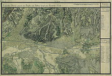
Cutina
|
Cutina Kuttina Gutonya |
||||
|
||||
| Basic data | ||||
|---|---|---|---|---|
| State : |
|
|||
| Historical region : | Banat | |||
| Circle : | Timiș | |||
| Municipality : | Chapels | |||
| Coordinates : | 45 ° 50 ' N , 21 ° 56' E | |||
| Time zone : | EET ( UTC +2) | |||
| Residents : | 364 (2002) | |||
| Postal code : | 307053 | |||
| Telephone code : | (+40) 02 56 | |||
| License plate : | TM | |||
| Structure and administration | ||||
| Community type : | Village | |||
Cutina (German: Kuttina , Hungarian: Gutonya ) is a village in Timiș County , Banat , Romania . Cutina belongs to the Bethausen community .
Geographical location
Cutina is located in the east of Timiș County, on the DJ 609B Făget - Lugoj county road , 21 kilometers from Făget and 24 kilometers from Lugoj.
Neighboring places
| Fădimac | Lăpușnic | Cladova |
| Bodo |

|
Chapels |
| Țipari | Nevrincea | Cliciova |
history
The village was first mentioned in 1440 under the names Gwthonia and Bwthonya . On the Josephine land survey of 1717 the place Kuttina is registered with 20 houses. After the Austro-Hungarian Compromise (1867), the Banat was annexed to the Kingdom of Hungary within the dual monarchy of Austria-Hungary . The official place name was Gutonya . The Treaty of Trianon on June 4, 1920 resulted in the Banat being divided into three parts, whereby Cutina fell to the Kingdom of Romania .
Demographics
| census | Ethnicity | |||||||
|---|---|---|---|---|---|---|---|---|
| year | Residents | Romanians | Hungary | German | Other | |||
| 1880 | 845 | 839 | 4th | 2 | - | |||
| 1910 | 969 | 963 | 2 | 4th | - | |||
| 1930 | 876 | 865 | 1 | 2 | 8th | |||
| 1977 | 521 | 519 | 2 | - | - | |||
| 2002 | 364 | 362 | 2 | - | - | |||
Web links
- cjtimis.ro , Brief history of Cutina
- youtube.com , Cutina on YouTube
- basilica.ro , Diocese of Făget: Blessing of the Church in Cutina


