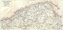
Czajcze (Mielno)
| Czajcze | ||
|---|---|---|
 Help on coat of arms |
|
|
| Basic data | ||
| State : | Poland | |
| Voivodeship : | West Pomerania | |
| Powiat : | Koszalin | |
| Geographic location : | 54 ° 17 ' N , 16 ° 9' E | |
| Residents : | ||
Czajcze ( German Deep , also Kösliner Deep ) is a fishing village in the city-and-country municipality Mielno ( Großmöllen ) in the Polish West Pomeranian Voivodeship .
Geographical location
The village is located in Western Pomerania , on the 500 to 700 meter wide spit between Lake Jamno (in Polish: Jamno ) and the Baltic Sea , about twelve kilometers north of Köslin ( Koszalin ). Neighboring towns are Unieście ( Nest ) in the southwest and Łazy ( Laase ) in the east.
history

The old fishing village was built around the turn of the 14th to the 15th century and was named after the nearby flowing connecting canal, Tief or Deep , through which water flows from the Jamunder Lake into the Baltic Sea . In the great storm of 1552, six of the 21 existing cottages were destroyed. In 1784 there were 13 fishermen's cottages, a schoolmaster and 13 fireplaces (households) in Deep. In 1864 there were 21 cottages in Deep, in which 24 families and a total of 117 residents lived. The fishermen practiced coastal fishing on the Baltic Sea and in summer and winter also fishing on the Jamunder Lake. Peat was used as fuel, which was cut in the Puddemdorfer Moor .
Towards the end of World War II , Deep got caught up in the war in the spring of 1945 and was eventually occupied by the Red Army . Subsequently, the region - like all of Western Pomerania - was placed under Polish administration. The German place Deep was given the Polish name Czajcze . In the following months the Alteinwohner were from Deep sold .
Population development
| year | Residents | Remarks |
|---|---|---|
| 1864 | 117 | in 24 families, spread over 21 houses |
| 1925 | 131 | including 130 Evangelicals and one Catholic |
| 1933 | 137 | |
| 1939 | 120 |
literature
- Ludwig Wilhelm Brüggemann : Detailed description of the current state of the Königl. Prussian Duchy of Vor and Hinter Pomerania . Part II, Volume 2: Description of the court district of the Royal. State colleges in Cößlin belonging to the Eastern Pomeranian districts . Stettin 1784, p. 513, paragraph (2).
- Johann Ernst Benno : The history of the city of Coeslin from its foundation to the present day . Cöslin 1840, p. 193, paragraph 4).
- Heinrich Berghaus : Land book of the Duchy of Pomerania and the Principality of Rügen . Part III, Volume 1, Anklam 1867, pp. 222-223.
Individual evidence
- ↑ Detailed description of the current state of the Royal Prussian Duchy of Western and Western Pomerania ( Ludwig Wilhelm Brüggemann , ed.). Part II, Volume 2, Stettin 1784, p. 513, paragraph (2).
- ^ A b Heinrich Berghaus : Land book of the Duchy of Pomerania and the Principality of Rügen . Part III, Volume 1, Anklam 1867, pp. 222-223.
- ↑ The community Deep in the former Köslin district in Pomerania (Gunthard Stübs and Pomeranian Research Association)
- ↑ a b Michael Rademacher: German administrative history from the unification of the empire in 1871 to the reunification in 1990. koeslin.html # ew39kslnhdeep. (Online material for the dissertation, Osnabrück 2006).
Web links
- The community Deep in the former Köslin district in Pomerania (Gunthard Stübs and Pomeranian Research Association)

