
Villages in the urban area of Meppen
Apeldorn, Bokeloh, Borken, Groß Fullen, Klein Fullen, Helte, Hemsen, Holthausen, Hüntel, Rühle, Schwefingen, Teglingen and Versen, the villages in the urban area of Meppen , were incorporated into Lower Saxony as part of the 1974 municipal reform. Until then there were 13 independent municipalities.
| Location of the incorporated villages in the urban area of Meppen | ||
|---|---|---|
Situation in Germany:
|
|
|

Apeldorn
Coordinates: 52 ° 45 ' N , 7 ° 24' E
origin of the name
Apeldorn was called Apaldrun around 850 . un probably stands for settlement; in the remaining part of the word the basic word appears as third and the defining word apul clearly. It is the Nordic apaldr , which initially means apple tree, then also tree in general (cf. Gering, Glossary for the songs of the Edda, 4th ed. 1915, sv apaldr.). The ter , tree with un, is later no longer understood and, as in some of the same formations, reinterpreted as thorn . The Emsland historian Diepenbrock mentions that the village of Apeldorn was already known under the name of apulderion around 978 . This is interpreted as an apple orchard .
Description of the place
Mayor: Franz-Josef Wienert

In 2005 Apeldorn had about 780 inhabitants on an area of 20.98 km².
The most famous sight in Apeldorn is the large stone grave , which was built between 2300 and 1800 BC. BC ( Neolithic ) was built.
The sports club is SC Apeldorn with nine soccer teams, the gymnastics group and women's gymnastics. The St. Antonius shooting club is also based in Apeldorn . There is also a theater group that performs with Low German plays.
Population development
| year | 1821 | 1848 | 1871 | 1885 | 1905 | 1925 | 1933 | 1939 | 1946 | 1950 | 1956 | 1961 | 1971 | 2005 |
|---|---|---|---|---|---|---|---|---|---|---|---|---|---|---|
| Residents | 218 | 226 | 200 | 215 | 194 | 278 | 428 | 440 | 552 | 605 | 580 | 553 | 660 | 777 |
Bokeloh
Coordinates: 52 ° 42 ' N , 7 ° 21' E
origin of the name
The name Bokeloh is made up of the qualifier boke (beech) and the basic word lo , loh also la (wood). The name means beech wood.
Description of the place
Mayor: Marita Westermann

In 2005 Bokeloh had a good 1250 inhabitants on an area of 4.45 km² and is located on the Hase in the east of the city area.
The painter Otto Pankok lived in Bokeloh with his family from 1938 to 1941 , so that he could live and work undisturbed by the National Socialists . In the old village school, which was renovated in 2002, he is remembered in a permanent exhibition.
With St. Vitus Bokeloh, Bokeloh owns a church that is more than 1000 years old, which is probably the oldest in the district. Bokeloh represents a special case regarding property:
According to an unsecured history, the secretary responsible for the secularization of ecclesiastical property in the Napoleonic times was a cousin of the pastor of St. Vitus in Bokeloh to the bishop of Osnabrück. He managed to put the Bokeloh file on the back burner until these bad times for ecclesiastical property were over. In this way, all the land in the village of Bokeloh remained the property of the parish until the 1960s (in contrast to the directly adjacent areas outside the town limits such as in Hofe (the Jansen and Meyring farms) and Vormeppen (the Wekenborg farm)). Only then could the citizens of the village buy the land on which their houses stood.
Population development
| year | 1821 | 1848 | 1871 | 1885 | 1905 | 1925 | 1933 | 1939 | 1946 | 1950 | 1956 | 1961 | 1971 | 2005 |
|---|---|---|---|---|---|---|---|---|---|---|---|---|---|---|
| Residents | 77 | 83 | 85 | 81 | 118 | 143 | 174 | 213 | 312 | 320 | 57 | 413 | 917 | 1253 |

Saint Vitus, 10th century

Saint Vitus, detail

Sankt Vitus, 1462, extension of the Gothic choir
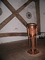
Saint Vitus, holy water font


Bark
Coordinates: 52 ° 44 ' N , 7 ° 17' E
Description of the place
Mayor: Annelene Ewers

In 2005, Borken had almost 550 inhabitants on an area of 10.28 km² and belongs to the northern districts of Meppens . In the area of the once independent municipality of Borken, surrounded by an oxbow lake of the Ems , is the nature reserve " Borkener Paradies ". It is a historical hut pasture , which is characteristic of the cultural landscape of northwest Germany. Earlier this was about 30 hectares large Allmendegebiet used as pasture. Moist and dry pastures alternate with blackthorn bushes and oak groves. Due to the ongoing grazing, the character of this landscape will be preserved in the future.
Population development
| year | 1821 | 1848 | 1871 | 1885 | 1905 | 1925 | 1933 | 1939 | 1946 | 1950 | 1956 | 1961 | 1971 | 2005 |
|---|---|---|---|---|---|---|---|---|---|---|---|---|---|---|
| Residents | 56 | 77 | 99 | 100 | 106 | 97 | 101 | 210 | 225 | 201 | 190 | 194 | 247 | 545 |

NSG "Borkener Paradies"

NSG "Borkener Paradies"

NSG "Borkener Paradies"


To fill
According to Diepenbrock, Fullen was first mentioned in a document as vollun 854.
Mayor: Ferdinand Redeker
origin of the name
Fullen ( old form: Vollen ) can be related to the Old High German volo , horse, which is already contained in the Merseburg magic spells ("Do wart deme Balders volon sin fuoz birenkit"). But it is also conceivable that Vollen can be derived from fole ( volde , valde ). That means hurdle .
- Big fill
Coordinates: 52 ° 42 ' N , 7 ° 14' E
Description of the place Groß Fullen

In 2005, Groß Fullen had a good 1070 inhabitants on an area of 17.34 km². It is located on the old left-Emsian trade route known as the Frisian Road .
Population development
| year | 1821 | 1848 | 1871 | 1885 | 1905 | 1925 | 1933 | 1939 | 1946 | 1950 | 1956 | 1961 | 1971 | 2005 |
|---|---|---|---|---|---|---|---|---|---|---|---|---|---|---|
| Residents | 363 | 354 | 396 | 374 | 414 | 449 | 503 | 551 | 714 | 708 | 647 | 628 | - | 1072 |
- Small fill
Coordinates: 52 ° 41 ′ N , 7 ° 14 ′ E
Description of the place Klein Fullen

In 2005 Klein Fullen had a good 400 inhabitants on an area of 15.02 km². It is located on the old left-Emsian trade route known as the Frisian Road .
Population development
| year | 1821 | 1848 | 1871 | 1885 | 1905 | 1925 | 1933 | 1939 | 1946 | 1950 | 1956 | 1961 | 1971 | 2005 |
|---|---|---|---|---|---|---|---|---|---|---|---|---|---|---|
| Residents | 307 | 281 | 280 | 260 | 279 | 305 | 316 | - | 408 | 405 | 387 | 406 | - | 401 |

Small fill, buildings

Small fill, buildings


Helte
Coordinates: 52 ° 40 ′ N , 7 ° 21 ′ E
origin of the name
Helte , old Hellithi around 1000, consists of the defining word bright (elongated elevation) and the basic word lithi (dependent terrain). Helte is called sloping terrain on a long elevation.
Description of the place
Mayor: Ewald Holt

In 2005 Helte had almost 600 inhabitants on an area of 12.12 km² and is located in the east of the urban area of Meppen .
Population development
| year | 1821 | 1848 | 1871 | 1885 | 1905 | 1925 | 1933 | 1939 | 1946 | 1950 | 1956 | 1961 | 1971 | 2005 |
|---|---|---|---|---|---|---|---|---|---|---|---|---|---|---|
| Residents | 260 | 285 | 263 | 312 | 287 | 331 | 328 | 316 | 450 | 412 | 393 | 400 | 424 | 596 |
Hems
Coordinates: 52 ° 44 ' N , 7 ° 17' E
Mayor: Annelene Ewers

In 2005, Hemsen had 750 inhabitants on an area of 10.76 km² and belongs to the northern districts of Meppens .
Population development
| year | 1821 | 1848 | 1871 | 1885 | 1905 | 1925 | 1933 | 1939 | 1946 | 1950 | 1956 | 1961 | 1971 | 2005 |
|---|---|---|---|---|---|---|---|---|---|---|---|---|---|---|
| Residents | 122 | 134 | 152 | 164 | 158 | 273 | 292 | 331 | 456 | 445 | 454 | 453 | 572 | 750 |
Holthausen
Coordinates: 52 ° 44 ' N , 7 ° 15' E
Mayor: Annelene Ewers

Holthausen was first mentioned in a document in 890 as holthusun . In 2005 it had a good 140 inhabitants on an area of 3.21 km², belongs to the northern districts of Meppens and is the smallest district of the city.
Population development
| year | 1821 | 1848 | 1871 | 1885 | 1905 | 1925 | 1933 | 1939 | 1946 | 1950 | 1956 | 1961 | 1971 | 2005 |
|---|---|---|---|---|---|---|---|---|---|---|---|---|---|---|
| Residents | 59 | 71 | 59 | 56 | 51 | 74 | 85 | 72 | 100 | 81 | 82 | 105 | 134 | 142 |
Hüntel

Coordinates: 52 ° 45 ' N , 7 ° 15' E
Mayor: Annelene Ewers
Description of the place

In 2005, Hüntel had almost 330 inhabitants on an area of 10.73 km² and belongs to the northern districts of Meppens .
The Dutch entrepreneur Hendrikus van der Most plans to build the amusement park " Fun-Park-Hüntel " (comparable to Wunderland Kalkar ) on the site of the former gas power station in Meppen-Hüntel by 2009 . A map of the world is painted on the cooling tower of the power plant.
Population development
| year | 1821 | 1848 | 1871 | 1885 | 1905 | 1925 | 1933 | 1939 | 1946 | 1950 | 1956 | 1961 | 1971 | 2005 |
|---|---|---|---|---|---|---|---|---|---|---|---|---|---|---|
| Residents | 95 | 96 | 93 | 89 | 80 | 142 | 107 | 177 | 187 | 166 | 173 | 162 | 274 | 328 |
Rühle
Coordinates: 52 ° 40 ′ N , 7 ° 15 ′ E

Description of the place
Mayor: Juliane Große-Neugebauer

In 2005, Rühle had almost 1370 inhabitants and is located on the old left-hand Semsian trade route known as the Frisian Road .
The place was first mentioned in a document in 1241, but according to historians' estimates it is one of the oldest settlements , which began around 800 BC. In today's Emsland . After a self-government valid until 1970, Rühle was merged with the neighboring municipalities to form the municipality of Emslage in 1970 and was incorporated into the nearby town of Meppen in 1974 . The municipal areas beyond the Süd-Nord-Straße today belong to the municipality of Twist (Rühlermoor and Rühlerfeld ).
The place, which is still characterized today by a characteristic close to nature and oriented towards agriculture , maintains a lively club life and is also involved in the social field through activities of the village community .
Population development
| year | 1821 | 1848 | 1871 | 1885 | 1905 | 1925 | 1933 | 1939 | 1946 | 1950 | 1956 | 1961 | 1971 | 2005 | 2016 |
|---|---|---|---|---|---|---|---|---|---|---|---|---|---|---|---|
| Residents | 282 | 270 | 269 | 302 | 335 | 522 | 817 | 819 | 1136 | 1198 | 1502 | 1610 | - | 1368 | 1397 |
Schwefingen
Coordinates: 52 ° 39 ′ N , 7 ° 16 ′ E
origin of the name
The name of the village comes from the late Middle Ages. In the past he also appeared as "Svevinge" or "Sweuinge". The ending “ingen” is found in many place names, such as Lingen or Teglingen. It means place or village.
Description of the place
Mayor: Marlies Gruber

Schwefingen had 450 inhabitants in 2007 on an area of 9.33 km² and is located in the southern part of the city.
Population development
| year | 1821 | 1848 | 1871 | 1885 | 1905 | 1925 | 1933 | 1939 | 1946 | 1950 | 1956 | 1961 | 1971 | 2005 |
|---|---|---|---|---|---|---|---|---|---|---|---|---|---|---|
| Residents | 128 | 120 | 111 | 94 | 106 | 103 | 139 | 207 | 213 | 204 | 190 | 216 | 309 | 442 |
Clubs: Sports club Sportfreunde Schwefingen (approx. 500 members), Schützenverein St. Josef Schwefingen Varloh (approx. 400 members)
Teglingen
Coordinates: 52 ° 40 ′ N , 7 ° 21 ′ E
origin of the name
Teglingen was mentioned in the 9th century as Tehtlingi (h as ch spoken). The term techt denotes a place of justice. The basic word linge denotes a watercourse, a brook. On the whole, a place of justice on a watercourse was named here. At this place there was a trademark court, where the rural wooden court (Hölting) was held until around 1700 .
Description of the place
Mayor: Heinz Hackmann

In 2007 Teglingen had a good 1150 inhabitants on an area of 10.47 km² and is located in the south-east of the city.
Population development
| year | 1821 | 1848 | 1871 | 1885 | 1905 | 1925 | 1933 | 1939 | 1946 | 1950 | 1956 | 1961 | 1971 | 2005 | 2007 |
|---|---|---|---|---|---|---|---|---|---|---|---|---|---|---|---|
| Residents | 294 | 290 | 289 | 266 | 315 | 452 | 511 | 552 | 685 | 712 | 580 | 568 | 588 | 771 | 1150 |
Clubs: Schützenverein St. Hubertus Teglingen (200 members), Sportverein Teglingen 1957 e. V. (900 members) and Heimatverein Teglingen 2006 e. V.
Verse

Coordinates: 52 ° 43 ' N , 7 ° 14' E
Description of the place
Mayor: Gerhard Gels

Versen had almost 1800 inhabitants in 2005 and is located on the Ems as well as on the federal road 402 (B 402) and the federal motorway 31 (A 31). The old left-Emsian trade route, the so-called Friesische Strasse , runs through the town. The place was first mentioned in a document in 854 as fersne . Versen celebrated its 1150th anniversary in 2004.
Versen became known far beyond the Emsland through the discovery of the bog body " Roter Franz ". For a long time it was considered to be the best preserved bog corpse. The "Red Franz" was found in June 1900. Latest Untersuchungeng date the death of "Emsland-Ötzi" in the period 252-388 n. Chr.
In the era of National Socialism was in verse one of the summer of 1938 Emslandlager been established.
Population development
| year | 1821 | 1848 | 1871 | 1885 | 1905 | 1925 | 1933 | 1939 | 1946 | 1950 | 1956 | 1961 | 1971 | 2005 |
|---|---|---|---|---|---|---|---|---|---|---|---|---|---|---|
| Residents | 332 | 379 | 370 | 358 | 364 | 374 | 468 | 498 | 659 | 878 | 926 | 1123 | - | 1795 |