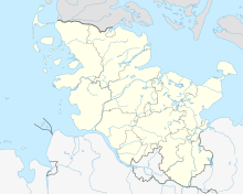
Dune at the Treßsee
Coordinates: 54 ° 42 ′ 26 ″ N , 9 ° 28 ′ 22 ″ E

The dune at the Treßsee is a small inland dune field south of Flensburg in the state of Schleswig-Holstein and in the Schleswig-Flensburg district near the Treßsee . The area is part of the Obere Treenelandschaft nature reserve . This is in turn part of the "Upper Treenetal and Surroundings" nature reserve. The inland dune field is also part of the FFH area Treene Winderatter See to Friedrichstadt and Bollingstedter Au .
geomorphology
The dune is part of the young moraine landscape in the eastern hill country of Angelns and is located directly in front of a compression moraine complex from the Glacial Vistula . In the area there are several smaller dune bodies that are fixed by the vegetation. They cannot be assigned to a specific type of dune. In addition, there are drift sand covers at the edge. A maximum sand thickness of around 10 m is assumed. Since the Holocene Podsol (a soil that was created by the vertical displacement of humus and sesquioxides ( iron , manganese )) is exposed at several break-off edges along the dunes , it can be concluded that the majority of the sand bodies from the end of the Vistula glacial period originates. However, a more recent overflow of the Holocene soil with shifted drifting sand is also clearly visible, which indicates a partial remobilization of drifting sand (and not the entire dune), probably during the early modern period . This coincides with studies on the floodplain sediments of the nearby Treene , which also suggest an increased agricultural use of the area for this period. So far, no detailed studies have been carried out on the origin of the sands during the late glacial period. Most likely, the origin is due to the prevailing westerly winds from the sandy areas of the Lower Geest to the west . South of the dune is the heavily silted up Treßsee , through which the Treene flows. It is also a possible source for the drifting sand.
Protection status
The approximately ten hectare area of the dune on the Treßsee has been under nature protection since 1937 . It is also located in the area of the major nature conservation project Upper Treenelandschaft . Silver grass and sand heather appear around the dune ; the drift sand areas of the dune are predominantly overgrown with dry heather. In the nature reserve there are also many specialized and rare insects such as spiders, digger wasps , grasshoppers and tiger beetles . Depressions are characterized by stagnant bodies of water such as the adjacent Julesee , moors, and wet and wet grassland. Individual free-standing trees or groups of trees made of pine , alder and birch occur on the otherwise unforested areas. Originally, the dune area was afforested with non-native and non-resident spruce , but these were removed again as part of nature conservation measures. The Nature Conservation Foundation is currently transferring the area from the remaining agricultural use to the original herding. Sheep and robust cattle are used extensively for grazing in order to keep the area open and to promote the growth of heather and dry grass.
Tourist use
Eight designated hiking trails around the Treßsee lead to various destinations in the Upper Treenetal conservation area and the surrounding area . There is a lookout point on one of the dune tops .
Web links
Individual evidence
- ↑ New nature reserve Upper Treenelandschaft. In: State portal of the state government of Schleswig-Holstein. Ministry for Energy Transition, Agriculture, Environment, Nature and Digitization of the State of Schleswig-Holstein, accessed on March 10, 2020 .
- ↑ District ordinance on the landscape protection area "Upper Treenetal and surroundings". (PDF) Kreisblatt for the Schleswig-Flensburg district, No. 9 of April 24, 2008. In: Internet portal Schleswig-Flensburg district. Schleswig-Flensburg district, April 15, 2008, pp. 121–141 , accessed on March 22, 2020 .
- ↑ a b FFH area 1322-391 Treene Winderatter See to Friedrichstadt and Bollingstedter Au. In: Profiles of the Natura 2000 areas. Federal Agency for Nature Conservation, 2018, accessed on March 22, 2020 .
- ↑ Müller, MJ (1999): Genesis and development of Schleswig-Holstein inland dunes , reports on German regional studies 73, 2–3, pp. 129–150
- ↑ Stolz, C., D. Nass & A. Fülling (2015): Process - response systems on the floodplains of lowland rivers: Results from the Treene River in the northernmost part of Germany concerning human impact and carbon budgeting. - Journal of Geomorphology NF Supplement (in print).
- ↑ Müller, MJ (1999): Genesis and development of Schleswig-Holstein inland dunes , reports on German regional studies 73, 2–3, pp. 129–150
- ↑ http://www.umweltdaten.landsh.de/nuis/upool/vergleich/jahrbe07/Zur%20naturschutzfachlichen%20Situation.pdf
- ↑ http://141.91.150.40/public/gsb/natura/pdf/gebietssteckbriefe/1322-391.pdf ( page no longer available , search in web archives ) Info: The link was automatically marked as defective. Please check the link according to the instructions and then remove this notice.
See also
- Sorgwohld nature reserve , an inland dune area north of Rendsburg
- Appendix 1 to the district ordinance on the landscape protection area "Upper Treenetal and surroundings" (PDF; 860 kB)


