
FFH area Treene Winderatter See to Friedrichstadt and Bollingstedter Au
|
FFH area Treene Winderatter See to Friedrichstadt and Bollingstedter Au
|
||
 East bank of Winderatter See |
||
| location | Schleswig-Holstein , Germany | |
| Identifier | 1322-391 | |
| WDPA ID | 555517800 | |
| Natura 2000 ID | DE1322391 | |
| FFH area | 2906 ha | |
| Geographical location | 54 ° 42 ' N , 9 ° 29' E | |
|
||
| Sea level | from 0 m to 52.3 m | |
| Setup date | January 2010 | |

The FFH area Treene Winderatter See to Friedrichstadt and Bollingstedter Au is a NATURA 2000 protected area in the state of Schleswig-Holstein . The area was proposed to the European Union as an area of Community importance (GGB) in September 2009, confirmed as such by the EU in November 2007 and made a special conservation area in January 2010 in accordance with Section 32 (2) to (4) BNatSchG in conjunction with Section 23 LNatSchG ( BEG) explained. It has an area of 2906 hectares. The largest extent is in the southwest and is about 54 km as the crow flies. It is a contiguous water system made up of rivers , which partly becomeWidening lakes and a nearby moor . It begins at 38 meters above sea level near the watershed of the Cimbrian peninsula on the Winderatter See in the fishing region near Sörup in the Schleswig-Flensburg district and ends in Friedrichstadt in the North Friesland district at the lock to the Eider at sea level. It crosses the three large landscape areas of Schleswig-Holstein hill country over the Geest to the marshland . Due to the large extent and the resulting high number of owners and residents, the FFH area was divided into 6 sub-areas, for each of which a separate management plan was drawn up for the conservation and development goals. These are the sub-areas "Winderatter See and Kielstau", "Schmiedekrug to Eggebek ", "Eggebek to Hollingstedt (middle Treene)", "Treene from Hollingstedt to Friedrichsstadt", "NSG Wildes Moor" and "SHSL areas" (areas of the Schleswig-Holstein State Forests ).
FFH sub-area Winderatter See and Kielstau

The FFH sub-area has an area of 148.7 hectares. The Winderatter See is located 3 km east of Ausacker in Mittelangeln. The sub-area borders in the east on the Flensburg-Kiel railway line at Neuseegard, a district of the municipality of Sörup, and in the west on the L23 in Schmiedekrug, a district of Freienwill . The eastern part with the Winderatter See lies almost entirely in the "Winderatter See" nature reserve. This has a share of 4% of the total FFH area. The Kielstau rises approx. 2 km east of the Winderatter See, crosses under the Flensburg-Kiel railway line, flows after approx. 100 m into the Winderatter See and leaves it to the west. The FFH sub-area narrows in the further course to a 10 m wide strip to the right and left of the Kielstau through Ausacker and Kleinsolt to Schmiedekrug. In December 2011 the first management plan for the entire FFH area was drawn up. On October 23, 2013, a separate management plan was drawn up for the FFH sub-area Winderatter See and Kielstau.
FFH conservation object
As of May 2017, the following were reported to the European Environment Agency:
3 FFH habitat types according to Annex I FFH Directive, see also inventory map:
- Natural eutrophic lakes with magnopotamion or hydrocharition vegetation
- Rivers of the planar to montane level with vegetation of the Ranunculion fluitantis and the Callitricho-Batrachion
- Woodruff beech forest
4 FFH types according to Annex II and IV FFH Directive:
FFH conservation objectives
The following FFH conservation objectives were defined and described in more detail from the FFH conservation objects:
3 objectives for habitat types of community interest :
- Natural eutrophic lakes with magnopotamion or hydrocharition vegetation
- Rivers of the planar to montane level with vegetation of the Ranunculion fluitantis and the Callitricho-Batrachion
- Woodruff beech forest
3 goals for habitat types and types of community interest :
- Crested newt
- Brook lamprey
- Wolffish
FFH analysis and assessment


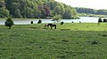
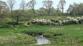
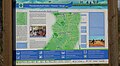
The chapter Analysis and Assessment deals with the ecological condition of the Winderatter See, the Kielstau and the surrounding meadows and forests. The lake threatens to silt up because of the overfertilization from the tributaries of the Kielstau. This poses a risk e.g. B. for the wolffish. In the further course the Kielstau has numerous tributaries from intensively used agricultural areas, the nutrient inputs of which could deprive the small brook mussel on the lower reaches of the Treene the livelihood. The extensively used pasture landscape that surrounds the lake contributes in the long term to reducing nutrient inputs and increasing biodiversity. The Department of Hydrology and Water Management at Christian-Albrechts-Universität in Kiel has set up an automatic measuring station at the outlet area of the Kielstau from the Winderatter See to research the connections between climate changes and the hydrology of river plains. The Kielstau catchment area was declared a UNESCO hydrology reference program in 2010, see pictures.
FFH catalog of measures
A catalog of measures was created from the analysis and evaluation. Since the 1990s, the Schleswig-Holstein Nature Conservation Foundation bought most of the land in the area. There are also several institutions that have been supporting nature conservation there for years. These include in particular the Kurt and Erika Schrobach Foundation , the Obere Treenelandschaft eV, the Winderatter See - Kielstau eV and the Water and Soil Association Obere Treene.
FFH success control and monitoring of the measures
In Schleswig-Holstein, the implementation of the measures is randomly checked every 6 years. The next success control would have been due in 2019. An example of the effectiveness of the measures is a comparison of the meadow mushroom species on the extensively grazed areas between 2016 and 2019. According to this, the area around the Winderatter See is one of the 10 most important locations in Europe. The preservation of the wolffish as a fish species in the Kielstau and the tributaries is one of the declared FFH conservation goals. A study was commissioned by the State Association of Water and Soil Associations to determine the actual fish population in the Winderatter See, the Kielstau and their tributaries Moorau and Dammende. Only a few specimens of wolffish were counted in it. From 2006 to 2012, FFH follow-up monitoring with mapping of FFH habitat and biotope types for the sub-area was completed for the 2007–2012 reporting period . The overview map 1 of 6 shows the number and location of sub-maps 1 to 5 for this FFH sub-area.
- Map 1 Winderatter See (eastern half): FFH habitat types , FFH biotope types
- Map 2 Winderatter See (western half): FFH habitat types, FFH biotope types
- Map 3 Kielstau bei Ausacker: FFH habitat types, FFH biotope types
- Map 4 Kielstau from Ausacker to Kleinsoltholz: FFH habitat types, FFH biotope types
- Map 5 Kielstau from Kleinsoltholz to Kleinsoltfeld: FFH habitat types, FFH biotope types
Picture gallery
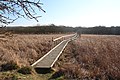
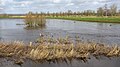
Boardwalk over the reed area in the west of the Winderatter See

FFH notice board on the eastern edge of Lake Winderatter

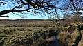
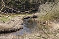
Small biotope on the northern edge of Lake Winderatter
North-east edge of the Winderatter lake

Water point for grazing animals on the north bank of the Winderatter See

Winderatter See in winter


FFH sub-area Schmiedekrug to Eggebek

The sub-area “Schmiedekrug to Eggebek” begins after crossing under the L23 through the Kielstau in the Schmiedekrug district in the municipality of Freienwill. Above the Tresssee , the sub-area expands into an inland dune landscape . The Kielstau flows into the Bondenau about 500 m before the Treßsee and this into the Treßsee. After crossing the lake, the Bondenau is then called Treene . In Oeversee the Treene turns south to the end of the sub-area in Eggebek. The area is almost entirely in the NSG Obere Treenelandschaft . Treene leaves the NSG in Keelbekfeld. The southern and western edge of the FFH sub-area borders between Treßsee and the federal road B76 in large parts on the FFH area "Forest, Moor and Heathland Landscape of the Frörup Mountains and Surroundings". FFH conservation objects and objectives were adopted as Annex 2 in the state ordinance in 2018, insofar as they are within the scope of the two FFH areas. The two FFH areas are also partly on the "Upper Treenetal and Surroundings" landscape protection area of the Schleswig-Flensburg district announced on April 15, 2008. The FFH conservation objects and objectives of the two FFH areas are also laid down in the associated district ordinance, insofar as they are part of the landscape protection area.
No FFH management plan has yet been drawn up for the FFH sub-area Schmiedekrug to Eggebeck. However, since the state of Schleswig-Holstein had already started a major nature conservation project, the Upper Treen Landscape, with a NATURA 2000 connection, the maintenance and development plan created for this purpose in January 2006 was recognized as a management plan. In terms of systematics and terminology, however, it is fundamentally not comparable with that of an FFH management plan. The following information in the FFH terminology is taken from the above Annex 2 of the regulation on the NSG Obere Treenelandschaft from 2018:
FFH conservation object
According to the Habitats Directive, the following are listed:
- 18 habitat types of particular importance according to Annex I.
- 5 species of particular importance according to Annex II and IV
- 1 Habitat type of importance according to Annex I.
- 2 types of importance according to Annex II and IV
FFH conservation objectives
The following FFH conservation objectives were defined and described in more detail from the FFH conservation objects:
- 17 Habitat types of particular importance according to Annex I.
- 5 species of particular importance according to Annex II and IV
- 1 Habitat type of importance according to Annex I.
- 2 types of importance according to Annex II and IV
FFH analysis and assessment
Not specified
FFH catalog of measures
A catalog of FFH measures is not available. The measures from the maintenance and development plan of the major nature conservation project Obere Treenelandschaft apply.
FFH success control and monitoring of the measures
In Schleswig-Holstein, the implementation of the measures is randomly checked for NATURA 2000 areas every 6 years.
From 2006 to 2012, FFH follow-up monitoring with mapping of FFH habitat and biotope types for the sub-area was completed for the 2007–2012 reporting period. The overview maps 1 of 6 and 2 of 6 show the number and location of sub-maps 5 to 13 of the FFH sub-area:
- Map 5 Kielstau from Kleinsoltholz to Kleinsoltfeld: FFH habitat types , FFH biotope types
- Map 6 Kielstau from Kleinsoltfeld to the entrance of the Bondenau into the Treßsee_: FFH habitat types, FFH biotope types
- Map 7 Treßsee to Treene in Augard: FFH habitat types, FFH biotope types
- Map 8 Treene from Augard to Oeversee: FFH habitat types, FFH biotope types
- Map 9 Treene from Oeversee to Bonzelbek: FFH habitat types, FFH biotope types
- Map 10 Treene from Bonzelbek to Tarp: FFH habitat types, FFH biotope types
- Map 11 Treene from Tarp to Keelbek: FFH habitat types, FFH biotope types
- Map 12 Treene from Keelbek to Tüdal: FFH habitat types, FFH biotope types
- Map 13 Treene from Tüdal to Eggebek: FFH habitat types, FFH biotope types
Picture gallery

Dune at the Treßsee

Black-headed gulls on the Treßsee
Inland dune south of the Julesees

Julesee in winter
Treenetal south of Frörup

Watermill in Frörup on the Treene

Weir from 1928 of the Frörup watermill on the Treene

Stapelholmer Weg with a sign on the historic trade route
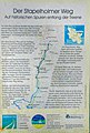
Information board on the historical trade route "Stapelholmer Weg"

Small bridge at Tarp
Treene near Tüdal with Blänke
Treene near Tüdal in spring
Natural edge of the Treene near Tüdal


FFH sub-area Eggebek to Hollingstedt

The FFH sub-area “Eggebek bis Hollingstedt” begins in the north at the bridge over the Treene on Bollingstedter Straße in Eggebek, where it leaves the LSG “Upper Treenetal and Surroundings”, and ends at the Treenebrücke in Hollingstedt. In addition to the Treene, it includes the Bollingstedter Au from Engbrück to its confluence with the Treene near Sollbrück, as well as the Jerrisbek from Sollerupmühle to Sollerup. The two forest areas " Büschauer Holz " between Eggebek and Sollerup and "Steinholz" in Bollingstedt are a separate FFH sub-area, s. u. The longest extension of the sub-area is 18 km in a south-westerly direction. The current management plan for this FFH sub-area was drawn up in December 2011.
FFH conservation object
The 2011 management plan for the FFH sub-area only contains information for the entire FHH area. Sub-area-specific information is not listed separately. The current EU standard data sheet contains information for the entire FFH area as of May 2015.
FFH conservation objectives
The 2011 management plan for the FFH sub-area only contains information for the entire FHH area. Sub-area-specific information is not listed separately.
FFH analysis and assessment
The 2011 management plan only contains information for the entire FHH area. Sub-area-specific information is not listed separately. The current EU standard data sheet contains information as of May 2015.
FFH catalog of measures
The scope of the measures for the FFH sub-area is shown in a map of the LLUR. The FFH catalog of measures for the FFH sub-area was planned in the form of action sheets:
- E1 in Eggebek municipality: restoration of steep slopes and small biotopes (location map 12)
- E2 in Eggebek municipality: Small biotope and fencing (location map 12)
- E3 in Eggebek municipality: Small biotope facility (location map 12)
- E4 in Eggebek municipality: creation of small biotopes (location map 13)
- E5 in Eggebek municipality: replace fencing (location map 13)
- E6 in Eggebek municipality: fencing and drainage regulation (location map 13)
- E7 in Eggebek municipality: No planned measures from 2011 (situation map 13)
- E8 in Eggebek municipality: No planned measures from 2011 (situation map 13)
- E9 in Eggebek municipality: No planned measures from 2011 (situation map 13)
- E10 in Eggebek municipality: Small biotope system (location maps 13 and 14)
- E11 in Eggebek municipality: creation of small biotopes and fencing (location map 14)
- L1 in the municipality of Langstedt; Small biotope system (map 13)
- L2 in the municipality of Langstedt; Creation of small biotopes (map 13)
- L3 in the municipality of Langstedt; No planned measures from 2011 (situation map 14)
- L4 in the municipality of Langstedt; Small biotope system (map 14)
- L5 in the municipality of Langstedt; No planned measures from 2011 (situation map 14)
- L6 in the municipality of Langstedt; Creation of small biotopes and planting campaigns (location map 14)
- L7 in the municipality of Langstedt; No planned measures from 2011 (situation map 14)
- L8 in the municipality of Langstedt; Creation of small biotopes and fencing (location map 15)
- L9 in the municipality of Langstedt; No planned measures from 2011 (situation map 15)
- L10 in the municipality of Langstedt; Planting campaign (location map 15)
- L11 in the municipality of Langstedt; Small biotope system (location map 15)
- L12 in the municipality of Langstedt; Small biotope system (location map 15)
- So 1 in the municipality of Sollerup; Creation of small biotopes, fencing and planting campaigns (location map 14)
- So 2 in Sollerup municipality; Removal of the raw humus layer and planting action (location maps 14 and 15)
- So 3 in Sollerup municipality; Planting (location map 16)
- So 4 in Sollerup municipality; No planned measures from 2011 (situation map 16)
- So 5 in Sollerup municipality; Planting (location map 16)
- So 6 in Sollerup municipality; Planting (location map 16)
- Sun 7 in Sollerup municipality; Planting (location map 16)
- Sun 8 in Sollerup municipality; Planting (location map 16)
- Sun 9 in Sollerup municipality; No planned measures from 2011 (situation map 16)
- So 10 in Sollerup municipality; No planned measures from 2011 (situation map 16)
- Sun 11 in Sollerup municipality; Planting (location map 16)
- Sun 12 in Sollerup municipality; Planting (location maps 16 and 20)
- So 13 in Sollerup municipality; No planned measures from 2011 (situation map 20 and 21)
- Sun 14 in Sollerup municipality; Drainage and planting (location map 21)
- So 15 in Sollerup municipality; Planting (location map 21)
- So 16 in Sollerup municipality; Planting and fencing (location map 20 and 21)
- Sun 17 in Sollerup municipality; Planting (location map 21)
- B1 in the municipality of Bollingstedt; No planned measures from 2011 (situation map 19)
- B2 in the municipality of Bollingstedt; Combating the poisonous late blooming bird cherry (location map 18 and 19)
- T1 in the municipality of Treia; Planting (location map 21)
- T2 in the municipality of Treia; Renaturation of the Treene and planting (location map 21)
- T3 in the municipality of Treia; Planting (location map 21)
- T4 in the municipality of Treia; Planting (location maps 21 and 22)
- T5 in the municipality of Treia; Planting (location map 22)
- T6 in the municipality of Treia; Plant biotope and planting (location map 22)
- T7 in the municipality of Treia; Planting (location map 22)
- T8 in the municipality of Treia; Planting (location map 22)
- T9 in the municipality of Treia; Planting (location maps 22 and 23)
- T10 in the municipality of Treia; Planting (location map 23)
- T11 in the municipality of Treia; Creation of small biotopes (map 25)
- S1 in the municipality of Silberstedt ; System of small biotope, fencing and planting (location map 16)
- S2 in the community of Silberstedt; No planned measures from 2011 (situation map 16)
- S3 in the community of Silberstedt; No planned measures from 2011 (situation map 20)
- S4 in the municipality of Silberstedt; Planting (location map 20)
- S5 in the municipality of Silberstedt; Combating the poisonous late blooming bird cherry and forest conversion (location maps 20 and 16)
- S6 in the municipality of Silberstedt; No planned measures from 2011 (situation map 20)
- S7 in the municipality of Silberstedt; No planned measures from 2011 (situation map 20)
- S8 in the municipality of Silberstedt; Planting (location map 20)
- S9 in the municipality of Silberstedt; Planting (location map 21)
- S10 in the municipality of Silberstedt; Creation of small biotopes and planting (location map 21)
- S11 in the municipality of Silberstedt; No planned measures from 2011 (situation map 25)
- S12 in the municipality of Silberstedt; Planting (location map 20)
- S13 in the municipality of Silberstedt; Planting (location map 20)
- S14 in the municipality of Silberstedt; Planting (location map 20)
- S15 in the municipality of Silberstedt; Planting (location map 20)
- S16 in the municipality of Silberstedt; Planting (location map 20)
- S17 in the municipality of Silberstedt; No planned measures from 2011 (situation map 20)
- S18 in the municipality of Silberstedt; No planned measures from 2011 (situation map 19)
- S19 in the community of Silberstedt; Fencing (location map 19)
- S20 in the municipality of Silberstedt; Plant biotope and planting (location map 19)
- S21 in the municipality of Silberstedt; Creation of small biotopes (map 19)
- S22 in the municipality of Silberstedt; Planting (location map 19)
- S23 in the community of Silberstedt; No planned measures from 2011 (situation map 19)
- S24 in the municipality of Silberstedt; Planting (location map 19)
- S25 in the municipality of Silberstedt; No planned measures from 2011 (situation map 19)
- S26 in the municipality of Silberstedt; Combating the poisonous late blooming bird cherry and forest conversion (location maps 19)
- S27 in the municipality of Silberstedt; No planned measures from 2011 (situation map 19)
- S28 in the municipality of Silberstedt; No planned measures from 2011 (situation map 19)
- S29 in the community of Silberstedt; Planting (location map 19)
- S30 in the municipality of Silberstedt; Planting (location map 19)
- S31 in the municipality of Silberstedt; No planned measures from 2011 (situation map 19)
FFH success control and monitoring of the measures
In Schleswig-Holstein, the implementation of the measures is randomly checked for NATURA 2000 areas every 6 years.
From 2006 to 2012, FFH follow-up monitoring with mapping of FFH habitat and biotope types for the sub-area was completed for the 2007–2012 reporting period. The overview maps 2 of 6, 3 of 6 and 4 of 6 show the number and location of the partial maps of the FFH sub-area:
- Map 13 Treene from Tüdal to Eggebek: FFH habitat types , FFH biotope types
- Map 14 Treene from Eggebek Süd to Jerrisbek: FFH habitat types, FFH biotope types
- Map 15 Treene from Jerrisbek to Sollerup: FFH habitat types, FFH biotope types
- Map 16 Treene near Sollerup: FFH habitat types, FFH biotope types
- Map 17 Bollingstedter Au from Engbrück to Bollingstedt: FFH habitat types, FFH biotope types
- Map 18 Bollingstedter Au in Bollingstedt: FFH habitat types, FFH biotope types
- Map 19 Bollingstedter Au around Görrisau: FFH habitat types, FFH biotope types
- Map 20 Bollingstedter Au from Espersloftfeld to Sollbrück: FFH habitat types, FFH biotope types
- Map 21 Treene from Sollbrück to Esperstoft: FFH habitat types, FFH biotope types
- Map 22 Treene from Esperstoft to north of Gromsholm: FFH habitat types, FFH biotope types
- Map 23 Treene north of Gromsholm to Treia : FFH habitat types, FFH biotope types
- Map 24 Treene from Treia to Steenwallholter Bach: FFH habitat types, FFH biotope types
- Map 25 Treene from Steenwallholter Bach to the northern edge of Hollingstedt: FFH habitat types, FFH biotope types
- Map 26 Treene from the northern edge of Hollingstedt to the southern edge of Hollingstedt: FFH habitat types, FFH biotope types
Picture gallery

Information board at the canoe deployment point near Hollingstedt
Information board at the canoe deployment point on the Treene in Hollingstedt

Detail from information board
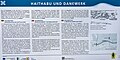
Information board 2 at the canoe deployment point on the Treene in Hollingstedt
Detail from information board 2
Treene near Hollingstedt is the district border between North Friesland and Flensburg-Schleswig

Treene at high water north of the Treenebrücke in Hollingstedt
Flooded meadows north of the Treenebrücke near Hollingstedt

Gray herons and mallards on the flooded Treene north of Hollingstedt
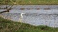
Gray heron on the banks of the Treene, north of the Treenebrücke near Hollingstedt


FFH sub-area Treene from Hollingstedt to Friedrichsstadt

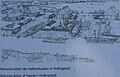
The sub-area “Treene from Hollingstedt to Friedrichstadt” begins in the north at the Treenebrücke in Hollingstedt and ends in the south in Friedrichstadt at the lock to the Eider. The largest extension is 18.3 km and an area of 540 ha. The current management plan for this FFH sub-area was published on April 3, 2018. It also includes the management plan for the EU bird sanctuary DE-1622 493 “Eider-Treene-Sorge-Niederung”, as far as the sub-area is concerned. An overview map shows the area boundaries. The mapping of the biotope types has been updated (as of 2018). A map of the ownership structure and the protection status was created (as of 2018).
FFH conservation object
Three FFH habitat types according to Annex I of the Habitats Directive are identified as FFH conservation objects on 211.8 hectares : The mapping of FFH habitat types and some species has been updated as Annex 8 (as of 2018).
- 0.2% natural eutrophic lakes with vegetation of the diving leaf zone
- 99.1% rivers of the planar to montane level with vegetation of the flooding water crowfoot
- 0.7% lean flatland hay meadows ( meadow foxtail , large meadow head )
All are in an unfavorable state of preservation (as of 2010).
Ten FFH species were identified as FFH species in accordance with Annex II and IV of the Habitats Directive, including 6 fish species:
- Asp
- Wolffish
- North Sea Bill
- Sea lamprey
- Mud whip
- River lamprey
- Common river mussel
- Otter
- Water bat
- Pipistrelle
They are in a good to poor state of preservation (as of 2012)
FFH conservation objectives
The following conservation objectives apply to the FFH sub-area "Treene from Hollingstedt to Friedrichsstadt":
Habitat types according to Annex I Habitats Directive of Community Interest :
- 3150 natural eutrophic lakes
- 3260 rivers of planar to montane level
- 6510 Lean, lowland hay meadows
Species according to Annex II and IV Habitats Directive of Community Interest and Special Importance:
- 1032 Small river mussel
- 1095 sea lamprey
- 1099 river lamprey
- 1130 asp
Species according to Annex II and IV Habitats Directive of Community Interest:
FFH analysis and assessment
The FFH analysis and assessment deals in particular with the state of the water bodies and the environmental influences from the surrounding area of the FFH sub-area. In particular, the cause of the observed decline in the reed areas on the lower reaches of the Treene has not yet been clarified. a. Annex 11. An important factor is the constant input of nutrients from the intensively agricultural areas on flora and fauna.
FFH catalog of measures
The findings from the FFH analysis and assessment lead to a catalog of measures with 6 necessary conservation measures, 7 further development measures and 2 other maintenance and development measures for the sub-area. See also Appendix 10 with a map of some necessary conservation measures (as of March 2018), as well as in tabular form as action sheets for the course of the river and grassland with a time horizon.
FFH success control and monitoring of the measures
In Schleswig-Holstein, the implementation of the measures is randomly checked for NATURA 2000 areas every 6 years.
From 2006 to 2012, FFH follow-up monitoring with mapping of FFH habitat and biotope types for the sub-area was completed for the 2007–2012 reporting period. The overview maps 4 of 6, 5 of 6 and 6 of 6 show the number and location of the partial maps of the FFH sub-area
- Map 26 Treene from the northern edge of Hollingstedt to the southern edge of Hollingstedt: FFH habitat types , FFH biotope types
- Map 27 Treene Südrand Hollingstedt to the Moorgraben pumping station: FFH habitat types, FFH biotope types
- Map 28 Treene south pumping station Moorgraben to Höppelmoorweg near Wohlde : FFH habitat types, FFH biotope types
- Map 29 Eastern half of the Wild Moors with Treene: FFH habitat types, FFH biotope types
- Map 33 Treene from Knabshusenweg east of Wohlde to the Fresendelfer ferry: FFH habitat types, FFH biotope types
- Map 34 Treene south Fresendelfer ferry to Alte Treeneschleife on the K56: FFH habitat types, FFH biotope types
- Map 35 Treenebogen am Osterkoog: FFH habitat types, FFH biotope types
- Map 36 Treene from Süderhöft to Kuhfennenweg near Hude: FFH habitat types, FFH biotope types
- Map 37 Treene near Schwabstedt: FFH habitat types, FFH biotope types
- Map 38 Treene west of Schwabstedt to west of Kleinmittelburg: FFH habitat types, FFH biotope types
- Map 39 Treene west of Kleinmittelburg to west of Ziegelhof: FFH habitat types, FFH biotope types
- Map 40 Treene west of Ziegelhof to Friedrichstadt: FFH habitat types, FFH biotope types
Picture gallery

FFH area Friedrichstadt

End of the Treene near Friedrichstadt

Behind the lock in Friedrichstadt, the Treene flows into the Eider


FFH sub-area NSG Wildes Moor

The sub-area "NSG Wildes Moor" is located on the west bank of the Treene between Wohlde and Winnert , and is 631 hectares in size. Originally declared an independent FFH area, it is now part of the FFH area “Treene Winderatter See to Friedrichstadt and Bollingstedter Au”. In October 2015, a separate management plan was drawn up by the Schleswig-Holstein Nature Conservation Foundation for the FFH sub-area Wildes Moor. The management plan also deals with the aspects of the EU bird sanctuary DE 1622-493 "Eider-Treene-Sorge-Niederung" of which the Wildes Moor NSG is a sub-area, see Map. Most of the bog is publicly owned. Only a small part, especially on the edge areas, is used as pasture. The rest is withdrawn from use.
FFH conservation object
Four FFH habitat types according to Annex I FFH Directive and 1 FFH type of Annex IV FFH Directive are identified as FFH conservation objects on 485.8 hectares: The mapping of the FFH habitat types in the sub-area is published as Annex 10.
Habitat types according to Annex I Habitats Directive:
- Natural eutrophic lakes with vegetation of the diving leaf zone
- Pipe grass meadows on lime-rich soil, peaty u. clayey silty soils ( wet meadows )
- Degraded raised bogs that can still be renatured
- Transitional and rocking bogs
Habitat type of Annex IV Habitats Directive:
- Moor frog
FFH conservation objectives
The following conservation objectives were defined and mapped for the FFH sub-area:
FFH habitat types of Annex I Habitats Directive is of particular importance :
- Natural eutrophic lakes with vegetation of the diving leaf zone
- Pipe grass meadows on lime-rich soil, peaty u. clayey silty soils ( wet meadows )
- Degraded raised bogs that can still be renatured
- Transitional and rocking bogs
FFH analysis and assessment
The long-term development goal of this FFH sub-area is to restore the state of a raised bog before large-scale peat extraction. A detailed analysis and evaluation was carried out for this purpose.
FFH catalog of measures
A catalog of measures was drawn up from the FFH analysis and assessment. As a central measure to comply with the prohibition of deterioration, which is legally stipulated for all FFH areas, the continuation of the waterlogging measures in the FFH sub-area, which began in the 1970s, see p. a. Fig. 7 of the MP. The measures are recorded in a form of measures for the moorland and one for the remaining areas in tabular form. These were supplemented by mapping the necessary maintenance, further development and other maintenance and development measures.
FFH success control and monitoring of the measures
In Schleswig-Holstein, the implementation of the measures is randomly checked for NATURA 2000 areas every 6 years.
From 2006 to 2012, FFH follow-up monitoring with mapping of FFH habitat and biotope types for the sub-area was completed for the 2007–2012 reporting period. An overview map shows the number of maps for this sub-area.
- Map 29 Eastern half of the Wild Moors with Treene: FFH habitat types , FFH biotope types
- Map 30 Northeastern Wildes Moor: FFH habitat types, FFH biotope types
- Map 31 North-western section of the wild moor: FFH habitat types, FFH biotope types
- Map 32 Southwest Wildes Moor: FFH habitat types, FFH biotope types
- Map 33 Treene from Knabshusenweg east of Wohlde to the Fresendelfer ferry: FFH habitat types, FFH biotope types
Picture gallery

Wild moor near Schwabstedt
Wild moor nature trail near Schwabstedt

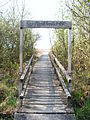
Hochsteg in the Wild Moor

Hochsteg in the high moor of the Wild Moor

Old peat cut in the wild moor


FFH sub-area SHSL areas
The sub-area “SHSL areas” is the Büschauer Gehege forest area on the eastern bank of the Treene between Langstedt and Sollerup , insofar as it is part of the FFH area. It has an area of 220 hectares and belongs to the Schleswig-Holstein Geest natural area. Almost half of it consists of coniferous forest between the ages of 20 and 40, which was created on former heathland through afforestation. Only 4% are oak and beech forests up to 140 years old. The State Office for Agriculture, Environment and Rural Areas published the first management plan for the sub-area in August 2012 on behalf of the Ministry for Energy Transition, Agriculture, Environment and Rural Areas.
FFH conservation object
7 FFH habitat types according to Annex I of the Habitats Directive with an area of 35.4 hectares were set as FFH conservation objects. The stock of FFH habitat types and biotope types were mapped for the sub-area.
- Dry European heaths
- Moist tall perennials
- Planar lowland hay meadows
- Transitional and swinging lawn bogs
- Grove beech forest
- Old acidic oak forests on sandy plains with English oaks
- Bog forests
All FFH habitat types are in an unfavorable state of conservation
FFH conservation objectives
The FFH conservation objectives correspond to the aforementioned FFH conservation objects:
- Dry European heaths
- Moist tall perennials
- Planar lowland hay meadows
- Transitional and swinging lawn bogs
- Grove beech forest
- Old acidic oak forests on sandy plains with English oaks
- Bog forests
FFH analysis and assessment
The FFH conservation objectives were subjected to a detailed analysis and assessment. As a result of climate change and the increasing number of storms, the central task is to convert the forests away from the coniferous forests that are not typical of the location and towards more storm-resistant deciduous forests with indigenous trees. In order to preserve the moors, the water levels must be increased by closing drainage ditches. Green spaces are increasingly to be converted to extensive use in order to reduce the nitrate pollution of the nearby Treene and Büschau rivers.
FFH catalog of measures
A catalog of measures was drawn up from analysis and evaluation and recorded in tabular form in 8 action sheets and a map.
FFH success control and monitoring of the measures
In Schleswig-Holstein, the implementation of the measures is randomly checked for NATURA 2000 areas every 6 years.
From 2006 to 2012, an FFH follow-up monitoring with mapping of the FFH habitat and biotope types for the FFH sub-area was completed for the 2007–2012 reporting period:
- Map 14 Treene from Eggebek Süd to Jerrisbek: FFH habitat types , FFH biotope types
- Map 15 Treene from Jerrisbek to Sollerup: FFH habitat types, FFH biotope types
- Map 16 Treene near Sollerup: FFH habitat types, FFH biotope types
Web links
- Winderatter See - Kielstau eV
- Leaflet Stiftungsland Winderatter See - Kielstau , (PDF), Winderatter See - Kielstau eV, December 13, 2017, accessed on July 25, 2020.
- Species and habitat protection in NATURA 2000 state forests (PDF 1.5 MB), Schleswig-Holstein State Forests
- Reading instructions for standard data sheets for the transmission of information on Natura 2000 areas ( 2011/484 / EU) (PDF; 588 KB) State Office for Agriculture, Environment and Rural Areas of Schleswig-Holstein
- Habitat types and species (protected objects) of the Habitats and Birds Protection Directive , Federal Agency for Nature Conservation, October 24, 2019 (HTML)
- List of FFH areas in Schleswig-Holstein
Individual evidence
- ↑ Area profile Treene Winderatter See to Friedrichstadt and Bollingstedter Au (FFH DE 1322-391). (PDF; 27 kB) In: Schleswig-Holstein state portal. State Office for Agriculture, Environment and Rural Areas of the State of Schleswig-Holstein, pp. 1–2 , accessed on May 14, 2020 .
- ↑ a b Official Journal of the European Union. (PDF; 56 kB) STANDARD DATA SHEET DE1322391. In: Schleswig-Holstein state portal. State Office for Agriculture, Environment and Rural Areas, May 2017, accessed on May 14, 2020 .
- ↑ Treene Winderatter See to Friedrichstadt and Bollingstedter Au. European Invironment Agency, accessed on May 14, 2020 .
- ↑ Management plan for the fauna-flora-habitat area DE-1322-391 “Treene Winderatter See to Friedrichstadt and Bollingstedter Au” sub-area Winderatter See and Kielstau. (PDF; 819 kB) 2.1. Area description. In: Schleswig-Holstein state portal. Ministry of Energy Transition, Agriculture. Environment and rural areas of the State of Schleswig-Holstein, October 23, 2013, p. 6 , accessed on May 17, 2020 .
- ↑ DE1322391 Official Journal of the European Union L 198/41. (PDF; 56 kB) 5.2. Connection of the described area with other areas. In: Schleswig-Holstein state portal. State Office for Agriculture, Environment and Rural Areas of the State of Schleswig-Holstein, May 2017, p. 10 , accessed on May 15, 2020 .
- ↑ Management plan FFH DE-1322-391 / Treene Winderatter See to Friedrichstadt and Bollingstedter Au sub-area: Winderatter See and Kielstau. (PDF; 2026 kB) Map 1 - overview -. In: Schleswig-Holstein state portal. Ministry of Energy Transition, Agriculture. Environment and Rural Areas of Schleswig-Holstein, October 4, 2012, accessed on June 16, 2020 .
- ↑ a b Management plan for the fauna-flora-habitat area DE-1322-391 “Treene Winderatter See to Friedrichstadt and Bollingstedter Au”. (PDF; 1101 kB) In: Schleswig-Holstein state portal. Ministry of Agriculture. Environment and Rural Areas of Schleswig-Holstein, December 2011, pp. 1–38 , accessed on May 22, 2020 .
- ↑ Management plan for the fauna-flora-habitat area DE-1322-391 “Treene Winderatter See to Friedrichstadt and Bollingstedter Au” sub-area Winderatter See and Kielstau. (PDF; 819 kB) In: Schleswig-Holstein state portal. Ministry of Energy Transition, Agriculture. Environment and Rural Areas of Schleswig-Holstein, October 23, 2013, accessed on May 18, 2020 .
- ↑ a b FFH follow-up monitoring reporting period 2007-2012 EU area no .: 1322-391 Map 1 of 40 Treene from Winderatter See to Friedrichstadt and Bollingstedter Au. (PDF; 2224 kB) FFH habitat types (LRT). In: Schleswig-Holstein state portal. Ministry of Energy Transition, Agriculture. Environment and rural areas of Schleswig-Holstein, April 1, 2010, accessed on May 18, 2020 (Winderatter See (eastern half)).
- ↑ Management plan for the fauna-flora-habitat area DE-1322-391 “Treene Winderatter See to Friedrichstadt and Bollingstedter Au” sub-area Winderatter See and Kielstau. (PDF; 819 kB) 4. Conservation goals. In: Schleswig-Holstein state portal. Ministry of Energy Transition, Agriculture. Environment and rural areas of the State of Schleswig-Holstein, October 23, 2013, p. 14 , accessed on May 18, 2020 .
- ↑ Management plan for the fauna-flora-habitat area DE-1322-391 “Treene Winderatter See to Friedrichstadt and Bollingstedter Au” sub-area Winderatter See and Kielstau. (PDF; 819 kB) 5. Analysis and evaluation. In: Schleswig-Holstein state portal. Ministry of Energy Transition, Agriculture. Environment and Rural Areas of the State of Schleswig-Holstein, October 23, 2013, pp. 15–18 , accessed on May 19, 2020 .
- ↑ Technical information on grazing. 6.4.1 Grazing on rivers. In: Bavarian Academy for Nature Conservation and Landscape Management. Bavarian State Ministry for Environment and Consumer Protection, accessed on May 19, 2020 .
- ↑ Management plan for the fauna-flora-habitat area DE-1322-391 “Treene Winderatter See to Friedrichstadt and Bollingstedter Au” sub-area Winderatter See and Kielstau. (PDF; 819 kB) 6. Catalog of measures. In: Schleswig-Holstein state portal. Ministry of Energy Transition, Agriculture. Environment and Rural Areas of Schleswig-Holstein, October 23, 2013, pp. 19–31 , accessed on May 19, 2020 .
- ↑ Management plan for the fauna-flora-habitat area DE-1322-391 “Treene Winderatter See to Friedrichstadt and Bollingstedter Au” sub-area Winderatter See and Kielstau. (PDF; 819 kB) 7. Success control and monitoring of the measures. In: Schleswig-Holstein state portal. Ministry of Energy Transition, Agriculture. Environment and Rural Areas of the State of Schleswig-Holstein, October 23, 2013, p. 32 , accessed on May 19, 2020 .
- ↑ Matthias Lüderitz: 2. Mycological recording and evaluation of historical grassland occurrences in the planned nature reserve "Winderatter See". (PDF) 1. Follow-up entry 2017–2019. In: wiskie-ev annual report 2019. Winderatter See - Kielstau eV, 2019, pp. 5–21 , accessed on May 19, 2020 : "... the Winderatter See is certainly one of the" top ten "meadow mushroom locations in Northern Europe."
- ↑ Record of fish stocks in the upper Kielstau and its tributaries as well as in the bank area of the Winderatter See as well as evaluation of the results according to EU-WFD and FFH-RL. Stöckmann Foundation, 2015, accessed on July 9, 2020 .
- ↑ a b FFH follow-up monitoring reporting period 2007-2012 EU area no .: 1322-391 Treene from Winderatter See to Friedrichstadt and Bollingstedter Au. (PDF; 832 kB) Overview 1 of 6. In: Landesportal Schleswig-Holstein. State Office for Agriculture, Environment and Rural Areas of the State of Schleswig-Holstein, March 12, 2010, accessed on May 26, 2020 (maps 1–6 Winderatter See to Treßsee).
- ↑ FFH follow-up monitoring reporting period 2007-2012 EU area no .: 1322-391 Treene from Winderatter See to Friedrichstadt and Bollingstedter Au. (PDF; 2182 kB) Map 1 of 40 - biotope types (short) -. In: Schleswig-Holstein state portal. State Office for Agriculture, Environment and Rural Areas of the State of Schleswig-Holstein, April 1, 2010, accessed on May 21, 2020 (Winderatter See (eastern half)).
- ↑ FFH follow-up monitoring reporting period 2007-2012 EU area no .: 1322-391 Treene from Winderatter See to Friedrichstadt and Bollingstedter Au. (PDF; 2196 kB) Map 2 of 40 FFH habitat types (LRT) -. In: Schleswig-Holstein state portal. State Office for Agriculture, Environment and Rural Areas of the State of Schleswig-Holstein, April 1, 2010, accessed on May 21, 2020 (Winderatter See (western half)).
- ↑ FFH follow-up monitoring reporting period 2007-2012 EU area no .: 1322-391 Treene from Winderatter See to Friedrichstadt and Bollingstedter Au. (PDF; 2166 kB) Map 2 of 40 - biotope types (short) -. In: Schleswig-Holstein state portal. State Office for Agriculture, Environment and Rural Areas of the State of Schleswig-Holstein, April 1, 2010, accessed on May 21, 2020 (Winderatter See (western half)).
- ↑ FFH follow-up monitoring reporting period 2007-2012 EU area no .: 1322-391 Treene from Winderatter See to Friedrichstadt and Bollingstedter Au. (PDF; 1978 kB) Map 3 of 40 FFH habitat types (LRT). In: Schleswig-Holstein state portal. State Office for Agriculture, Environment and Rural Areas of Schleswig-Holstein, April 1, 2010, accessed on May 21, 2020 (Kielstau bei Ausacker).
- ↑ FFH follow-up monitoring reporting period 2007-2012 EU area no .: 1322-391 Treene from Winderatter See to Friedrichstadt and Bollingstedter Au. (PDF; 1822 kB) Map 3 of 40 - biotope types (short) -. In: Schleswig-Holstein state portal. State Office for Agriculture, Environment and Rural Areas of Schleswig-Holstein, April 1, 2010, accessed on May 21, 2020 (Kielstau bei Ausacker).
- ↑ FFH follow-up monitoring reporting period 2007-2012 EU area no .: 1322-391 Treene from Winderatter See to Friedrichstadt and Bollingstedter Au. (PDF; 2021) Map 4 of 40 FFH habitat types (LRT). In: Schleswig-Holstein state portal. State Office for Agriculture, Environment and Rural Areas of the State of Schleswig-Holstein, April 1, 2010, accessed on May 21, 2020 (Kielstau from Ausacker to Kleinsoltholz).
- ↑ FFH follow-up monitoring reporting period 2007-2012 EU area no .: 1322-391 Treene from Winderatter See to Friedrichstadt and Bollingstedter Au. (PDF; 1859 kB) Map 4 of 40 - biotope types (short) -. In: Schleswig-Holstein state portal. State Office for Agriculture, Environment and Rural Areas of the State of Schleswig-Holstein, April 1, 2010, accessed on May 21, 2020 (Kielstau from Ausacker to Kleinsoltholz).
- ↑ a b c FFH follow-up monitoring reporting period 2007-2012, EU area no .: 1322-391 Treene from Winderatter See to Friedrichstadt and Bollingstedter Au. (PDF; 2155 kB) Map 5 of 40, FFH habitat types (LRT). In: Schleswig-Holstein state portal. Ministry of Energy Transition, Agriculture. Environment and rural areas of Schleswig-Holstein, April 1, 2010, accessed on May 16, 2020 (Kielstau from Kleinsoltfeld to Kleinsoltholz).
- ↑ a b FFH follow-up monitoring reporting period 2007-2012 EU area no .: 1322-391 Treene from Winderatter See to Friedrichstadt and Bollingstedter Au. (PDF; 2036 kB) Map 5 of 40 - biotope types (short) -. In: Schleswig-Holstein state portal. State Office for Agriculture, Environment and Rural Areas of the State of Schleswig-Holstein, April 1, 2010, accessed on May 20, 2020 (Kielstau from Kleinsoltfeld to Kleinsoltholz).
- ↑ a b FFH follow-up monitoring reporting period 2007-2012, EU area no .: 1322-391, Treene from Winderatter See to Friedrichstadt and Bollingstedter Au. (PDF; 2555 kB) Map 6 of 40, FFH habitat types (LRT). In: Schleswig-Holstein state portal. Ministry of Energy Transition, Agriculture. Environment and rural areas of the State of Schleswig-Holstein, April 1, 2010, accessed on May 16, 2020 (Kleinsoltfeld until Bondenau enters the Treßsee).
- ↑ a b FFH follow-up monitoring reporting period 2007-2012, EU area no .: 1322-391, Treene from Winderatter See to Friedrichstadt and Bollingstedter Au. (PDF; 2628 kB) Map 7 of 40, FFH habitat types (LRT). In: Schleswig-Holstein state portal. Ministry of Energy Transition, Agriculture. Environment and rural areas of Schleswig-Holstein, April 1, 2010, accessed on May 16, 2020 (Treßsee to Augard).
- ↑ FFH follow-up monitoring reporting period 2007-2012 EU area no .: 1322-391 Treene from Winderatter See to Friedrichstadt and Bollingstedter Au. (PDF; 997 kB) Overview 2 of 6. In: Landesportal Schleswig-Holstein. Ministry of Energy Transition, Agriculture. Environment and rural areas of Schleswig-Holstein, March 12, 2010, accessed on May 16, 2020 .
- ↑ a b overview map 1b sheet 4, annex to the state ordinance on the nature reserve "Obere Treenelandschaft". In: State regulations and state jurisprudence. State government of Schleswig-Holstein, accessed on May 17, 2020 .
- ↑ Overview map 1b sheet 2, annex to the state ordinance on the "Obere Treenelandschaft" nature reserve. In: State regulations and state jurisprudence. State government of Schleswig-Holstein, accessed on May 17, 2020 .
- ↑ Overview map 1b sheet 1, annex to the state ordinance on the "Obere Treenelandschaft" nature reserve. In: State regulations and state jurisprudence. State government of Schleswig-Holstein, accessed on May 17, 2020 .
- ↑ a b c d State ordinance on the "Obere Treenelandschaft" nature reserve of June 23, 2015. Appendix 2 to § 3 Paragraph 2 Number 7 of the state ordinance on the "Obere Treenelandschaft" nature reserve Conservation objectives for the sub-areas of the statutory Protected Areas of Community Importance DE-1322-391 “Treene, Winderatter See to Friedrichstadt and Bollingstedter Au” as well as DE-1322-392 “Forest, moor and heathland of the Fröruper Berge and surroundings”. In: State regulations and state case law. State government of Schleswig-Holstein, May 16, 2018, accessed on May 17, 2020 (FFH conservation objects and FFH conservation objectives defined.).
- ↑ Crisis Ordinance on the "Upper Treenetal and Surroundings" nature reserve. (PDF) In: Schleswig-Flensburg district portal. Schleswig-Flensburg district, April 15, 2008, accessed on May 17, 2020 .
- ↑ Crisis Ordinance on the "Upper Treenetal and Surroundings" nature reserve. (PDF) Annex 1 to the district ordinance on the landscape protection area "Upper Treenetal and surroundings". In: Schleswig-Flensburg district portal. Schleswig-Flensburg District, p. 129 , accessed on April 15, 2008 .
- ↑ a b Note from the state of Schleswigholstein on the management plan for the Schmiedekrug area to Eggbek. (PDF; 95 kB) In: Schleswig-Holstein state portal. Ministry of Energy Transition, Agriculture. Environment and rural areas of the State of Schleswig-Holstein, accessed on May 19, 2020 : "... The existing maintenance and development plan (PEPL) for the sub-area, which has a Natura2000 reference and is therefore recognized as a management plan ..."
- ↑ a b Maintenance and development plan for the major nature conservation project Obere Treenelandschaft. (PDF) Action plan, final plan version. Pro Regione GmbH, January 2006, pp. 1-74 , accessed on May 19, 2020 .
- ↑ a b FFH follow-up monitoring reporting period 2007-2012 EU area no .: 1322-391 Treene from Winderatter See to Friedrichstadt and Bollingstedter Au. (PDF; 997 kB) Overview 2 of 6. In: Landesportal Schleswig-Holstein. State Office for Agriculture, Environment and Rural Areas of the State of Schleswig-Holstein, March 12, 2010, accessed on May 26, 2020 (partial maps 6 to 13 from Treßsee to Eggebeck).
- ↑ FFH follow-up monitoring reporting period 2007-2012 EU area no .: 1322-391 Treene from Winderatter See to Friedrichstadt and Bollingstedter Au. (PDF; 2239 kB) Map 6 of 40 - biotope types (short) -. In: Schleswig-Holstein state portal. State Office for Agriculture, Environment and Rural Areas of the State of Schleswig-Holstein, April 1, 2010, accessed on May 21, 2020 (Kleinsoltfeld until Bondenau enters the Treßsee).
- ↑ FFH follow-up monitoring reporting period 2007-2012 EU area no .: 1322-391 Treene from Winderatter See to Friedrichstadt and Bollingstedter Au. (PDF; 2573) Map 7 of 40 - biotope types (short) -. In: Schleswig-Holstein state portal. State Office for Agriculture, Environment and Rural Areas of the State of Schleswig-Holstein, April 1, 2010, accessed on May 21, 2020 (Treßsee to Augard).
- ↑ FFH follow-up monitoring reporting period 2007-2012 EU area no .: 1322-391 Treene from Winderatter See to Friedrichstadt and Bollingstedter Au. (PDF; 2595 kB) Map 8 of 40 - FFH habitat types (LRT) -. In: Schleswig-Holstein state portal. Ministry of Energy Transition, Agriculture. Environment and Rural Areas of Schleswig-Holstein, April 1, 2010, accessed on May 20, 2020 (Augard to Oeversee).
- ↑ FFH follow-up monitoring reporting period 2007-2012 EU area no .: 1322-391 Treene from Winderatter See to Friedrichstadt and Bollingstedter Au. (PDF; 2489 kB) Map 8 of 40 - biotope types (short) -. In: Schleswig-Holstein state portal. State Office for Agriculture, Environment and Rural Areas of the State of Schleswig-Holstein, April 1, 2010, accessed on May 21, 2020 (Augard to Oeversee).
- ↑ FFH follow-up monitoring reporting period 2007-2012 EU area no .: 1322-391 Treene from Winderatter See to Friedrichstadt and Bollingstedter Au. (PDF; 2254 kB) Map 9 of 40 - FFH habitat types (LRT) -. In: Schleswig-Holstein state portal. State Office for Agriculture, Environment and Rural Areas of the State of Schleswig-Holstein, April 1, 2010, accessed on May 20, 2020 (Oeversee to Bonzelbek).
- ↑ FFH follow-up monitoring reporting period 2007-2012 EU area no .: 1322-391 Treene from Winderatter See to Friedrichstadt and Bollingstedter Au. (PDF; 2168 kB) Map 9 of 40 - biotope types (short) -. In: Schleswig-Holstein state portal. State Office for Agriculture, Environment and Rural Areas of the State of Schleswig-Holstein, April 1, 2010, accessed on May 21, 2020 (Oeversee to Bonzelbek).
- ↑ FFH follow-up monitoring reporting period 2007-2012 EU area no .: 1322-391 Treene from Winderatter See to Friedrichstadt and Bollingstedter Au. (PDF; 2312 kB) Map 10 of 40 - FFH habitat types (LRT) -. In: Schleswig-Holstein state portal. State Office for Agriculture, Environment and Rural Areas of the State of Schleswig-Holstein, April 1, 2010, accessed on May 20, 2020 (Bonzelbek to Tarp).
- ↑ FFH follow-up monitoring reporting period 2007-2012 EU area no .: 1322-391 Treene from Winderatter See to Friedrichstadt and Bollingstedter Au. (PDF; 2261) Map 10 of 40 - Biotope types (short) -. In: Schleswig-Holstein state portal. State Office for Agriculture, Environment and Rural Areas of the State of Schleswig-Holstein, April 1, 2010, accessed on May 21, 2020 (Bonzelbek to Tarp).
- ↑ FFH follow-up monitoring reporting period 2007-2012 EU area no .: 1322-391 Treene from Winderatter See to Friedrichstadt and Bollingstedter Au. (PDF; 2467 kB) Map 11 of 40 - FFH habitat types (LRT) -. In: Schleswig-Holstein state portal. State Office for Agriculture, Environment and Rural Areas of the State of Schleswig-Holstein, April 1, 2010, accessed on May 20, 2020 (Tarp to Keelbek).
- ↑ FFH follow-up monitoring reporting period 2007-2012 EU area no .: 1322-391 Treene from Winderatter See to Friedrichstadt and Bollingstedter Au. (PDF; 2451 kB) Map 11 of 40 - biotope types (short) -. In: Schleswig-Holstein state portal. State Office for Agriculture, Environment and Rural Areas of the State of Schleswig-Holstein, April 1, 2010, accessed on May 21, 2020 (Tarp to Keelbek).
- ↑ FFH follow-up monitoring reporting period 2007-2012 EU area no .: 1322-391 Treene from Winderatter See to Friedrichstadt and Bollingstedter Au. (PDF; 1851 kB) Map 12 of 40 - FFH habitat types (LRT) -. In: Schleswig-Holstein state portal. State Office for Agriculture, Environment and Rural Areas of the State of Schleswig-Holstein, April 1, 2010, accessed on May 20, 2020 (Keelbek to Tüdal).
- ↑ FFH follow-up monitoring reporting period 2007-2012 EU area no .: 1322-391 Treene from Winderatter See to Friedrichstadt and Bollingstedter Au. (PDF; 1839 kB) Map 12 of 40 - biotope types (short) -. In: Schleswig-Holstein state portal. State Office for Agriculture, Environment and Rural Areas of the State of Schleswig-Holstein, April 1, 2010, accessed on May 21, 2020 (Keelbek to Tüdal).
- ↑ a b FFH follow-up monitoring reporting period 2007-201 EU area no .: 1322-391 Treene from Winderatter See to Friedrichstadt and Bollingstedter Au. (PDF; 2449 kB) Map 13 of 40 - FFH habitat types (LRT) -. In: Schleswig-Holstein state portal. State Office for Agriculture, Environment and Rural Areas of the State of Schleswig-Holstein, April 1, 2010, accessed on May 20, 2020 (Tüdal to Eggebek).
- ↑ a b FFH follow-up monitoring reporting period 2007-2012 EU area no .: 1322-391 Treene from Winderatter See to Friedrichstadt and Bollingstedter Au. (PDF; 2453 kB) Map 13 of 40 - biotope types (short) -. In: Schleswig-Holstein state portal. State Office for Agriculture, Environment and Rural Areas of the State of Schleswig-Holstein, April 1, 2010, accessed on May 21, 2020 (Tüdal to Eggebek).
- ↑ FFH follow-up monitoring reporting period 2007-2012 EU area no .: 1322-391 Map 13 of 40. (PDF; 2449 kB) Treene from Winderatter See to Friedrichstadt and Bollingstedter Au. In: Schleswig-Holstein state portal. Ministry of Energy Transition, Agriculture. Environment and rural areas of Schleswig-Holstein, April 1, 2010, accessed on May 17, 2020 .
- ↑ a b FFH follow-up monitoring reporting period 2007-2012 EU area no .: 1322-391 Map 26 of 40 Treene from Winderatter See to Friedrichstadt and Bollingstedter Au. (PDF; 1825 kB) FFH habitat types (LRT). In: Schleswig-Holstein state portal. Ministry of Energy Transition, Agriculture. Environment and rural areas of Schleswig-Holstein, April 1, 2010, accessed on May 18, 2020 .
- ↑ Management plan for the fauna-flora-habitat area DE-1322-391 “Treene Winderatter See to Friedrichstadt and Bollingstedter Au”. (PDF; 1101 kB) Annex 1: Excerpt from the Official Journal (p. 961 ff.), 1. Subject of preservation. In: Schleswig-Holstein state portal. Ministry of Energy Transition, Agriculture. Environment and Rural Areas of the State of Schleswig-Holstein, December 2011, p. 28 , accessed on May 27, 2020 .
- ↑ a b DE1322391 Official Journal of the European Union L 198 / 41DE. (PDF; 56 kB) 3.1. Habitat types occurring in the area and their assessment of the area. In: Schleswig-Holstein state portal. Ministry of Energy Transition, Agriculture. Environment and Rural Areas of the State of Schleswig-Holstein, May 2017, p. 3 , accessed on May 27, 2020 .
- ↑ Management plan for the fauna-flora-habitat area DE-1322-391 “Treene Winderatter See to Friedrichstadt and Bollingstedter Au”. (PDF: 1101 kB) 4. Conservation goals. In: Schleswig-Holstein state portal. Ministry of Energy Transition, Agriculture. Environment and Rural Areas of the State of Schleswig-Holstein, December 2011, p. 18 , accessed on May 27, 2020 .
- ↑ Management plan for the fauna-flora-habitat area DE-1322-391 “Treene Winderatter See to Friedrichstadt and Bollingstedter Au”. (PDF; 1101 kB) 5. Analysis and evaluation (for sub-area 3 - without Büschauer forest and stone wood). In: Schleswig-Holstein state portal. Ministry of Energy Transition, Agriculture. Environment and Rural Areas of the State of Schleswig-Holstein, December 2011, p. 19 , accessed on May 27, 2020 .
- ↑ Management plan for the FFH area DE-1322-391 "Treene Winderater See to Friedrichstadt and Bollingstedter Au" sub-area Mittlere Treene. (PDF; 8744 kB) Overview. In: Schleswig-Holstein state portal. State Office for Agriculture, Environment and Rural Areas of the State of Schleswig-Holstein, December 22, 2010, accessed on May 27, 2020 .
- ↑ Management plan for the fauna-flora-habitat area DE-1322-391 “Treene Winderatter See to Friedrichstadt and Bollingstedter Au”. (PDF; 1101 kB) 6. Catalog of measures (for sub-area 3 - without Büschauer forest and stone wood). In: Schleswig-Holstein state portal. Ministry of Energy Transition, Agriculture. Environment and rural areas of the State of Schleswig-Holstein, December 2011, pp. 20–26 , accessed on May 28, 2020 .
- ↑ action sheet E1 municipality Eggebeck. (PDF; 3362 kB) In: Schleswig-Holstein state portal. State Office for Agriculture, Environment and Rural Areas of the State of Schleswig-Holstein, 2010, accessed on May 27, 2020 .
- ↑ a b c Map of measures 12. (PDF; 26.5 MB) In: Landesportal Schleswig-Holstein. State Office for Agriculture, Environment and Rural Areas of the State of Schleswig-Holstein, accessed on May 28, 2020 .
- ^ Measures sheet E2 of the Eggebek municipality. (PDF; 3453 kB) In: Schleswig-Holstein state portal. State Office for Agriculture, Environment and Rural Areas of the State of Schleswig-Holstein, 2010, accessed on May 27, 2020 .
- ^ Measures sheet E3 in Eggebek municipality. (PDF; 3601 kB) In: Schleswig-Holstein state portal. State Office for Agriculture, Environment and Rural Areas of the State of Schleswig-Holstein, 2010, accessed on May 28, 2020 .
- ^ Measures sheet E2 of the Eggebek municipality. (PDF; 3267 kB) In: Schleswig-Holstein state portal. State Office for Agriculture, Environment and Rural Areas of the State of Schleswig-Holstein, 2010, accessed on May 28, 2020 .
- ↑ a b c d e f g h i Map of measures 13. (PDF; 145.6 MB) In: Landesportal Schleswig-Holstein. State Office for Agriculture, Environment and Rural Areas of the State of Schleswig-Holstein, accessed on May 28, 2020 .
- ^ Measures sheet E5 of the Eggebek community. (PDF; 3742 kB) In: Schleswig-Holstein state portal. State Office for Agriculture, Environment and Rural Areas of the State of Schleswig-Holstein, 2010, accessed on May 28, 2020 .
- ^ Measures sheet E6 of the Eggebek community. (PDF; 3740 kB) In: Schleswig-Holstein state portal. State Office for Agriculture, Environment and Rural Areas of the State of Schleswig-Holstein, 2010, accessed on May 28, 2020 .
- ^ Measure sheet E7 of the Eggebek community. (PDF; 3868 kB) In: Schleswig-Holstein state portal. State Office for Agriculture, Environment and Rural Areas of the State of Schleswig-Holstein, 2010, accessed on May 28, 2020 .
- ^ Measure sheet E8 of the Eggebek community. (PDF; 3243 kB) In: Schleswig-Holstein state portal. State Office for Agriculture, Environment and Rural Areas of the State of Schleswig-Holstein, 2010, accessed on May 28, 2020 .
- ^ Measures sheet E9 of the Eggebek community. (PDF; 2951 kB) In: Schleswig-Holstein state portal. State Office for Agriculture, Environment and Rural Areas of the State of Schleswig-Holstein, 2010, accessed on May 28, 2020 .
- ^ Measures sheet E10 of the Eggebek community. (PDF; 3169 kB) In: Schleswig-Holstein state portal. State Office for Agriculture, Environment and Rural Areas of the State of Schleswig-Holstein, 2010, accessed on May 28, 2020 .
- ↑ a b c d e f g h i Map of measures 14. (PDF; 85.5 MB) In: Landesportal Schleswig-Holstein. State Office for Agriculture, Environment and Rural Areas of the State of Schleswig-Holstein, 2010, accessed on May 29, 2020 .
- ^ Measures sheet E11 of the Eggebek municipality. (PDF; 2821 kB) In: Schleswig-Holstein state portal. State Office for Agriculture, Environment and Rural Areas of the State of Schleswig-Holstein, 2010, accessed on May 28, 2020 .
- ^ FFH measures sheet L1 of the Langstedt community. (PDF; 3412 kB) In: Schleswig-Holstein state portal. State Office for Agriculture, Environment and Rural Areas of the State of Schleswig-Holstein, 2010, accessed on May 29, 2020 .
- ↑ FFH-measure sheet L2 of the municipality Langstedt. (PDF; 3704 kB) In: Schleswig-Holstein state portal. State Office for Agriculture, Environment and Rural Areas of the State of Schleswig-Holstein, 2010, accessed on May 29, 2020 .
- ^ FFH measures sheet L3 of the Langstedt community. (PDF; 3311 kB) In: Schleswig-Holstein state portal. State Office for Agriculture, Environment and Rural Areas of the State of Schleswig-Holstein, 2010, accessed on May 29, 2020 .
- ^ FFH measures sheet L4 of the municipality of Langstedt. (PDF; 3469 kB) In: Schleswig-Holstein state portal. State Office for Agriculture, Environment and Rural Areas of the State of Schleswig-Holstein, 2010, accessed on May 29, 2020 .
- ^ FFH measures sheet L5 of the Langstedt community. (PDF; 3352 kB) In: Schleswig-Holstein state portal. State Office for Agriculture, Environment and Rural Areas of the State of Schleswig-Holstein, 2010, accessed on May 29, 2020 .
- ^ FFH measures sheet L6 of the Langstedt community. (PDF; 3400 kB) In: Schleswig-Holstein state portal. State Office for Agriculture, Environment and Rural Areas of the State of Schleswig-Holstein, 2010, accessed on May 29, 2020 .
- ↑ FFH measures sheet L7 of the municipality of Langstedt. (PDF; 3293 KB) In: Schleswig-Holstein state portal. State Office for Agriculture, Environment and Rural Areas of the State of Schleswig-Holstein, 2010, accessed on May 29, 2020 .
- ^ FFH measures sheet L8 of the municipality of Langstedt. (PDF; 3427 KB) In: Schleswig-Holstein state portal. State Office for Agriculture, Environment and Rural Areas of the State of Schleswig-Holstein, 2010, accessed on May 29, 2020 .
- ↑ a b c d e f FFH action map 15. (PDF; 68.9 MB) In: Landesportal Schleswig-Holstein. State Office for Agriculture, Environment and Rural Areas of the State of Schleswig-Holstein, 2010, accessed on May 29, 2020 .
- ^ FFH measures sheet L9 of the Langstedt community. (PDF; 3691 KB) In: Schleswig-Holstein state portal . State Office for Agriculture, Environment and Rural Areas of the State of Schleswig-Holstein, 2010, accessed on May 29, 2020 .
- ↑ FFH measures sheet L10 of the municipality of Langstedt. (PDF; 2609 KB) In: Schleswig-Holstein state portal. State Office for Agriculture, Environment and Rural Areas of the State of Schleswig-Holstein, 2010, accessed on May 29, 2020 .
- ^ FFH measures sheet L11 of the municipality of Langstedt. (PDF; 3711 KB) In: Schleswig-Holstein state portal. State Office for Agriculture, Environment and Rural Areas of the State of Schleswig-Holstein, 2010, accessed on May 29, 2020 .
- ^ FFH measures sheet L12 of the Langstedt community. (PDF; 3587 KB) In: Schleswig-Holstein state portal . State Office for Agriculture, Environment and Rural Areas of the State of Schleswig-Holstein, 2010, accessed on May 29, 2020 .
- ↑ FFH data sheet So1 of the municipality of Sollerup. (PDF; 3224 KB) In: Schleswig-Holstein state portal. State Office for Agriculture, Environment and Rural Areas of the State of Schleswig-Holstein, 2010, accessed on May 30, 2020 .
- ↑ FFH sheet So2 of the municipality of Sollerup. (PDF; 3070 KB) In: Schleswig-Holstein state portal. State Office for Agriculture, Environment and Rural Areas of the State of Schleswig-Holstein, 2010, accessed on May 30, 2020 .
- ↑ FFH sheet So3 of the community of Sollerup. (PDF; 2678 KB) In: Schleswig-Holstein state portal. State Office for Agriculture, Environment and Rural Areas of the State of Schleswig-Holstein, 2010, accessed on May 30, 2020 .
- ↑ a b c d e f g h i j k l m FFH map of measures 16. (PDF; 104.3 MB) In: Landesportal Schleswig-Holstein. State Office for Agriculture, Environment and Rural Areas of the State of Schleswig-Holstein, 2010, accessed on May 30, 2020 .
- ↑ FFH data sheet So 4 of the community of Sollerup. (PDF; 3552 KB) In: Schleswig-Holstein state portal. State Office for Agriculture, Environment and Rural Areas of the State of Schleswig-Holstein, 2010, accessed on May 30, 2020 .
- ↑ FFH data sheet So5 of the municipality of Sollerup. (PDF; 469 KB) In: Schleswig-Holstein state portal. State Office for Agriculture, Environment and Rural Areas of the State of Schleswig-Holstein, 2010, accessed on May 30, 2020 .
- ^ FFH measures sheet So 6 of the community of Sollerup. (PDF; 3143 KB) In: Schleswig-Holstein state portal. State Office for Agriculture, Environment and Rural Areas of the State of Schleswig-Holstein, 2010, accessed on May 30, 2020 .
- ↑ FFH measures sheet So 7 of the community of Sollerup. (PDF; 3337 KB) In: Schleswig-Holstein state portal. State Office for Agriculture, Environment and Rural Areas of the State of Schleswig-Holstein, 2010, accessed on May 30, 2020 .
- ↑ FFH measures sheet So 8 of the community of Sollerup. (PDF; 452 KB) In: Schleswig-Holstein state portal. State Office for Agriculture, Environment and Rural Areas of the State of Schleswig-Holstein, 2010, accessed on May 30, 2020 .
- ↑ FFH measures sheet So 9 of the community of Sollerup. (PDF; 399 KB) In: Schleswig-Holstein state portal. State Office for Agriculture, Environment and Rural Areas of the State of Schleswig-Holstein, 2010, accessed on May 30, 2020 .
- ^ FFH measures sheet So 10 of the community of Sollerup. (PDF; 441 KB) In: Schleswig-Holstein state portal. State Office for Agriculture, Environment and Rural Areas of the State of Schleswig-Holstein, 2010, accessed on May 30, 2020 .
- ↑ FFH measures sheet So 11 of the community of Sollerup. (PDF; 433 KB) In: Schleswig-Holstein state portal. State Office for Agriculture, Environment and Rural Areas of the State of Schleswig-Holstein, 2010, accessed on May 30, 2020 .
- ↑ FFH measures sheet So 12 of the community of Sollerup. (PDF; 428 KB) In: Schleswig-Holstein state portal. State Office for Agriculture, Environment and Rural Areas of the State of Schleswig-Holstein, 2010, accessed on May 30, 2020 .
- ↑ a b c d e f g h i j k l m n o FFH map of measures 20. (PDF; 75.5 MB) In: Landesportal Schleswig-Holstein. State Office for Agriculture, Environment and Rural Areas of the State of Schleswig-Holstein, 2010, accessed on May 30, 2020 .
- ^ FFH measures sheet So 13 of the community of Sollerup. (PDF; 404 KB) In: Schleswig-Holstein state portal. State Office for Agriculture, Environment and Rural Areas of the State of Schleswig-Holstein, 2010, accessed on May 30, 2020 .
- ↑ a b c d e f g h i j k FFH map of measures 21. (PDF; 59.5 MB) In: Landesportal Schleswig-Holstein. State Office for Agriculture, Environment and Rural Areas of the State of Schleswig-Holstein, 2010, accessed on May 30, 2020 .
- ↑ FFH measures sheet So 14 of the community of Sollerup. (PDF; 416 KB) In: Schleswig-Holstein state portal. State Office for Agriculture, Environment and Rural Areas of the State of Schleswig-Holstein, 2010, accessed on May 30, 2020 .
- ↑ FFH measures sheet So 15 of the community of Sollerup. (PDF; 430 KB) In: Schleswig-Holstein state portal. State Office for Agriculture, Environment and Rural Areas of the State of Schleswig-Holstein, 2010, accessed on May 30, 2020 .
- ↑ FFH measures sheet So 16 of the community of Sollerup. (PDF; 439 KB) In: Schleswig-Holstein state portal. State Office for Agriculture, Environment and Rural Areas of the State of Schleswig-Holstein, 2010, accessed on May 30, 2020 .
- ↑ FFH measures sheet So 17 of the community of Sollerup. (PDF; 431 KB) In: Schleswig-Holstein state portal. State Office for Agriculture, Environment and Rural Areas of the State of Schleswig-Holstein, 2010, accessed on May 30, 2020 .
- ↑ FFH measures sheet B1 of the municipality of Bollingstedt. (PDF; 3479 KB) In: Schleswig-Holstein state portal. State Office for Agriculture, Environment and Rural Areas of the State of Schleswig-Holstein, 2010, accessed on May 30, 2020 .
- ↑ a b c d e f g h i j k l m n o p FFH map of measures 19. (PDF; 70.4 MB) In: Landesportal Schleswig-Holstein. State Office for Agriculture, Environment and Rural Areas of the State of Schleswig-Holstein, 2010, accessed on May 31, 2020 .
- ↑ FFH-measure sheet B2 of the community Bollingstedt. (PDF; 3834 KB) In: Schleswig-Holstein state portal. State Office for Agriculture, Environment and Rural Areas of the State of Schleswig-Holstein, 2010, accessed on May 30, 2020 .
- ↑ FFH map of measures 18. (PDF; 79.5 MB) In: Landesportal Schleswig-Holstein. State Office for Agriculture, Environment and Rural Areas of the State of Schleswig-Holstein, 2010, accessed on May 31, 2020 .
- ↑ FFH sheet T1 of the municipality of Treia. (PDF; 3722 KB) In: Schleswig-Holstein state portal. State Office for Agriculture, Environment and Rural Areas of the State of Schleswig-Holstein, 2010, accessed on May 30, 2020 .
- ↑ FFH sheet T2 of the municipality of Treia. (PDF; 3874 KB) In: Schleswig-Holstein state portal. State Office for Agriculture, Environment and Rural Areas of the State of Schleswig-Holstein, 2010, accessed on May 30, 2020 .
- ↑ FFH measures sheet T3 of the municipality of Treia. (PDF; 3721 KB) In: Schleswig-Holstein state portal . State Office for Agriculture, Environment and Rural Areas of the State of Schleswig-Holstein, 2010, accessed on May 30, 2020 .
- ↑ FFH sheet T4 of the municipality of Treia. (PDF; 3193 KB) In: Schleswig-Holstein state portal. State Office for Agriculture, Environment and Rural Areas of the State of Schleswig-Holstein, 2010, accessed on May 30, 2020 .
- ↑ a b c d e f FFH map of measures 22. (PDF; 60.3 MB) In: Landesportal Schleswig-Holstein. State Office for Agriculture, Environment and Rural Areas of the State of Schleswig-Holstein, 2010, accessed on May 30, 2020 .
- ↑ FFH measures sheet T5 of the municipality of Treia. (PDF; 2813 KB) In: Schleswig-Holstein state portal. State Office for Agriculture, Environment and Rural Areas of the State of Schleswig-Holstein, 2010, accessed on May 30, 2020 .
- ↑ FFH measures sheet T6 of the municipality of Treia. (PDF; 3132 KB) In: Schleswig-Holstein state portal. State Office for Agriculture, Environment and Rural Areas of the State of Schleswig-Holstein, 2010, accessed on May 30, 2020 .
- ↑ FFH measures sheet T7 of the municipality of Treia. (PDF; 3551 KB) In: Schleswig-Holstein state portal. State Office for Agriculture, Environment and Rural Areas of the State of Schleswig-Holstein, 2010, accessed on May 30, 2020 .
- ↑ FFH measures sheet T8 of the municipality of Treia. (PDF; 3319 KB) In: Schleswig-Holstein state portal. State Office for Agriculture, Environment and Rural Areas of the State of Schleswig-Holstein, 2010, accessed on May 30, 2020 .
- ↑ FFH measures sheet T9 of the municipality of Treia. (PDF; 3118 KB) In: Schleswig-Holstein state portal. State Office for Agriculture, Environment and Rural Areas of the State of Schleswig-Holstein, 2010, accessed on May 30, 2020 .
- ↑ a b FFH map of measures 23. (PDF; 66.8 MB) In: Landesportal Schleswig-Holstein. State Office for Agriculture, Environment and Rural Areas of the State of Schleswig-Holstein, 2010, accessed on May 30, 2020 .
- ↑ FFH sheet T10 of the municipality of Treia. (PDF; 3140 KB) In: Schleswig-Holstein state portal. State Office for Agriculture, Environment and Rural Areas of the State of Schleswig-Holstein, 2010, accessed on May 30, 2020 .
- ↑ FFH measures sheet T11 of the municipality of Treia. (PDF; 3562 KB) In: Schleswig-Holstein state portal. State Office for Agriculture, Environment and Rural Areas of the State of Schleswig-Holstein, 2010, accessed on May 30, 2020 .
- ↑ a b FFH map of measures 25. (PDF; 55.3 MB) In: Landesportal Schleswig-Holstein. State Office for Agriculture, Environment and Rural Areas of the State of Schleswig-Holstein, 2010, accessed on May 30, 2020 .
- ↑ FFH measures sheet S1 of the municipality Silberstedt. (PDF; 3456 KB) In: Schleswig-Holstein state portal. State Office for Agriculture, Environment and Rural Areas of the State of Schleswig-Holstein, 2010, accessed on May 30, 2020 .
- ↑ FFH measures sheet S2 of the community Silberstedt. (PDF; 2544 KB) In: Schleswig-Holstein state portal. State Office for Agriculture, Environment and Rural Areas of the State of Schleswig-Holstein, 2010, accessed on May 30, 2020 .
- ↑ FFH measures sheet S3 of the community Silberstedt. (PDF; 3205 KB) In: Schleswig-Holstein state portal. State Office for Agriculture, Environment and Rural Areas of the State of Schleswig-Holstein, 2010, accessed on May 30, 2020 .
- ^ FFH measures sheet S4 of the municipality of Silberstedt. (PDF; 2937 KB) In: Schleswig-Holstein state portal. State Office for Agriculture, Environment and Rural Areas of the State of Schleswig-Holstein, 2010, accessed on May 30, 2020 .
- ^ FFH measures sheet S5 of the municipality of Silberstedt. (PDF; 3674 KB) In: Schleswig-Holstein state portal. State Office for Agriculture, Environment and Rural Areas of the State of Schleswig-Holstein, 2010, accessed on May 30, 2020 .
- ↑ FFH measures sheet S6 of the community Silberstedt. (PDF; 3462 KB) In: Schleswig-Holstein state portal. State Office for Agriculture, Environment and Rural Areas of the State of Schleswig-Holstein, 2010, accessed on May 30, 2020 .
- ↑ FFH measures sheet S7 of the community Silberstedt. (PDF; 3758 KB) In: Schleswig-Holstein state portal. State Office for Agriculture, Environment and Rural Areas of the State of Schleswig-Holstein, 2010, accessed on May 30, 2020 .
- ^ FFH measures sheet S8 of the municipality of Silberstedt. (PDF; 2935 KB) In: Schleswig-Holstein state portal. State Office for Agriculture, Environment and Rural Areas of the State of Schleswig-Holstein, 2010, accessed on May 30, 2020 .
- ^ FFH measures sheet S9 of the municipality of Silberstedt. (PDF; 2787 KB) In: Schleswig-Holstein state portal. State Office for Agriculture, Environment and Rural Areas of the State of Schleswig-Holstein, 2010, accessed on May 30, 2020 .
- ^ FFH measures sheet S10 of the municipality of Silberstedt. (PDF; 3690 KB) In: Schleswig-Holstein state portal. State Office for Agriculture, Environment and Rural Areas of the State of Schleswig-Holstein, 2010, accessed on May 31, 2020 .
- ↑ FFH measures sheet S11 of the community Silberstedt. (PDF; 3498 KB) In: Schleswig-Holstein state portal. State Office for Agriculture, Environment and Rural Areas of the State of Schleswig-Holstein, 2010, accessed on May 30, 2020 .
- ^ FFH measures sheet S12 of the municipality of Silberstedt. (PDF; 3278 KB) In: Schleswig-Holstein state portal. State Office for Agriculture, Environment and Rural Areas of the State of Schleswig-Holstein, 2010, accessed on May 30, 2020 .
- ^ FFH measures sheet S13 of the municipality of Silberstedt. (PDF; 3612 KB) In: Schleswig-Holstein state portal. State Office for Agriculture, Environment and Rural Areas of the State of Schleswig-Holstein, 2010, accessed on May 31, 2020 .
- ↑ FFH measures sheet S14 of the community Silberstedt. (PDF; 3549 KB) In: Schleswig-Holstein state portal . State Office for Agriculture, Environment and Rural Areas of the State of Schleswig-Holstein, 2010, accessed on May 31, 2020 .
- ↑ FFH measures sheet S15 of the community Silberstedt. (PDF; 3497 KB) In: Schleswig-Holstein state portal. State Office for Agriculture, Environment and Rural Areas of the State of Schleswig-Holstein, 2010, accessed on May 31, 2020 .
- ^ FFH measures sheet S16 of the municipality of Silberstedt. (PDF; 3530 KB) In: Schleswig-Holstein state portal. State Office for Agriculture, Environment and Rural Areas of the State of Schleswig-Holstein, 2010, accessed on May 31, 2020 .
- ^ FFH measures sheet S17 of the municipality of Silberstedt. (PDF; 3595 KB) In: Schleswig-Holstein state portal . State Office for Agriculture, Environment and Rural Areas of the State of Schleswig-Holstein, 2010, accessed on May 31, 2020 .
- ↑ FFH measures sheet S18 of the community Silberstedt. (PDF; 3613 KB) In: Schleswig-Holstein state portal. State Office for Agriculture, Environment and Rural Areas of the State of Schleswig-Holstein, 2010, accessed on May 31, 2020 .
- ^ FFH measures sheet S19 of the community Silberstedt. (PDF; 3502 KB) In: Schleswig-Holstein state portal. State Office for Agriculture, Environment and Rural Areas of the State of Schleswig-Holstein, 2010, accessed on May 31, 2020 .
- ^ FFH measures sheet S20 of the municipality of Silberstedt. (PDF; 2813 KB) In: Schleswig-Holstein state portal. State Office for Agriculture, Environment and Rural Areas of the State of Schleswig-Holstein, 2010, accessed on May 31, 2020 .
- ^ FFH measures sheet S21 of the community Silberstedt. (PDF; 3692 KB) In: Schleswig-Holstein state portal. State Office for Agriculture, Environment and Rural Areas of the State of Schleswig-Holstein, 2010, accessed on May 31, 2020 .
- ^ FFH measures sheet S22 of the municipality of Silberstedt. (PDF; 3260 KB) In: Schleswig-Holstein state portal. State Office for Agriculture, Environment and Rural Areas of the State of Schleswig-Holstein, 2010, accessed on May 31, 2020 .
- ↑ FFH-measure sheet S23 of the municipality Silberstedt. (PDF; 3767 KB) In: Schleswig-Holstein state portal . State Office for Agriculture, Environment and Rural Areas of the State of Schleswig-Holstein, 2010, accessed on May 31, 2020 .
- ↑ FFH measures sheet S24 of the community Silberstedt. (PDF; 2787 KB) In: Schleswig-Holstein state portal. State Office for Agriculture, Environment and Rural Areas of the State of Schleswig-Holstein, 2010, accessed on May 31, 2020 .
- ↑ FFH measures sheet S25 of the municipality of Silberstedt. (PDF; 3032 KB) In: Schleswig-Holstein state portal. State Office for Agriculture, Environment and Rural Areas of the State of Schleswig-Holstein, 2010, accessed on May 31, 2020 .
- ^ FFH measures sheet S26 of the municipality of Silberstedt. (PDF; 3224 KB) In: Schleswig-Holstein state portal. State Office for Agriculture, Environment and Rural Areas of the State of Schleswig-Holstein, 2010, accessed on May 30, 2020 .
- ↑ FFH measures sheet S27 of the community Silberstedt. (PDF; 3429 KB) In: Schleswig-Holstein state portal. State Office for Agriculture, Environment and Rural Areas of the State of Schleswig-Holstein, 2010, accessed on May 31, 2020 .
- ^ FFH measures sheet S28 of the community Silberstedt. (PDF; 3041 KB) In: Schleswig-Holstein state portal. State Office for Agriculture, Environment and Rural Areas of the State of Schleswig-Holstein, 2010, accessed on May 31, 2020 .
- ^ FFH measures sheet S29 of the Silberstedt community. (PDF; 2787 KB) In: Schleswig-Holstein state portal. State Office for Agriculture, Environment and Rural Areas of the State of Schleswig-Holstein, 2010, accessed on May 31, 2020 .
- ^ FFH measures sheet S30 of the municipality of Silberstedt. (PDF; 3631 KB) In: Schleswig-Holstein state portal . State Office for Agriculture, Environment and Rural Areas of the State of Schleswig-Holstein, 2010, accessed on May 31, 2020 .
- ↑ FFH measures sheet S31 of the community Silberstedt. (PDF; 3561 KB) In: Schleswig-Holstein state portal. State Office for Agriculture, Environment and Rural Areas of the State of Schleswig-Holstein, 2010, accessed on May 31, 2020 .
- ↑ FFH follow-up monitoring reporting period 2007-2012 EU area no .: 1322-391 Treene from Winderatter See to Friedrichstadt and Bollingstedter Au. (PDF; 1061 kB) Overview 3 of 6. In: Landesportal Schleswig-Holstein. State Office for Agriculture, Environment and Rural Areas of the State of Schleswig-Holstein, March 12, 2010, accessed on May 26, 2020 (partial maps 13 to 21 Eggebek to Espertoft).
- ↑ a b FFH follow-up monitoring reporting period 2007-2012 EU area no .: 1322-391 Treene from Winderatter See to Friedrichstadt and Bollingstedter Au. (PDF; 979 kB) Overview 4 of 6. In: Landesportal Schleswig-Holstein. State Office for Agriculture, Environment and Rural Areas of the State of Schleswig-Holstein, March 12, 2010, accessed on May 26, 2020 (partial maps 22 to 26 from Esperstoft to the southern edge of Hollingstedt).
- ↑ a b FFH follow-up monitoring reporting period 2007-2012 EU area no .: 1322-391 Treene from Winderatter See to Friedrichstadt and Bollingstedter Au. (PDF; 1917 kB) Map 14 of 40 FFH habitat types (LRT). In: Schleswig-Holstein state portal. State Office for Agriculture, Environment and Rural Areas of the State of Schleswig-Holstein, April 1, 2010, accessed on May 21, 2020 (Treene von Eggebek Süd to Jerrisbek).
- ↑ a b FFH follow-up monitoring reporting period 2007-2012 EU area no .: 1322-391 Treene from Winderatter See to Friedrichstadt and Bollingstedter Au. (PDF; 1805 kB) Map 14 of 40 - biotope types (short) -. In: Schleswig-Holstein state portal. State Office for Agriculture, Environment and Rural Areas of the State of Schleswig-Holstein, April 1, 2010, accessed on May 23, 2020 (Treene von Eggebek Süd to Jerrisbek).
- ↑ a b FFH follow-up monitoring reporting period 2007-2012 EU area no .: 1322-391 Treene from Winderatter See to Friedrichstadt and Bollingstedter Au. (PDF; 1898 kB) Map 15 of 40 FFH habitat types (LRT). In: Schleswig-Holstein state portal. State Office for Agriculture, Environment and Rural Areas of the State of Schleswig-Holstein, April 1, 2010, accessed on May 23, 2020 (Treene von Jerrisbek to Sollerup).
- ↑ a b FFH follow-up monitoring reporting period 2007-2012 EU area no .: 1322-391 Treene from Winderatter See to Friedrichstadt and Bollingstedter Au. (PDF; 1776 kB) Map 15 of 40 - biotope types (short) -. In: Schleswig-Holstein state portal. State Office for Agriculture, Environment and Rural Areas of the State of Schleswig-Holstein, April 1, 2010, accessed on May 23, 2020 (Treene von Jerrisbek to Sollerup).
- ↑ a b FFH follow-up monitoring reporting period 2007-2012 EU area no .: 1322-391 Treene from Winderatter See to Friedrichstadt and Bollingstedter Au. (PDF; 1943 kB) Map 16 of 40 FFH habitat types (LRT). In: Schleswig-Holstein state portal. State Office for Agriculture, Environment and Rural Areas of the State of Schleswig-Holstein, April 1, 2010, accessed on May 23, 2020 (Treene near Sollerup).
- ↑ a b FFH follow-up monitoring reporting period 2007-2012 EU area no .: 1322-391 Treene from Winderatter See to Friedrichstadt and Bollingstedter Au. (PDF; 1981 kB) Map 16 of 40 - biotope types (short) -. In: Schleswig-Holstein state portal. State Office for Agriculture, Environment and Rural Areas of the State of Schleswig-Holstein, April 1, 2010, accessed on May 23, 2020 (Treene near Sollerup).
- ↑ FFH follow-up monitoring reporting period 2007-2012 EU area no .: 1322-391 Treene from Winderatter See to Friedrichstadt and Bollingstedter Au. (PDF; 1929 kB) Map 17 of 40 FFH habitat types (LRT). In: Schleswig-Holstein state portal. State Office for Agriculture, Environment and Rural Areas of the State of Schleswig-Holstein, April 1, 2010, accessed on May 23, 2020 (Bollingstedter Au from Engbrück to Bollingstedt).
- ↑ FFH follow-up monitoring reporting period 2007-2012 EU area no .: 1322-391 Treene from Winderatter See to Friedrichstadt and Bollingstedter Au. (PDF; 1798 kB) Map 17 of 40 - biotope types (short) -. In: Schleswig-Holstein state portal. State Office for Agriculture, Environment and Rural Areas of the State of Schleswig-Holstein, April 1, 2010, accessed on May 23, 2020 (Bollingstedter Au from Engbrück to Bollingstedt).
- ↑ FFH follow-up monitoring reporting period 2007-2012 EU area no .: 1322-391 Treene from Winderatter See to Friedrichstadt and Bollingstedter Au. (PDF; 1832 kB) Map 18 of 40 FFH habitat types (LRT). In: Schleswig-Holstein state portal. Ministry of Energy Transition, Agriculture. Environment and rural areas of Schleswig-Holstein, April 1, 2010, accessed on May 23, 2020 (Bollingstedter Au in Bollingstedt).
- ↑ FFH follow-up monitoring reporting period 2007-2012 EU area no .: 1322-391 Treene from Winderatter See to Friedrichstadt and Bollingstedter Au. (PDF; 1715 kB) Map 18 of 40 - biotope types (short) -. In: Schleswig-Holstein state portal. State Office for Agriculture, Environment and Rural Areas of the State of Schleswig-Holstein, April 1, 2010, accessed on May 23, 2020 (Bollingstedter Au in Bollingstedt).
- ↑ FFH follow-up monitoring reporting period 2007-2012 EU area no .: 1322-391 Treene from Winderatter See to Friedrichstadt and Bollingstedter Au. (PDF; 1752 kB) Map 19 of 40 FFH habitat types (LRT). In: Schleswig-Holstein state portal. State Office for Agriculture, Environment and Rural Areas of the State of Schleswig-Holstein, April 1, 2010, accessed on May 23, 2020 (Bollingstedter Au um Görrisau).
- ↑ FFH follow-up monitoring reporting period 2007-2012 EU area no .: 1322-391 Treene from Winderatter See to Friedrichstadt and Bollingstedter Au. (PDF; 1641 kB) Map 19 of 40 - biotope types (short) -. In: Schleswig-Holstein state portal. State Office for Agriculture, Environment and Rural Areas of the State of Schleswig-Holstein, April 1, 2010, accessed on May 23, 2020 (Bollingstedter Au um Görrisau).
- ↑ FFH follow-up monitoring reporting period 2007-2012 EU area no .: 1322-391 Treene from Winderatter See to Friedrichstadt and Bollingstedter Au. (PDF; 1851 kB) Map 20 of 40 FFH habitat types (LRT). In: Schleswig-Holstein state portal. State Office for Agriculture, Environment and Rural Areas of the State of Schleswig-Holstein, April 1, 2010, accessed on May 23, 2020 (Bollingstedter Au from Espersloftfeld to Sollbrück).
- ↑ FFH follow-up monitoring reporting period 2007-2012 EU area no .: 1322-391 Treene from Winderatter See to Friedrichstadt and Bollingstedter Au. (PDF; 1759 kB) Map 20 of 40 - biotope types (short) -. In: Schleswig-Holstein state portal. State Office for Agriculture, Environment and Rural Areas of the State of Schleswig-Holstein, April 1, 2010, accessed on May 23, 2020 (ollingstedter Au from Espersloftfeld to Sollbrück).
- ↑ FFH follow-up monitoring reporting period 2007-2012 EU area no .: 1322-391 Treene from Winderatter See to Friedrichstadt and Bollingstedter Au. (PDF; 1869 kB) Map 21 of 40 FFH habitat types (LRT). In: Schleswig-Holstein state portal. State Office for Agriculture, Environment and Rural Areas of the State of Schleswig-Holstein, April 1, 2010, accessed on May 24, 2020 (Treene from Sollbrück to Esperstoft).
- ↑ FFH follow-up monitoring reporting period 2007-2012 EU area no .: 1322-391 Treene from Winderatter See to Friedrichstadt and Bollingstedter Au. (PDF; 1709 kB) Map 21 of 40 - biotope types (short) -. In: Schleswig-Holstein state portal. State Office for Agriculture, Environment and Rural Areas of the State of Schleswig-Holstein, April 1, 2010, accessed on May 24, 2020 (Treene from Sollbrück to Esperstoft).
- ↑ FFH follow-up monitoring reporting period 2007-2012 EU area no .: 1322-391 Treene from Winderatter See to Friedrichstadt and Bollingstedter Au. (PDF; 1839 kB) Map 22 of 40 FFH habitat types (LRT). In: Schleswig-Holstein state portal. State Office for Agriculture, Environment and Rural Areas of the State of Schleswig-Holstein, April 1, 2010, accessed on May 24, 2020 (Treene from Esperstoft to northern Gromsholm).
- ↑ FFH follow-up monitoring reporting period 2007-2012 EU area no .: 1322-391 Treene from Winderatter See to Friedrichstadt and Bollingstedter Au. (PDF; 1689 kB) Map 22 of 40 - biotope types (short) -. In: Schleswig-Holstein state portal. State Office for Agriculture, Environment and Rural Areas of the State of Schleswig-Holstein, April 1, 2010, accessed on May 24, 2020 (Treene from Esperstoft to northern Gromsholm).
- ↑ FFH follow-up monitoring reporting period 2007-2012 EU area no .: 1322-391 Treene from Winderatter See to Friedrichstadt and Bollingstedter Au. (PDF; 2132 kB) Map 23 of 40 FFH habitat types (LRT). In: Schleswig-Holstein state portal. State Office for Agriculture, Environment and Rural Areas of the State of Schleswig-Holstein, April 1, 2010, accessed on May 24, 2020 (Treene north of Gromsholm to Treia).
- ↑ FFH follow-up monitoring reporting period 2007-2012 EU area no .: 1322-391 Treene from Winderatter See to Friedrichstadt and Bollingstedter Au. (PDF; 2021 kB) Map 23 of 40 - biotope types (short) -. In: Schleswig-Holstein state portal. Ministry of Energy Transition, Agriculture. Environment and rural areas of Schleswig-Holstein, April 1, 2010, accessed on May 24, 2020 (Treene north of Gromsholm to Treia).
- ↑ FFH follow-up monitoring reporting period 2007-2012 EU area no .: 1322-391 Treene from Winderatter See to Friedrichstadt and Bollingstedter Au. (PDF; 1920 kB) Map 24 of 40 FFH habitat types (LRT). In: Schleswig-Holstein state portal. State Office for Agriculture, Environment and Rural Areas of the State of Schleswig-Holstein, April 1, 2010, accessed on May 24, 2020 (Treene von Treia to Steenwallholter Bach).
- ↑ FFH follow-up monitoring reporting period 2007-2012 EU area no .: 1322-391 Treene from Winderatter See to Friedrichstadt and Bollingstedter Au. (PDF; 1777 kB) Map 24 of 40 - biotope types (short) -. In: Schleswig-Holstein state portal. Ministry of Energy Transition, Agriculture. Environment and rural areas of Schleswig-Holstein, April 1, 2010, accessed on May 24, 2020 (Treene von Treia to Steenwallholter Bach).
- ↑ FFH follow-up monitoring reporting period 2007-2012 EU area no .: 1322-391 Treene from Winderatter See to Friedrichstadt and Bollingstedter Au. (PDF; 1798 kB) Map 25 of 40 FFH habitat types (LRT). In: Schleswig-Holstein state portal. State Office for Agriculture, Environment and Rural Areas of Schleswig-Holstein, April 1, 2010, accessed on May 24, 2020 (Treene vom Steenwallholter Bach to the northern edge of Hollingstedt).
- ↑ FFH follow-up monitoring reporting period 2007-2012 EU area no .: 1322-391 Treene from Winderatter See to Friedrichstadt and Bollingstedter Au. (PDF; 1672 kB) Map 25 of 40 - biotope types (short) -. In: Schleswig-Holstein state portal. State Office for Agriculture, Environment and Rural Areas of Schleswig-Holstein, April 1, 2010, accessed on May 24, 2020 (Treene vom Steenwallholter Bach to the northern edge of Hollingstedt).
- ↑ a b FFH follow-up monitoring reporting period 2007-2012 EU area no .: 1322-391 Treene from Winderatter See to Friedrichstadt and Bollingstedter Au. (PDF; 1825 kB) Map 26 of 40 FFH habitat types (LRT). In: Schleswig-Holstein state portal. State Office for Agriculture, Environment and Rural Areas of the State of Schleswig-Holstein, April 1, 2010, accessed on May 24, 2020 (Treene from the northern edge of Hollingstedt to the southern edge of Hollingstedt).
- ↑ a b FFH follow-up monitoring reporting period 2007-2012 EU area no .: 1322-391 Treene from Winderatter See to Friedrichstadt and Bollingstedter Au. (PDF; 1825 kB) Map 26 of 40 - biotope types (short) -. In: Schleswig-Holstein state portal. State Office for Agriculture, Environment and Rural Areas of the State of Schleswig-Holstein, April 1, 2010, accessed on May 24, 2020 (Treene from the northern edge of Hollingstedt to the southern edge of Hollingstedt).
- ↑ a b FFH follow-up monitoring reporting period 2007-2012 EU area no .: 1322-391 Map 40 of 40 Treene from Winderatter See to Friedrichstadt and Bollingstedter Au. (PDF; 2138 kB) FFH habitat types (LRT). In: Schleswig-Holstein state portal. Ministry of Energy Transition, Agriculture. Environment and rural areas of the State of Schleswig-Holstein, April 1, 2010, accessed on May 18, 2020 (Treene westl. Ziegelhof to Friedrichstadt).
- ↑ Management plan for the FFH area DE-1622-391 "Treene, Wineratter See to Friedrichstadt and Bollingstedter Au" and the European bird sanctuary DE-1622-493 "Eider - Treene - Sorge - Niederung" sub-area "Hollingstedt to Friedrichstadt". (PDF; 1255 KB) Annex 6, Map 1c aerial photo. In: Schleswig-Holstein state portal. Ministry of Energy Transition, Agriculture. Environment and Rural Areas of the State of Schleswig-Holstein, March 2018, accessed on June 1, 2020 .
- ↑ Management plan for the fauna-flora-habitat area DE-1322-391 “Treene, Winderatter See to Friedrichstadt and Bollingstedter Au”. (PDF; 12.6 MB) Sub-area “Hollingstedt to Friedrichstadt”. In: Schleswig-Holstein state portal. Ministry for Energy Transition, Agriculture, Environment, Nature and Digitization of the State of Schleswig-Holstein, April 3, 2018, accessed on May 31, 2020 .
- ↑ Management plan for the FFH area DE-1622-391 "Treene, Wineratter See to Friedrichstadt and Bollingstedter Au" and the European bird sanctuary DE-1622-493 "Eider - Treene - Sorge - Niederung" sub-area "Hollingstedt to Friedrichstadt". (PDF; 723 KB) Annex 4, Map 1: Overview. In: Schleswig-Holstein state portal. Ministry of Energy Transition, Agriculture. Environment and Rural Areas of the State of Schleswig-Holstein, March 2018, accessed on June 1, 2020 .
- ↑ Management plan for the FFH area DE-1622-391 "Treene, Winderatter See to Friedrichstadt and Bollingstedter Au" and the European bird sanctuary DE-1622-493 "Eider - Treene - Sorge - Niederung" sub-area "Hollingstedt to Friedrichstadt". (PDF; 1245 KB) Annex 7, Map 2a: Biotope types. In: Schleswig-Holstein state portal. Ministry of Energy Transition, Agriculture. Environment and Rural Areas of the State of Schleswig-Holstein, March 2018, accessed on June 1, 2020 .
- ↑ Management plan for the FFH area DE-1622-391 "Treene, Wineratter See to Friedrichstadt and Bollingstedter Au" and the European bird sanctuary DE-1622-493 "Eider - Treene - Sorge - Niederung" sub-area "Hollingstedt to Friedrichstadt". (PDF; 921 KB) Annex 5, Map 1b: Ownership structure and protection status. In: Schleswig-Holstein state portal. Ministry of Energy Transition, Agriculture. Environment and Rural Areas of the State of Schleswig-Holstein, March 2018, accessed on June 1, 2020 .
- ↑ Management plan for the fauna-flora-habitat area DE-1322-391 “Treene, Winderatter See to Friedrichstadt and Bollingstedter Au”. (PDF; 12.6 MB) Sub-area “Hollingstedt to Friedrichstadt”, 3rd subject of preservation. In: Schleswig-Holstein state portal. Ministry for Energy Transition, Agriculture, Environment, Nature and Digitization of the State of Schleswig-Holstein, April 3, 2018, pp. 17–19 , accessed on June 1, 2020 .
- ↑ Management plan for the FFH area DE-1622-391 "Treene, Wineratter See to Friedrichstadt and Bollingstedter Au" and the European bird sanctuary DE-1622-493 "Eider - Treene - Sorge - Niederung" sub-area "Hollingstedt to Friedrichstadt". (PDF; 880 KB) Annex 8, Map 2b: Habitat types and FFH species. In: Schleswig-Holstein state portal. Ministry of Energy Transition, Agriculture. Environment and Rural Areas of the State of Schleswig-Holstein, March 2018, accessed on June 1, 2020 .
- ↑ Management plan for the fauna-flora-habitat area DE-1322-391 “Treene, Winderatter See to Friedrichstadt and Bollingstedter Au”. (PDF; 12.6 MB) Sub-area “Hollingstedt to Friedrichstadt”, conservation objectives for the area “Treene Hollingstedt to Friedrichstadt”. In: Schleswig-Holstein state portal. Ministry for Energy Transition, Agriculture, Environment, Nature and Digitization of the State of Schleswig-Holstein, April 3, 2018, pp. 20–22 , accessed on June 1, 2020 .
- ↑ Management plan for the FFH area DE-1622-391 "Treene, Wineratter See to Friedrichstadt and Bollingstedter Au" and the European bird sanctuary DE-1622-493 "Eider - Treene - Sorge - Niederung" sub-area "Hollingstedt to Friedrichstadt". (PDF; 242 KB) Annex 11, photos on problem areas. In: Schleswig-Holstein state portal. Ministry of Energy Transition, Agriculture. Environment and Rural Areas of the State of Schleswig-Holstein, March 2018, accessed on June 1, 2020 .
- ↑ Management plan for the fauna-flora-habitat area DE-1322-391 “Treene, Winderatter See to Friedrichstadt and Bollingstedter Au”. (PDF; 12.6 MB) Sub-area “Hollingstedt to Friedrichstadt”, FFH analysis and assessment. In: Schleswig-Holstein state portal. Ministry for Energy Transition, Agriculture, Environment, Nature and Digitization of the State of Schleswig-Holstein, April 3, 2018, pp. 25-29 , accessed on June 1, 2020 .
- ↑ Management plan for the fauna-flora-habitat area DE-1322-391 “Treene, Winderatter See to Friedrichstadt and Bollingstedter Au”. (PDF; 12.6 MB) “Hollingstedt to Friedrichstadt” sub-area, FFH catalog of measures. In: Schleswig-Holstein state portal. Ministry of Energy Transition, Agriculture, Environment, Nature and Digitization of the State of Schleswig-Holstein, April 3, 2018, pp. 31–35 , accessed on June 1, 2020 .
- ↑ Management plan for the FFH area DE-1622-391 "Treene, Wineratter See to Friedrichstadt and Bollingstedter Au" and the European bird sanctuary DE-1622-493 "Eider - Treene - Sorge - Niederung" sub-area "Hollingstedt to Friedrichstadt". (PDF; 869 KB) Annex 10, Map 3a: Measures. In: Schleswig-Holstein state portal. Ministry of Energy Transition, Agriculture. Environment and Rural Areas of the State of Schleswig-Holstein, March 2018, accessed on June 1, 2020 .
- ↑ Management plan for the FFH area DE-1622-391 "Treene, Wineratter See to Friedrichstadt and Bollingstedter Au" and the European bird sanctuary DE-1622-493 "Eider - Treene - Sorge - Niederung" sub-area "Hollingstedt to Friedrichstadt". (PDF; 101 KB) Annex 11, sheet of measures No. 1: The course of the Treene river with reed beds and foreland areas in the diked area. In: Schleswig-Holstein state portal. Ministry of Energy Transition, Agriculture. Environment and Rural Areas of the State of Schleswig-Holstein, March 2018, accessed on June 1, 2020 .
- ↑ Management plan for the FFH area DE-1622-391 "Treene, Wineratter See to Friedrichstadt and Bollingstedter Au" and the European bird sanctuary DE-1622-493 "Eider - Treene - Sorge - Niederung" sub-area "Hollingstedt to Friedrichstadt". (PDF; 19 KB) Annex 15, Sheet No. 2: Grassland in the Winnertpolder and species-rich wet meadows. In: Schleswig-Holstein state portal. Ministry of Energy Transition, Agriculture. Environment and Rural Areas of the State of Schleswig-Holstein, March 2018, accessed on June 1, 2020 .
- ↑ a b FFH follow-up monitoring reporting period 2007-2012 EU area no .: 1322-391 Treene from Winderatter See to Friedrichstadt and Bollingstedter Au. (PDF; 795 kB) Overview 5 of 6. In: Landesportal Schleswig-Holstein. State Office for Agriculture, Environment and Rural Areas of the State of Schleswig-Holstein, March 12, 2010, accessed on May 26, 2020 (partial maps 29, 30, 31, 32 and 33 about the Wilde Moor).
- ↑ FFH follow-up monitoring reporting period 2007-2012 EU area no .: 1322-391 Treene from Winderatter See to Friedrichstadt and Bollingstedter Au. (PDF; 700 kB) Overview 6 of 6. In: Landesportal Schleswig-Holstein. State Office for Agriculture, Environment and Rural Areas of the State of Schleswig-Holstein, March 12, 2010, accessed on May 26, 2020 (partial maps 36 to 40 Treene from Süderhöft to Friedrichstadt).
- ↑ FFH follow-up monitoring reporting period 2007-2012 EU area no .: 1322-391 Treene from Winderatter See to Friedrichstadt and Bollingstedter Au. (PDF; 1676 kB) Map 27 of 40 FFH habitat types (LRT). In: Schleswig-Holstein state portal. State Office for Agriculture, Environment and Rural Areas of the State of Schleswig-Holstein, April 1, 2010, accessed on May 24, 2020 (Treene Südrand Hollingstedt to the Moorgraben pumping station).
- ↑ FFH follow-up monitoring reporting period 2007-2012 EU area no .: 1322-391 Treene from Winderatter See to Friedrichstadt and Bollingstedter Au. (PDF; 1511 kB) Map 27 of 40 - biotope types (short) -. In: Schleswig-Holstein state portal. State Office for Agriculture, Environment and Rural Areas of the State of Schleswig-Holstein, April 1, 2010, accessed on May 24, 2020 (Treene Südrand Hollingstedt to the Moorgraben pumping station).
- ↑ FFH follow-up monitoring reporting period 2007-2012 EU area no .: 1322-391 Treene from Winderatter See to Friedrichstadt and Bollingstedter Au. (PDF; 1723 kB) Map 28 of 40 FFH habitat types (LRT). In: Schleswig-Holstein state portal. State Office for Agriculture, Environment and Rural Areas of the State of Schleswig-Holstein, April 1, 2010, accessed on May 24, 2020 (Treene southern pumping station Moorgraben to Höppelmoorweg near Wohlde).
- ↑ FFH follow-up monitoring reporting period 2007-2012 EU area no .: 1322-391 Treene from Winderatter See to Friedrichstadt and Bollingstedter Au. (PDF; 1560 kB) Map 28 of 40 - biotope types (short) -. In: Schleswig-Holstein state portal. State Office for Agriculture, Environment and Rural Areas of the State of Schleswig-Holstein, April 1, 2010, accessed on May 24, 2020 (Treene southern pumping station Moorgraben to Höppelmoorweg near Wohlde).
- ↑ a b FFH follow-up monitoring reporting period 2007-2012 EU area no .: 1322-391 Treene from Winderatter See to Friedrichstadt and Bollingstedter Au. (PDF; 2382 kB) Map 29 of 40 FFH habitat types (LRT). In: Schleswig-Holstein state portal. State Office for Agriculture, Environment and Rural Areas of the State of Schleswig-Holstein, April 1, 2010, accessed on May 24, 2020 (Eastern half of the Wilder Moors with Treene).
- ↑ a b FFH follow-up monitoring reporting period 2007-2012 EU area no .: 1322-391 Treene from Winderatter See to Friedrichstadt and Bollingstedter Au. (PDF; 2316 kB) Map 29 of 40 - biotope types (short) -. In: Schleswig-Holstein state portal. State Office for Agriculture, Environment and Rural Areas of the State of Schleswig-Holstein, April 1, 2010, accessed on May 24, 2020 (Eastern half of the Wilder Moors with Treene).
- ↑ a b FFH follow-up monitoring reporting period 2007-2012 EU area no .: 1322-391 Treene from Winderatter See to Friedrichstadt and Bollingstedter Au. (PDF; 1577 kB) Map 33 of 40 FFH habitat types (LRT). In: Schleswig-Holstein state portal. State Office for Agriculture, Environment and Rural Areas of the State of Schleswig-Holstein, April 1, 2010, accessed on May 24, 2020 (Treene from Knabshusenweg east of Wohlde to Fresendelfer ferry).
- ↑ a b FFH follow-up monitoring reporting period 2007-2012 EU area no .: 1322-391 Treene from Winderatter See to Friedrichstadt and Bollingstedter Au. (PDF; 1567 kB) Map 33 of 40 - biotope types (short) -. In: Schleswig-Holstein state portal. State Office for Agriculture, Environment and Rural Areas of the State of Schleswig-Holstein, April 1, 2010, accessed on May 24, 2020 (Treene from Knabshusenweg east of Wohlde to Fresendelfer ferry).
- ↑ FFH follow-up monitoring reporting period 2007-2012 EU area no .: 1322-391 Treene from Winderatter See to Friedrichstadt and Bollingstedter Au. (PDF; 1667 kB) Map 34 of 40 FFH habitat types (LRT). In: Schleswig-Holstein state portal. State Office for Agriculture, Environment and Rural Areas of Schleswig-Holstein, April 1, 2010, accessed on May 24, 2020 (Treene south Fresendelfer ferry to Alte Treeneschleife on the K56).
- ↑ FFH follow-up monitoring reporting period 2007-2012 EU area no .: 1322-391 Treene from Winderatter See to Friedrichstadt and Bollingstedter Au. (PDF;) Map 34 of 40 - biotope types (short) -. In: Schleswig-Holstein state portal. State Office for Agriculture, Environment and Rural Areas of Schleswig-Holstein, April 1, 2010, accessed on May 24, 2020 (Treene south Fresendelfer ferry to Alte Treeneschleife on the K56).
- ↑ FFH follow-up monitoring reporting period 2007-2012 EU area no .: 1322-391 Treene from Winderatter See to Friedrichstadt and Bollingstedter Au. (PDF; 1758 kB) Map 35 of 40 FFH habitat types (LRT). In: Schleswig-Holstein state portal. State Office for Agriculture, Environment and Rural Areas of the State of Schleswig-Holstein, April 1, 2010, accessed on May 24, 2020 (Treenebogen am Osterkoog).
- ↑ FFH follow-up monitoring reporting period 2007-2012 EU area no .: 1322-391 Treene from Winderatter See to Friedrichstadt and Bollingstedter Au. (PDF; 1613 kB) Map 35 of 40 - biotope types (short) -. In: Schleswig-Holstein state portal. State Office for Agriculture, Environment and Rural Areas of the State of Schleswig-Holstein, April 1, 2010, accessed on May 24, 2020 (Treenebogen am Osterkoog).
- ↑ FFH follow-up monitoring reporting period 2007-2012 EU area no .: 1322-391 Treene from Winderatter See to Friedrichstadt and Bollingstedter Au. (PDF; 1892 kB) Map 36 of 40 FFH habitat types (LRT). In: Schleswig-Holstein state portal. State Office for Agriculture, Environment and Rural Areas of the State of Schleswig-Holstein, April 1, 2010, accessed on May 24, 2020 (Treene from Süderhöft to Kuhfennenweg near Hude).
- ↑ FFH follow-up monitoring reporting period 2007-2012 EU area no .: 1322-391 Treene from Winderatter See to Friedrichstadt and Bollingstedter Au. (PDF; 1729 kB) Map 36 of 40 - biotope types (short) -. In: Schleswig-Holstein state portal. State Office for Agriculture, Environment and Rural Areas of the State of Schleswig-Holstein, April 1, 2010, accessed on May 24, 2020 (Treene from Süderhöft to Kuhfennenweg near Hude).
- ↑ FFH follow-up monitoring reporting period 2007-2012 EU area no .: 1322-391 Treene from Winderatter See to Friedrichstadt and Bollingstedter Au. (PDF; 2058 kB) Map 37 of 40 FFH habitat types (LRT). In: Schleswig-Holstein state portal. State Office for Agriculture, Environment and Rural Areas of the State of Schleswig-Holstein, April 1, 2010, accessed on May 24, 2020 (Treene near Schwabstedt).
- ↑ FFH follow-up monitoring reporting period 2007-2012 EU area no .: 1322-391 Treene from Winderatter See to Friedrichstadt and Bollingstedter Au. (PDF; 1883 kB) Map 37 of 40 - biotope types (short) -. In: Schleswig-Holstein state portal. State Office for Agriculture, Environment and Rural Areas of the State of Schleswig-Holstein, April 1, 2010, accessed on May 24, 2020 (Treene near Schwabstedt).
- ↑ FFH follow-up monitoring reporting period 2007-2012 EU area no .: 1322-391 Treene from Winderatter See to Friedrichstadt and Bollingstedter Au. (PDF; 1649 kB) Map 38 of 40 FFH habitat types (LRT). In: Schleswig-Holstein state portal. State Office for Agriculture, Environment and Rural Areas of the State of Schleswig-Holstein, April 1, 2010, accessed on May 25, 2020 (Treene west Schwabstedt to west Kleinmittelburg).
- ↑ FFH follow-up monitoring reporting period 2007-2012 EU area no .: 1322-391 Treene from Winderatter See to Friedrichstadt and Bollingstedter Au. (PDF; 2036 kB) Map 38 of 40 - biotope types (short) -. In: Schleswig-Holstein state portal. State Office for Agriculture, Environment and Rural Areas of the State of Schleswig-Holstein, April 1, 2010, accessed on May 25, 2020 (Treene west Schwabstedt to west Kleinmittelburg).
- ↑ FFH follow-up monitoring reporting period 2007-2012 EU area no .: 1322-391 Treene from Winderatter See to Friedrichstadt and Bollingstedter Au. (PDF; 1603 kB) Map 39 of 40 FFH habitat types (LRT). In: Schleswig-Holstein state portal. State Office for Agriculture, Environment and Rural Areas of the State of Schleswig-Holstein, April 1, 2010, accessed on May 25, 2020 (Treene west. Kleinmittelburg to west. Ziegelhof).
- ↑ FFH follow-up monitoring reporting period 2007-2012 EU area no .: 1322-391 Treene from Winderatter See to Friedrichstadt and Bollingstedter Au. (PDF; 1401 kB) Map 39 of 40 - biotope types (short) -. In: Schleswig-Holstein state portal. State Office for Agriculture, Environment and Rural Areas of the State of Schleswig-Holstein, April 1, 2010, accessed on May 25, 2020 (Treene west. Kleinmittelburg to west. Ziegelhof).
- ↑ FFH follow-up monitoring reporting period 2007-2012 EU area no .: 1322-391 Treene from Winderatter See to Friedrichstadt and Bollingstedter Au. (PDF; 1934 kB) Map 40 of 40 - biotope types (short) -. In: Schleswig-Holstein state portal. State Office for Agriculture, Environment and Rural Areas of the State of Schleswig-Holstein, April 1, 2010, accessed on May 25, 2020 (Treene westl. Ziegelhof to Friedrichstadt).
- ↑ FFH follow-up monitoring reporting period 2007-2012 EU area no .: 1322-391 Treene from Winderatter See to Friedrichstadt and Bollingstedter Au. (PDF; 795 kB) Overview 5 of 6. In: Landesportal Schleswig-Holstein. Ministry of Energy Transition, Agriculture. Environment and rural areas of Schleswig-Holstein, March 12, 2010, accessed on May 18, 2020 .
- ↑ Management plan for the fauna-flora-habitat area DE 1322-391 "Treene, Winderatter See to Friedrichstadt and Bollingstedter Au" and the EU bird sanctuary DE 1622-493 "Eider-Treene-Sorge-Niederung" sub-area nature reserve "Wildes Moor bei Schwabstedt ". (PDF; 16478 KB) In: Schleswig-Holstein state portal . Ministry of Energy Transition, Agriculture. Environment and Rural Areas of the State of Schleswig-Holstein, October 2015, pp. 1–58 , accessed on June 2, 2020 .
- ↑ Management plan for the fauna-flora-habitat area DE 1322-391 "Treene, Winderatter See to Friedrichstadt and Bollingstedter Au" and the EU bird sanctuary DE 1622-493 "Eider-Treene-Sorge-Niederung" sub-area nature reserve "Wildes Moor bei Schwabstedt ". (PDF; 857 KB) Map 1 overview-. In: Schleswig-Holstein state portal. Ministry of Energy Transition, Agriculture. Environment and Rural Areas of the State of Schleswig-Holstein, October 15, 2015, accessed on June 2, 2020 .
- ↑ Management plan for the fauna-flora-habitat area DE 1322-391 "Treene, Winderatter See to Friedrichstadt and Bollingstedter Au" and the EU bird sanctuary DE 1622-493 "Eider-Treene-Sorge-Niederung" sub-area nature reserve "Wildes Moor bei Schwabstedt ". (PDF; 3422 KB) Map 4 Property-. In: Schleswig-Holstein state portal. Ministry of Energy Transition, Agriculture. Environment and Rural Areas of the State of Schleswig-Holstein, October 15, 2015, accessed on June 2, 2020 .
- ↑ Management plan for the fauna-flora-habitat area DE 1322-391 "Treene, Winderatter See to Friedrichstadt and Bollingstedter Au" and the EU bird sanctuary DE 1622-493 "Eider-Treene-Sorge-Niederung" sub-area nature reserve "Wildes Moor bei Schwabstedt ". (PDF; 4966 KB) Map 3 -use-. In: Schleswig-Holstein state portal. Ministry of Energy Transition, Agriculture. Environment and Rural Areas of the State of Schleswig-Holstein, October 15, 2015, accessed on June 2, 2020 .
- ↑ Management plan for the fauna-flora-habitat area DE-1322-391 “Treene, Winderatter See to Friedrichstadt and Bollingstedter Au”. (PDF; 16478 KB) Part of the nature reserve “Wildes Moor bei Schwabstedt”, chap. 3 Subject of Conservation. In: Schleswig-Holstein state portal. Ministry for Energy Transition, Agriculture, Environment, Nature and Digitization of the State of Schleswig-Holstein, October 15, 2015, pp. 19-25 , accessed on June 2, 2020 .
- ↑ Management plan for the FFH area DE-1622-391 "Treene, Wineratter See to Friedrichstadt and Bollingstedter Au" and the European bird sanctuary DE-1622-493 "Eider - Treene - Sorge - Niederung" sub-area "NSG Wildes Moor bei Schwabstedt" . (PDF; 5497 KB) Annex 10, Map 5: FFH habitat type inventory. In: Schleswig-Holstein state portal. Ministry of Energy Transition, Agriculture. Environment and Rural Areas of the State of Schleswig-Holstein, October 15, 2015, accessed on June 1, 2020 .
- ↑ Management plan for the fauna-flora-habitat area DE 1322-391 "Treene, Winderatter See to Friedrichstadt and Bollingstedter Au" and the EU bird sanctuary DE 1622-493 "Eider-Treene-Sorge-Niederung" sub-area nature reserve "Wildes Moor bei Schwabstedt ". (PDF; 16478 KB) Annex 4: Conservation objectives for the “Wildes Moor bei Schwabstedt” sub-area. In: Schleswig-Holstein state portal. Ministry of Energy Transition, Agriculture. Environment and Rural Areas of the State of Schleswig-Holstein, October 15, 2015, pp. 51-53 , accessed on June 2, 2020 .
- ↑ Management plan for the FFH area DE-1622-391 "Treene, Wineratter See to Friedrichstadt and Bollingstedter Au" and the European bird sanctuary DE-1622-493 "Eider - Treene - Sorge - Niederung" sub-area "NSG Wildes Moor bei Schwabstedt" . (PDF; 3879 KB) Map 6: Conservation and recovery goals. In: Schleswig-Holstein state portal. Ministry of Energy Transition, Agriculture. Environment and rural areas of the State of Schleswig-Holstein, October 15, 2015, accessed on June 3, 2020 .
- ↑ Management plan for the fauna-flora-habitat area DE 1322-391 "Treene, Winderatter See to Friedrichstadt and Bollingstedter Au" and the EU bird sanctuary DE 1622-493 "Eider-Treene-Sorge-Niederung" sub-area nature reserve "Wildes Moor bei Schwabstedt ". (PDF; 16478 KB) 5 Analysis and evaluation. In: Schleswig-Holstein state portal. Ministry of Energy Transition, Agriculture. Environment and Rural Areas of the State of Schleswig-Holstein, October 15, 2015, pp. 26–31 , accessed on June 2, 2020 .
- ↑ Management plan for the fauna-flora-habitat area DE 1322-391 "Treene, Winderatter See to Friedrichstadt and Bollingstedter Au" and the EU bird sanctuary DE 1622-493 "Eider-Treene-Sorge-Niederung" sub-area nature reserve "Wildes Moor bei Schwabstedt ". (PDF; 16478 KB) 6 Catalog of measures for the "Wildes Moor bei Schwabstedt" NSG. In: Schleswig-Holstein state portal. Ministry of Energy Transition, Agriculture. Environment and rural areas of Schleswig-Holstein, October 15, 2015, pp. 31–37 , accessed on June 4, 2020 .
- ↑ Management plan for the fauna-flora-habitat area DE 1322-391 "Treene, Winderatter See to Friedrichstadt and Bollingstedter Au" and the EU bird sanctuary DE 1622-493 "Eider-Treene-Sorge-Niederung" sub-area nature reserve "Wildes Moor bei Schwabstedt ". (PDF; 16478 KB) Figure 7: Rewetting measures already implemented in the Wild Moor. In: Schleswig-Holstein state portal. Ministry of Energy Transition, Agriculture. Environment and Rural Areas of the State of Schleswig-Holstein, October 15, 2015, p. 32 , accessed on June 4, 2020 .
- ↑ Management plan for the fauna-flora-habitat area DE 1322-391 "Treene, Winderatter See to Friedrichstadt and Bollingstedter Au" and the EU bird sanctuary DE 1622-493 "Eider-Treene-Sorge-Niederung" sub-area nature reserve "Wildes Moor bei Schwabstedt ". (PDF; 74 KB) Measure sheet 1: raised and transitional moor areas. In: Schleswig-Holstein state portal. Ministry of Energy Transition, Agriculture. Environment and Rural Areas of Schleswig-Holstein, October 15, 2015, accessed on June 4, 2020 .
- ↑ Management plan for the fauna-flora-habitat area DE 1322-391 "Treene, Winderatter See to Friedrichstadt and Bollingstedter Au" and the EU bird sanctuary DE 1622-493 "Eider-Treene-Sorge-Niederung" sub-area nature reserve "Wildes Moor bei Schwabstedt ". (PDF; 75 KB) Measure sheet 2: Other areas. In: Schleswig-Holstein state portal. Ministry of Energy Transition, Agriculture. Environment and Rural Areas of Schleswig-Holstein, October 15, 2015, accessed on June 4, 2020 .
- ↑ Management plan for the fauna-flora-habitat area DE 1322-391 "Treene, Winderatter See to Friedrichstadt and Bollingstedter Au" and the EU bird sanctuary DE 1622-493 "Eider-Treene-Sorge-Niederung" sub-area nature reserve "Wildes Moor bei Schwabstedt ". (PDF; 3802 KB) Map 7.1 Necessary measures. In: Schleswig-Holstein state portal. Ministry of Energy Transition, Agriculture. Environment and Rural Areas of Schleswig-Holstein, October 15, 2015, accessed on June 4, 2020 .
- ↑ Management plan for the fauna-flora-habitat area DE 1322-391 "Treene, Winderatter See to Friedrichstadt and Bollingstedter Au" and the EU bird sanctuary DE 1622-493 "Eider-Treene-Sorge-Niederung" sub-area nature reserve "Wildes Moor bei Schwabstedt ". (PDF; 3773 KB) Map 7.2 Further development measures. In: Schleswig-Holstein state portal. Ministry of Energy Transition, Agriculture. Environment and Rural Areas of Schleswig-Holstein, October 15, 2015, accessed on June 4, 2020 .
- ↑ Management plan for the fauna-flora-habitat area DE 1322-391 "Treene, Winderatter See to Friedrichstadt and Bollingstedter Au" and the EU bird sanctuary DE 1622-493 "Eider-Treene-Sorge-Niederung" sub-area nature reserve "Wildes Moor bei Schwabstedt ". (PDF; 3817 KB) Map 7.3 Other maintenance and development measures. In: Schleswig-Holstein state portal. Ministry of Energy Transition, Agriculture. Environment and Rural Areas of Schleswig-Holstein, October 15, 2015, accessed on June 4, 2020 .
- ↑ FFH follow-up monitoring reporting period 2007-2012 EU area no .: 1322-391 Treene from Winderatter See to Friedrichstadt and Bollingstedter Au. (PDF; 2177 kB) Map 30 of 40 FFH habitat types (LRT). In: Schleswig-Holstein state portal. State Office for Agriculture, Environment and Rural Areas of the State of Schleswig-Holstein, April 1, 2010, accessed on May 26, 2020 (northeastern Wildes Moor).
- ↑ FFH follow-up monitoring reporting period 2007-2012 EU area no .: 1322-391 Treene from Winderatter See to Friedrichstadt and Bollingstedter Au. (PDF; 2095) Map 30 of 40 - Biotope types (short) -. In: Schleswig-Holstein state portal. State Office for Agriculture, Environment and Rural Areas of the State of Schleswig-Holstein, April 1, 2010, accessed on May 26, 2020 (northeastern Wildes Moor).
- ↑ FFH follow-up monitoring reporting period 2007-2012 EU area no .: 1322-391 Treene from Winderatter See to Friedrichstadt and Bollingstedter Au. (PDF; 2462 kB) Map 31 of 40 FFH habitat types (LRT). In: Schleswig-Holstein state portal. State Office for Agriculture, Environment and Rural Areas of the State of Schleswig-Holstein, April 1, 2010, accessed on May 26, 2020 (Northwest Wildes Moor).
- ↑ FFH follow-up monitoring reporting period 2007-2012 EU area no .: 1322-391 Treene from Winderatter See to Friedrichstadt and Bollingstedter Au. (PDF; 2333 kB) Map 31 of 40 - biotope types (short) -. In: Schleswig-Holstein state portal. State Office for Agriculture, Environment and Rural Areas of the State of Schleswig-Holstein, April 1, 2010, accessed on May 26, 2020 (Northwest Wildes Moor).
- ↑ FFH follow-up monitoring reporting period 2007-2012 EU area no .: 1322-391 Treene from Winderatter See to Friedrichstadt and Bollingstedter Au. (PDF; 2550 kB) Map 32 of 40 FFH habitat types (LRT). In: Schleswig-Holstein state portal. State Office for Agriculture, Environment and Rural Areas of the State of Schleswig-Holstein, April 1, 2010, accessed on May 26, 2020 (southwestern Wildes Moor).
- ↑ FFH follow-up monitoring reporting period 2007-2012 EU area no .: 1322-391 Treene from Winderatter See to Friedrichstadt and Bollingstedter Au. (PDF; 2368 kB) Map 32 of 40 - biotope types (short) -. In: Schleswig-Holstein state portal. State Office for Agriculture, Environment and Rural Areas of the State of Schleswig-Holstein, April 1, 2010, accessed on May 26, 2020 (southwestern Wildes Moor).
- ↑ Management plan for the Fauna-Flora-Habitat-Area DE-1322-391 "Treene Winderatter See to Friedrichstadt and Bollingstedter Au" enclosure Büschau, parts of the Schleswig-Holstein State Forests (SHLF). (PDF; 3435 kB) Map 1 - overview -. In: Schleswig-Holstein state portal. Ministry of Energy Transition, Agriculture. Environment and rural areas of Schleswig-Holstein, March 13, 2013, accessed on May 18, 2020 .
- ↑ Management plan for the Fauna-Flora-Habitat-Area DE-1322-391 "Treene Winderatter See to Friedrichstadt and Bollingstedter Au" enclosure Büschau, parts of the Schleswig-Holstein State Forests (SHLF). (PDF; 3383 kB) Card 2c - protection status -. In: Schleswig-Holstein state portal. Ministry of Energy Transition, Agriculture. Environment and Rural Areas of Schleswig-Holstein, August 15, 2012, accessed on June 5, 2020 .
- ↑ Management plan for the fauna-flora-habitat area DE-1322-391 “Treene Winderatter See to Friedrichstadt and Bollingstedter Au”, Büschau enclosure, parts of the Schleswig-Holstein State Forests (SHLF). (PDF; 770 kB) Map 5 - Age structure of forest stands. In: Schleswig-Holstein state portal. Ministry of Energy Transition, Agriculture. Environment and Rural Areas of Schleswig-Holstein, August 15, 2012, accessed on June 5, 2020 .
- ↑ Management plan for the fauna-flora-habitat area DE-1322-391 “Treene Winderatter See to Friedrichstadt and Bollingstedter Au”, Büschau enclosure, parts of the Schleswig-Holstein State Forests (SHLF). (PDF; 819 kB) In: Schleswig-Holstein state portal. Ministry of Energy Transition, Agriculture. Environment and rural areas of the State of Schleswig-Holstein, August 27, 2012, accessed on June 5, 2020 .
- ↑ Management plan for the Fauna-Flora-Habitat-Area DE-1322-391 "Treene Winderatter See to Friedrichstadt and Bollingstedter Au" enclosure Büschau, parts of the Schleswig-Holstein State Forests (SHLF). (PDF; 819 kB) 3. Subject of preservation. In: Schleswig-Holstein state portal. Ministry of Energy Transition, Agriculture. Environment and rural areas of Schleswig-Holstein, August 27, 2012, pp. 12–15 , accessed on June 5, 2020 .
- ↑ Management plan for the fauna-flora-habitat area DE-1322-391 "Treene Winderatter See to Friedrichstadt and Bollingstedter Au" enclosure Büschau, parts of the Schleswig-Holstein State Forests (SHLF). (PDF; 2366 kB) Map 2b - Population of habitat types. In: Schleswig-Holstein state portal. Ministry of Energy Transition, Agriculture. Environment and Rural Areas of Schleswig-Holstein, August 15, 2012, accessed on June 5, 2020 .
- ↑ Management plan for the Fauna-Flora-Habitat-Area DE-1322-391 "Treene Winderatter See to Friedrichstadt and Bollingstedter Au" enclosure Büschau, parts of the Schleswig-Holstein State Forests (SHLF). (PDF; 2629 kB) Map 2a - Biotope types. In: Schleswig-Holstein state portal. Ministry of Energy Transition, Agriculture. Environment and Rural Areas of Schleswig-Holstein, August 15, 2012, accessed on June 5, 2020 .
- ↑ Management plan for the Fauna-Flora-Habitat-Area DE-1322-391 "Treene Winderatter See to Friedrichstadt and Bollingstedter Au" enclosure Büschau, parts of the Schleswig-Holstein State Forests (SHLF). (PDF; 819 kB) 4. Conservation goals. In: Schleswig-Holstein state portal. Ministry of Energy Transition, Agriculture. Environment and Rural Areas of the State of Schleswig-Holstein, August 27, 2012, pp. 16-17 , accessed on June 5, 2020 .
- ↑ Management plan for the fauna-flora-habitat area DE-1322-391 "Treene Winderatter See to Friedrichstadt and Bollingstedter Au" enclosure Büschau, parts of the Schleswig-Holstein State Forests (SHLF). (PDF; 819 kB) 5. Analysis and evaluation. In: Schleswig-Holstein state portal. Ministry of Energy Transition, Agriculture. Environment and Rural Areas of the State of Schleswig-Holstein, August 27, 2012, pp. 17–19 , accessed on June 5, 2020 .
- ↑ Management plan for the fauna-flora-habitat area DE-1322-391 “Treene Winderatter See to Friedrichstadt and Bollingstedter Au”, Büschau enclosure, parts of the Schleswig-Holstein State Forests (SHLF). (PDF; 819 kB) 6. Catalog of measures. In: Schleswig-Holstein state portal. Ministry of Energy Transition, Agriculture. Environment and Rural Areas of the State of Schleswig-Holstein, August 27, 2012, pp. 20–24 , accessed on June 5, 2020 .
- ↑ Management plan for the Fauna-Flora-Habitat-Area DE-1322-391 "Treene Winderatter See to Friedrichstadt and Bollingstedter Au" enclosure Büschau, parts of the Schleswig-Holstein State Forests (SHLF). (PDF; 152 kB) Sheets 1–8. In: Schleswig-Holstein state portal. Ministry of Energy Transition, Agriculture. Environment and Rural Areas of the State of Schleswig-Holstein, August 27, 2012, pp. 1–8 , accessed on June 5, 2020 .
- ↑ Management plan for the Fauna-Flora-Habitat-Area DE-1322-391 "Treene Winderatter See to Friedrichstadt and Bollingstedter Au" enclosure Büschau, parts of the Schleswig-Holstein State Forests (SHLF). (PDF; 3474 kB) Map 3 -Measures-. In: Schleswig-Holstein state portal. Ministry of Energy Transition, Agriculture. Environment and Rural Areas of Schleswig-Holstein, August 15, 2012, accessed on June 5, 2020 .