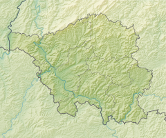
St. Arnualer Wiesen nature reserve
|
St. Arnualer meadows
|
||
| location | Saarbrücken | |
| surface | 39 ha | |
| Identifier | N 6708-308 | |
| WDPA ID | 555521668 | |
| Geographical location | 49 ° 13 ' N , 7 ° 1' E | |
|
|
||
| Setup date | August 12, 2004 | |
| administration | State Office for Environment and Occupational Safety | |
The St. Arnualer Wiesen (also: Daarler Wiesen ) are a nature reserve in Saarbrücken. The area covers 36 hectares and was designated as a nature reserve in 2004.
location
The nature reserve is located on the right bank of the Saar between the Saar and the Saarbrücken – Saargemünd railway line in the southeast of Saarbrücken. In the north the Osthafen borders the area, in the south an industrial area, in the east the Brebach-Fechingen district .
history
The western area of the St. Arnualer Wiesen was the location of Saarbrücken Airport until 1955 . Even before flight operations ceased, rubble was being stored in some areas . At this point in time, the entire length of the area was connected to the St. Arnual district in the west . In the 1960s, however, the Saar, which ran in the east, was relocated to the west and in future separated the meadows from St. Arnual. The A620 motorway between Saar and St. Arnual was also built. In addition to building rubble, the excavation of the Saar breakthrough in the St. Arnualer Wiesen was also disposed of. In some areas, sand was backfilled up to 3 m thick. At the same time, plans began for an industrial settlement, but these were rejected again. A stone witness to these plans is a four-lane " ghost bridge" over the Saar, which was supposed to connect the future industrial area to St. Arnual. However, the bridge lacks transport links, so that it only connects walking paths today. The area remained untouched.
Until the 1990s there were repeated considerations about industrial settlement, but the plans failed due to resistance from the population and a citizens' initiative. In 1995 advocates for the preservation of the St. Arnualer meadows as open space prevailed. In the same year, the city council decided on a “St. Arnualer Wiesen utilization concept”. In 2003, the state followed this decision to preserve it as open space and decided to designate it as a nature reserve. At the same time it was registered as a European protected area according to the Fauna-Flora-Habitat Directive .
In 2015 the nature reserve was declared part of the Natura 2000 network under the identifier N 6708-308 with the same name and location .
fauna and Flora
The combination of clayey floodplain soils and the debris and sand heaps created a complex biotope of forest , sandy grasslands , wet meadows and swamps . In the meantime 33 breeding bird species, such as kingfisher , partridge and snipe , but also 163 butterfly species , including the rare, endangered great fire butterfly , inhabit the area . A rare flora has also developed, including 10 types of orchid, such as pyramidal dogwort , forest bird , orchid , broad-leaved stendellum , large two-leaf , bee ragwort , horny orchid and two-leaved forest hyacinth .
Web links
Individual evidence
- ↑ Ordinance on the nature reserve “St. Arnual meadows ”. (PDF) In: Saarland Official Gazette . September 2, 2004, accessed July 25, 2020 .
- ↑ a b The St. Arnualer Wiesen nature reserve ( memento from July 15, 2013 in the Internet Archive ), Saarland Ministry for the Environment, Energy and Transport
- ↑ a b The St. Arnualer Wiesen nature reserve and its wild orchids , NABU Saarbrücken
- ↑ Ordinance on the nature reserve “St. Arnualer meadows ”(N 6708-308). (PDF) In: Saarland Official Gazette . November 19, 2015, accessed July 25, 2020 .


