Río Negro Department
| Río Negro | |||
|---|---|---|---|
| Symbols | |||
|
|||
| Basic data | |||
| Country | Uruguay | ||
| Capital | Fray Bentos | ||
| surface | 9282 km² | ||
| Residents | 54,765 (2011) | ||
| density | 5.9 inhabitants per km² | ||
| ISO 3166-2 | UY-RN | ||
| politics | |||
| Intendant | Omar Lafluf | ||
| Political party | Partido Nacional | ||
Coordinates: 32 ° 47 ′ S , 57 ° 27 ′ W
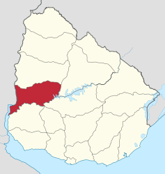
Río Negro is a department in Uruguay .
geography
Location and description
The department, which covers an area of 9,282 km², is located in the west of the country. The Uruguay River , which also forms the border with Argentina , flows on its western border . The capital Fray Bentos is a center of meat processing. It is located on the Río Uruguay opposite the Argentine Gualeguaychú and has 23,122 inhabitants (2004 census). The Puente Internacional Libertador General San Martín bridge near the city is part of the shortest overland connection between Buenos Aires and Montevideo . The second largest city is the important transport hub Young , 90 km northeast of Fray Bentos, with 15,759 inhabitants (as of 2004).
Natural resources
Gypsum deposits are present at Bellaco in the department .
history
The department was formed in 1868 from the old department of Paysandú. One of the pioneers in this area was the French Basque José Hargain, who settled here with his wife and daughters. Fray Bentos, the capital of the province, was founded in 1853 under the name Villa Independencia. The current name of the city refers to a supposed monk (fraile → fray) who lived in the Barranca de Caracoles (snail canyon) before Villa Independencia was founded.
origin of the name
The Río Negro , which gives the department its name, crosses the south of the department and is the most important inland river.
Infrastructure
education
Río Negro has a total of 14 secondary schools ( Liceos ) in which 4,296 students are taught by 373 teachers. The oldest Liceo in the department is the Liceo N ° 1 Departamental "Eugenio Capdevielle" , established in 1912 in the department capital Fray Bentos . (As of December 2008)
economy
Fray Bentos is home to one of the most important ports on the Uruguay River, which gave the area a great deal of development in the mid-19th century. Over time, the port developed into the port of departure for all of the region's dried meat production. Later, by enlarging the port, ships with great drafts were able to pass through, making it possible to ship the dried meat all over the world. In 1963 , silos were built to ship the regional grain production.
Population development
While 53,989 inhabitants were counted in 2004, the number of inhabitants determined in the 2011 census was 54,765. Of these, 27,576 were men and 27,189 women.
politics
Omar Lafluf of the Partido Nacional holds the leading position of the executive branch of the department, the office of the intendente .
Web links
- Map of the department on the website of the Instituto Nacional de Estadística . (PDF)
Individual evidence
- ↑ Ulises Rubens Grub : Atlas geografico de la República Oriental del Uruguay, Montevideo 1980, p. 35
- ↑ Liceos del Uruguay (Spanish) (PDF; 7.3 MB), accessed on February 29, 2012
- ↑ Statistical data of the 2011 census ( memento of the original from September 27, 2015 in the Internet Archive ) Info: The archive link was inserted automatically and has not yet been checked. Please check the original and archive link according to the instructions and then remove this notice. of the Instituto Nacional de Estadística de Uruguay , accessed on August 29, 2012 (XLS file; 25 kB)


