
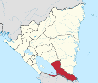
Río San Juan Department
| Río San Juan | |
|---|---|
  |
|
| Data | |
| Capital | San Carlos |
| population | 98,000 |
| surface | 7,473 km² |
| Population density | 13 people / km² |
| structure | 6th |
| ISO 3166-2 | NI-SJ |
 |
|
The department of Río San Juan is one of 15 administrative districts in Nicaragua .
It is named after the river of the same name , which starts at the capital of the department of San Carlos as an outflow from Lake Nicaragua and flows into the Caribbean Sea almost 200 km east at San Juan del Norte . The Río San Juan also forms the border with Costa Rica . The archipelago of the Solentiname Islands in Lake Nicaragua , which consists of 36 islands, also belongs to the region . In the east of the region towards the Caribbean lies a large nature reserve, the Reserva Biológica Indio-Maíz .
Around 98,000 people live in the department (2006 calculation) , making it the administrative district with the fewest inhabitants. The area is 7,473 km².
The city of San Carlos, founded in 1949, is located on the shores of Lake Nicaragua and has around 30,500 inhabitants. It is the economic and administrative center of the region. The second largest town is San Miguelito with about 16,257 inhabitants. About 70% of the inhabitants of the Río San Juan region live in rural structures, mostly in subsistence farming from the cultivation of corn, beans and rice; about 30% in San Carlos.
Municipios
The following municipalities belong to the Department of Río San Juan :
- San Carlos
- El Almendro
- El Castillo
- Morrito
- San Juan de Nicaragua
- San Miguelito
Coordinates: 11 ° 19 ′ N , 84 ° 42 ′ W
Web links
Boaco | Carazo | Chinandega | Chontales | Estelí | Granada | Jinotega | León | Madriz | Managua | Masaya | Matagalpa | Nueva Segovia | Rivas | Río San Juan
Autónoma Region in Nicaragua
Autónoma Region of the Costa Caribe Norte |
Autonomous Region of the Costa Caribe Sur