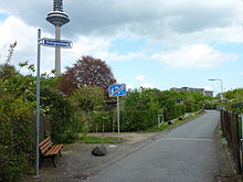
Diebsgrundweg


The Diebsgrundweg or Diebsweg for short in the Hessian city of Frankfurt am Main is part of the Hohe Straße or Antsanvia , an old road from Spain to Russia. This trade route ran through today's Frankfurt districts of Bockenheim , Dornbusch , Eckenheim and Preungesheim .
history
The course of the Diebsgrundweg was interrupted in 1967 by the construction of the headquarters of the Deutsche Bundesbank . Previously it had led from Bockenheim in the west over the Dornbusch to Marbachweg and left the Frankfurt area near Bergen in the east. Located directly outside the fortifications of the Frankfurter Landwehr , it marked the northern border of the urban area at that time. The name suggests “dark figures” who avoided control of the free imperial city.
With the incorporation of Preungesheim in 1911, part of the Diebsgrundweg, the area between Eschersheimer Landstrasse and Friedberger Landstrasse , was renamed Marbachweg. This street did not get its name from the city of Marbach, but from the former Markbach ("Grenzbach" - see Mark ), which separated the Frankfurt district from the neighboring Countess-Hanau area of Amt Bornheimerberg until the 19th century . This Markbach originated at a field court at the Wehrhof Kühhornshof , the remains of which are currently on a Hessischer Rundfunk plot of land that is not publicly accessible .
The Diebsgrundweg was first mentioned in a document from the Kühhornshof from 1323. The patrician and later mayor of Frankfurt Jakob Knoblauch bought that year from Mechthild von Breuberg , the widow of the last Breuberger Eberhard, their farmstead, described with the words "[...] who stoszent uf den Dypewek" ("who comes across the thief's path there." ").
At the moment, only a short stretch of road for pedestrians and cyclists, which leads between allotment gardens from Bockenheimer Frauenlobstraße to the edge of the Frankfurt-Miquelallee motorway exit , is officially called Diebsgrundweg.
Web links
References and comments
- ↑ The name Hohe Straße, on which a section of the Way of St. James runs, has been preserved northeast of today's Frankfurt district of Bergen-Enkheim . - City of Frankfurt am Main, Environment Agency (ed.): The Green Belt Leisure Card . 7th edition, 2011
- ^ Rudolf Jung, Julius Hülsen: The architectural monuments of Frankfurt am Main - Volume 3, private buildings . Self-published / Keller, Frankfurt am Main 1914, p. 301
- ↑ Falk map of Frankfurt a. M./Offenbach a. M., Falk Verlag, Ostfildern 2011