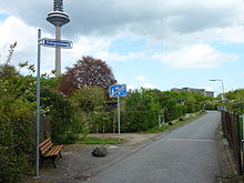
Antsanvia
The Antsanvia is an old road that ran from Mainz to Eisenach in Thuringia as a high-altitude path along the watersheds on the hills without crossing the villages . The name is derived from the Latin antiana via - old street.
Designations
Like all old streets, the Antsanvia had different names in its course. Between Bergen and Ostheim (now part of Nidderau ) it was called Hohe Straße . In the Büdinger Forest it is known as Reffenstrasse ; The name probably comes from the first hill, Großer Reffenkopf ( 298 m above sea level ), over the slopes of which the road continues into the Büdinger Forest. Then the names Alte Straße , Kärrnersweg (the name is derived from the term Karren) and Fuldaer Straße are recorded. The name Antsanvia has only been passed down from Fulda or Hünfeld to Eisenach .
Some of these names are still recorded today in the official topographic maps of the Land Surveying Office, so that the course can be easily traced. It should be noted that the field and forest paths so designated today no longer always follow the old route. The paths have changed in their course , for example due to land consolidation, filling in old ravines and the requirements of agricultural machinery.
course
In Mainz beginning, the road led parallel to Main to maximum (old Elizabeth Street ), on the Nidda at Nied ( Roedelheimer road today Oeserstraße ), on the vine past by the Biegwald (Biegweg), then north to Bockenheim over, about the Ginnheimer height ( Diebsgrundweg ) and over the Dornbusch (Marbachweg) and Lohrberg to Bergen . From here the path ( Hohe Straße ) stayed on the ridge between the Nidder and the Kinzig . It went from Bergen between Kilianstädten and Roßdorf via Ostheim (now part of Nidderau ) to Marköbel (district of Hammersbach ), where the road led through the Roman fort that was then located there and the Limes out of the formerly Roman-controlled area. Over the hills between Langen-Bergheim and Altwiedermus , the route continued via Diebach am Haag and Herrnhaag . From here the road (Reffenweg) ran between Lorbach and Vonhausen over the Großer Reffenkopf through the Büdinger Forest. Coming out of the woods, the path went on between Rinderbügen and Waldensberg past (today at Leisenwald Reffestraße ) Hitzkirchen and Hettersroth and between upper and lower Reichenbach until after Radmühl where the salt has been exceeded, here they crossed the Ortesweg . The route (Alte Straß) led between Salz and Freiensteinau , Reichlos and between Hauswurz and Brandlos .

.
South past the Himmelsberg, the state road 3079 runs further northwest to Giesel over the Himmelsberg and the Herrgotteiche near Giesel to Fulda near Kämmerzell, where the river was crossed by a ford. The Antsanvia then met the Kinzigtalstraße near Hünfeld .
Since the long bridge over the Fulda was built near Fulda in 872 (a little north of the mouth of the Giesel ), the route north to Giesel and between Sickels and Hamerz through to the Fulda has become more important. At the bridge over the river, the Kinzigtalstraße also met the Antsanvia.
From Hünfeld the Antsanvia then ran on through the Kuppenrhön to Vacha , where it crossed the Werra . From there the road continued to Eisenach . Today the federal highway 84 runs along this route between Hünfeld and Eisenach .
history
The road was at the Karl Mann - donation (handed down in the Chartula St. Bonifatii ) to the monastery of Fulda 747 for the first time earlier, when she served for the boundary description. The path was also mentioned in the Vita Sturmi (around 810). A passage describes how Sturmius was looking for the place for the monastery and how the Fulda hiked up from Hersfeld . He crossed the Antsanvia, which crossed the Fulda at Kämmerzell. This path has probably been used since the Stone Age . Historians established this on the basis of excavations of the old settlements and barrows along the old route.
The Antsanvia lost its importance as a trade route when the Kinzigtalstrasse gained importance in the early Middle Ages . Only in Hünfeld or Fulda did the Kinzigtalstrasse meet the Antsanvia again, from where it continued to Eisenach, Erfurt and Leipzig . This route is known as Via Regia or Alte Frankfurter-Leipziger Strasse .
literature
- Georg Landau : Contributions to the history of the old army and trade routes in Germany. Bärenreiter Verlag, Kassel 1958.
- Jochen Heinke: Out and about on the streets of our ancestors. Nidderau 2003, ISBN 3-936622-10-8 .
- Paul Erb: The cherry tree near Giesel - an early historical trail mark on the Antsanvia. In: Buchenblätter - Supplement to the Fuldaer Zeitung for Heimatfreunde, 85th year, No. 19 from September 25, 2012, p. 76.

