
Himmelsberg (Giesel)
| Himmelsberg | ||
|---|---|---|
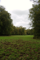
_von_S%C3%BCdosten.jpg) The Himmelsberg (in the background) from the southeast with a plateau-like summit area |
||
| height | 489.7 m above sea level NHN | |
| location | at Giesel ; District of Fulda , Hessen ( Germany ) | |
| Mountains |
Unterer Vogelsberg ( East Hessian highlands ) |
|
| Coordinates | 50 ° 30 '44 " N , 9 ° 32' 27" E | |
|
||

The Himmelsberg near Giesel in the Hessian district of Fulda is 489.7 m above sea level. NHN high mountain of the Lower Vogelsberg in the East Hessian highlands .
The Himmelsberg is an extinct volcano from the Tertiary , that is, it emerged millions of years ago over the large magma chamber of the Vogelsberg as an outflow in the Gieseler Forest . Under the lava rock there is lignite that was tried to be mined in the middle of the 19th century .
geography
The Himmelsberg near Fulda rises as a distinctive, elongated mountain ridge with a height of almost 490 m between Giesel and Kleinheiligkreuz in the extensive Gieseler Forest . Its flora and fauna , but also its geology and history are worth studying. Its mighty red sandstone base is underlain by the approximately 200 m thick salt deposits of the Zechstein Sea (around 240-2525 million years ago). In the deposits are mine galleries of potash K + S Neuhof , the sky to below the mountain toward Bad Salzschlirf rich. Sediments in which two coal seams are stored lie above the red sandstone . The top of the mountain is formed by a two-part basalt cover . The Himmelsberg can be called a witness mountain , as its basalt cover proves that the lava masses of the Vogelsberg volcanism penetrated this far.
Emergence
In the Miocene (around 10 million years ago) layers of sand and clay were deposited on the much older red sandstone (around 220 million years old) . In a basin without drainage, a peat bog formed , from which the brown coal later emerged. The character of the landscape at that time was determined by a number of forms of vegetation . Conifers stood next to beeches and willows , with bushes, herbaceous ferns and laurel trees in between . At the beginning of the Vogelsberg volcanism , a thin layer of tuff and ash was deposited, over which several layers of lava were then pushed. This hard cover has preserved the remains of plants from the Himmelsberg found in the tertiary history for posterity. The erosion that is still active today has eroded parts of the land surface at that time , washed away in the streams and rivers and thus modeled the shape of today's mountain.
location

;.JPG)
The Himmelsberg rises between the Vogelsberg in the west and the Rhön in the east in the Gieseler Forest . Its summit is 4.4 km southwest of Oberrode (city of Fulda ), 2 km west-northwest of Giesel (municipality of Neuhof ), 4.5 km east-northeast of the center of Hosenfeld , 3.6 km east-southeast of Schletzenhausen (municipality of Hosenfeld), 4.6 km southeast of Hainzell (Hosenfeld) and 4.5 km south-southeast of Kleinlüder (municipality of Großenlüder ). The core city of the city of Fulda, located on the Fulda , is about 10 km to the northeast. Although the mountain is considered mountain of Gieselmann, but he is in the district of Hosenfeld. The Egert ( 430.9 m ) lies east-southeast in the direction of Giesel .
At the eastern foot of the Himmelsberg lies the Neuhof district of Giesel in the Giesel (Gieselbach) valley . Is at its west foot the valley of Lüder -Zuflusses Cold Lüder extending from the Siebenbrunnental past the Weiler Sieberzmühle with the same excursion inn below a walker parking at the national road 3079 with the Rabental combined. It continues in a northerly direction past the Zwickmühle and past the Schlagberg and Hessenmühle residential areas to the west, past the pilgrimage church of Kleinheiligkreuz , to merge with the Jossa valley south of Kleinlüder .
Natural allocation
The Himmelsberg belongs in the natural spatial main unit group Osthessisches Bergland (No. 35) and in the main unit Unterer Vogelsberg (350) to the subunit Fuldavorland of the Vogelsberg ( Gieseler Forest ) (350.6) and represents a singularity of the 5th to 7th order. To the northeast leads the landscape over to the main unit Fuldaer Senke (352) and to the northwest to the subunit Eastern Lower Vogelsberg (350.3).
Protected areas
On the Himmelsberg are above the 420-m contour the nature reserve Himmelsberg ( CDDA -No 163681;. Expelled 1980 1.3261 square kilometers large) and area coverage and equal fauna Habitats -region Himmelsberg (FFH number 5423rd -301).
Flora and fauna
On the plateau- like summit region of the Himmelsberg there is a protected, gradually (left to itself) growing and light pearl grass beech stand, while the rest of the forest, such as that of the Gieseler Forest, consists mainly of pine forests with interspersed smaller spruce and mixed forest stands. On the western mountain slope, forest meadows used for agriculture are interspersed from Giesel . The mountain has predominantly the occurrence of blueberry and pine forests, which is unique in northern Hesse, as a habitat for Caprimulgus europaeus ( goat milkers ). It is of regional importance as a valuable breeding area . For example, there are black storks in the west in the Himmelsberg nature reserve with food relationships in the Giesel valley (Gieselbach) in the south and its tributary Saurode (with ponds) in the north. Reference to four red kite brood occurrences in the forest edge area in the northwest over the main part.
389 species (including introduced tree species) were found during the 1979 and 1985 inventories to compile a list of the total flora NSG "Himmelsberg".
history
overview
The Himmelberg part of the origin of the Frankish Empire under the dynasties of the Merovingian and Carolingian from the 5th century over 13 centuries and up to the modern era to the belonging to Gieselmann forest district of the former forester Gieselmann with its numerous forest areas. In terms of historical development, the district originates from the earlier Wildbann Zunderhart - Karlmann donation the donation of land from Hausmeier Karlmann to Winfried Bonifatius in 747 to the Fulda monastery - the later forest estate ( domain ) that existed until the 19th century . The boundaries of the Gieseler Forest almost coincide with the area of the Zunderenhart forest area (Zundernwald) between the rivers Fulda and Lüder up to the Fliede . After the regional reform in Hesse since the 1970s, the Himmelsberg was assigned to the Hosenfeld district in order to compensate for the size of the new district areas from the former district of Oberförsterei Giesel .
religion


The living spaces shock Berg , Hesse mill and small Holy Cross with the sanctuary belonged since 1731 to the Vice My Dung and Umpfarrung in the years 1961/62 the political community Gieselmann and pfarrlich to the Church of St. Lawrence (Giesel) . Since then, two pilgrimages have led to the cross festivals from the mother parish of Giesel to Kleinheiligkreuz. With the Umpfarrung also draws over centuries to the solemnities ended Finding of the Cross (May 3) with agricultural machinery blessing and Exaltation (September 14) that took place pilgrimages of Gieselmann to Klein Holy Cross.
It was not until the 1980s that the old pilgrimage from Giesel to Kleinheiligkreuz was resumed on the old pilgrimage route over the Himmelsberg / Herrgottseiche during the "Cross Week" (Exaltation of the Cross - September 14th). Since then, the pilgrimage has taken place in September during the pilgrimage week " Exaltation of the Cross ".
Economic history
pottery
On the upper south-east slope of the Himmelsberg there are a large number of clay chews (residual holes), some of which are filled with water , which are evidence of the ancient pottery in Giesel, which was documented from the 15th century . These are documented from 1400 under Prince Abbot Johann I von Merlau (1395–1440). In 1640 there are twelve "Uhlmeister" = Üllermeister (master potter) in Giesel. In 1832 there were 29 master potters in "Döpfgiesel", but only 15 of them were still active. 1850 when the community kiln (am Dalles) in Töpferstrasse is dismantled and sold.
Lignite mining
In the middle of the 19th century, paleobotanists from Dresden-Neustadt recorded the mine. Almost to the level of the sky mountain intersected by Hermann Engelhardt from the Dreikönigschule Dresden-Neustadt and local teacher Kunzmann in an approximately 70 m deep shaft first basalt , then a layer of clay , under which a layer of quicksand and including tone followed, wherein the ceiling of coal educated. According to the samples submitted, the latter was bog coal with lignite inclusions and was " extracted in two narrow seams and brought to the surface through a tunnel driven to the SE (southeast), some of which has been preserved".
"The fossils, however, which were found in the mostly black, chocolate-brown or porcelain-colored clays and less in the coals, have remained with us. They were collected by Ernst Conrad Hassencamp (1824-1881), who was responsible for the petrefacts of the Rhön and Vogelsberg has earned great merits, and they are kept in the Senkenbergisches Museum ; zu Frankfurt a. M. What we have heard from him so far has been extremely small; however, this work makes it possible to take an extended look at the embedded remains of the tertiary Himmelsberg flora She can report on more than 100 species, which can be classified into 46 families and 69 genera. The Cubulifera (9 species) Papiilionaceae (8), Iuglandeen (6), Rhamneen (5 ), followed by the Myriceen, Betulaceae, Proteaceen (each with 4 species and the Ferns, Ulmaceae, Salicineen, Laurineen and Acerineen (each with 3). "
In 1873 the mining was stopped because there was little need for coal in the area due to the abundance of wood and the low industry and the transport on bad roads to Fulda was too expensive.
The old mine tunnel , which now serves as a bat refuge, bears witness to the presence of brown coal under the summit area .
legend
According to a legend, many centuries ago lived in the Zunderhart, a large, deep forest between the Rhön and Vogelsberg mountains, the wild army that rose up against its king and was driven from his homeland.
Surveying and observation tower
Until after the Second World War (1939–1945) there was a walk-in wooden surveying and observation tower on the top of the Himmelsberg . Due to its exposed location, it offered an excellent view over the treetops of the old beech trees in all four directions - including these visual destinations: the Rimberg ( Knüllgebirge ) in the north, the Wasserkuppe ( Rhön ) in the east, the Hessian ridge in the south, the Taufstein and Hoherodskopf ( Vogelsberg ) in the west. Due to its age, the tower was no longer stable after 1954, fell apart and was no longer renewed.
Today there is a trigonometric point of the national survey as a visible granite stone on the mountain top at the place of the former location .
Economic history
The Himmelsberg was once of economic importance for Giesel:
Basalt quarry
A few hundred meters away from the surveying and observation tower that once stood on the mountain was a quarry in which basalt was mined. In the 1970s it was filled with demolition material from the former Hutstoffwerke Fulda located in the nearby city of Fulda . After this was forbidden for nature conservation reasons, it is now overgrown with bushes and young trees in the still recognizable edge areas in the course of the succession.
Sound degradation
Clay mining played an important role in the Middle Ages up to modern times, for the production of earthenware, for the area of the Fulda monastery and beyond. The still recognizable clay chewing are numerous on the south-eastern slopes that come close to the summit region. As funnel-shaped excavation pits, they testify to the historical clay mining. They are not bomb craters caused by bombs in the final days of World War II, as is often wrongly believed.

Lignite mining
For lignite mining in modern times, there were two phases of mining attempts on the southern slope of the mountain at the level of the 450 m height line at the beginning of the 20th century. Lignite was to be extracted by creating a tunnel excavated by miners through the adjacent red sandstone . The attempts failed. According to local research, the coal found was 1000 years too young. In 1920 the mine was finally closed.
The tunnel entrance and the remains of the facilities as well as the small spoil dump with a low pile head can still be found on what is popularly known as the mining road , which can be reached almost at the same level from the Sieberzheiligen hikers' car park .
traffic

.
State road 3079 ( Hosenfeld –Sieberzmühle– Giesel ) runs south past the Himmelsberg . The ancient Antsanvia trade route ran south-southeast of the mountain at the Sieberzheiligen hill . Old ways brands still bear witness to the course immediately to the side of the tarmac and into the 1970s by Oberrode leading circle Straße 107 . As part of a de-dedication procedure according to the Hessian Road Act (HessStrG), the road formerly dedicated to public road traffic was downgraded to a forest road in agreement with the Fulda Forestry Office, the Fulda district and the Hosenfeld community. The K 107 only exists between the Fulda districts of Oberrode and Besges .
hike
Opposite the Sieberzheiligen hikers' car park there is a wayside shrine and a vertical sandstone, an old boundary stone from the early Karlmann donation, probably from the year 747, which was moved to the opposite side of the street in the course of the construction of the L 3079 in the 1960s.
Himmelsberg can be explored and hiked directly from the much used Sieberzheilgen hikers' car park on the L 3079 on marked hiking trails that are in good condition. It can also be explored from other hikers' parking lots around the mountain from various starting points: At the hamlet of Sieberzmühle with the excursion restaurant of the same name or at the pilgrimage church of Kleinheiligkreuz , the mountain can be hiked on forest and forest paths that are closed to public vehicle traffic .
care
In 1966, the new elevated tank for the Giesel water supply was built directly adjacent to the hikers' car park.
Picture gallery
One of the many glades by the wild have been processed

Old beech stock

Trees

Wet meadows

Beech population in forest meadows

Border areas

The forest floor with Lycoperdon pyriform pear dusting


Web links
- Gieseler Forst , on ich-geh-wandern.de
- PDF action plan for the FFH area "Himmelsberg" Status: 31.08.2009
Individual evidence
http://natureg.hessen.de/resources/recherche/Schutzgebiete/RPKS/GDE/5423_301/Texte/Gutachten.pdf Basic data acquisition for the FFH area Himmelsberg (No. 5423-301)
literature
- Erwin Lorey: The Himmelsberg and its natural surroundings - from becoming and discovering its landscape , 1st edition 2010, German National Library, ISBN 978-3-86805-567-2
- Prof. H. Engelhardt About teritary plants from Himmelsberg near Fulda - 1902 Dreikönigsschle Dresden-Neustadt