Dischma
| Dischma | ||
|---|---|---|
|
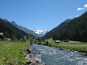
View into the Dischma at Uf den Chaiseren |
||
| location | canton of Grisons | |
| Waters | Dischmabach | |
| Mountains | Alps | |
| Geographical location | 785 665 / 183380 | |
|
|
||
| height | 1550 to 3146 m above sea level M. | |
| length | 13 km | |
The Dischma is a high valley in the area of the Swiss municipality of Davos . The name is derived from the Latin decimus "tithe", which is attested as decimata in the 12th century.
location
The Dischma is the middle of the three elongated, gently sloping high valleys that extend parallel to the south-east from the Davos plateau towards the Engadine ; The Flüela joins to the northeast and the Sertig to the southwest . It is drained from the Dischmabach . The valley floor is between 1500 and 2000 meters above sea level. The most important side valleys are the Rüedisch Tälli and the Rinertälli.
Settlements
There are some small settlements and alps in the valley. The most important ones are up the valley: In den Büelen, Wildi ( 1577 m above sea level ), Uf den Chaiseren ( 1590 m ), In den Stücken ( 1616 m ), Stillberg ( 1974 m ), Hof ( 1664 m ), Teufi ( 1700 m ), Boden ( 1704 m ), Gadmen ( 1819 m ), Am Rin ( 1846 m ), Grossalp ( 1953 m ) and Dürrboden ( 2007 m ).
These courtyards form the Dischma neighborhood, which belongs to the former Davos Platz parliamentary group .
Passes and glaciers
At the head of the valley are the two Scalettapass (Cuolm S-chaletta) and Fuorcla da Grialetsch with the SAC Grialetschhütte that lead into the Engadine . The Scalettapass was in the late Middle Ages and the early modern period for the wine import ( mule trains ) from the Valtellina to Davos important. The end of the valley is also determined by the Scaletta Glacier, which stretches between Piz Grialetsch ( 3131 m ) and Scalettahorn ( 3068 m ).
Surrounding mountains
The most important elevations towards the Flüela are the Schwarzhorn ( 3146 m ), Piz Radönt ( 3065 m ), Sentischhorn ( 2827 m ) and Baslersch Chopf ( 2629 m ); to Sertig towards Bocktenhorn ( 3044 m ), Jatzhorn ( 2682 m ) and the Jakobshorn ( 2590 m ), which is accessible by mountain railways .
The two valleys Dischma and Sertig are also the starting point for a multi-day hike to Piz Kesch , a mountain called Ultra in English, because it is more than 1500 meters independent. A hike called the Kesch Trek begins in Dischma, leads to the Kesch Hut and around the mountain.
The circuit of the Swissalpine Marathon Davos, which has been held annually since 1986, also leads through Dischma and Sertig .
traffic
From Davos to Dürrboden, line 12 of the Davos public transport company runs at irregular intervals.
Web links
Individual evidence
- ↑ Geoserver of the Swiss Federal Administration ( information )
- ↑ Andrea Schorta: How the mountain got its name. Terra Grischuna- Verlag, Chur 1999
- ↑ Archived copy ( Memento of the original from September 4, 2011 in the Internet Archive ) Info: The archive link was inserted automatically and has not yet been checked. Please check the original and archive link according to the instructions and then remove this notice. Hike around a giant in the Swiss Alps: Piz Kesch
- ↑ Anniversary: 30 years of the Swissalpine Marathon Davos swissalpine.ch, November 21, 2014, accessed September 27, 2018.


