
Dorfbach (Limmat, Spreitenbach)
|
Dorfbach Tobelacherbach |
||
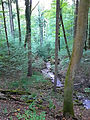
 The village stream just before the mouth |
||
| Data | ||
| Water code | CH : 2811 | |
| location |
Mittelland
|
|
| River system | Rhine | |
| Drain over | Limmat → Aare → Rhine → North Sea | |
| source | above Hausen , Bellikon 47 ° 24 ′ 8 ″ N , 8 ° 21 ′ 19 ″ E |
|
| Source height | 714 m above sea level M. | |
| muzzle | opposite Oetwil an der Limmat in the Limmat coordinates: 47 ° 25 ′ 40 ″ N , 8 ° 23 ′ 13 ″ E ; CH1903: 671 549 / 253414 47 ° 25 '40 " N , 8 ° 23' 13" O |
|
| Mouth height | 380 m above sea level M. | |
| Height difference | 334 m | |
| Bottom slope | 60 ‰ | |
| length | 5.6 km | |
| Catchment area | 5.29 km² | |
| Left tributaries | Bächlihau, Bächlihaubach, Hältebach, Bäremattbach | |
| Right tributaries | Moosmatt, Bergbach, Weidgangbach, Wilenbach | |
| Communities | Bellikon , Remetschwil , Spreitenbach | |
The Dorfbach ( called Tobelacherbach in the upper reaches ) is a roughly six-kilometer-long left tributary of the Limmat in the municipalities of Bellikon , Remetschwil and Spreitenbach in the Swiss canton of Aargau . It drains an area of around 5.3 square kilometers on the eastern slope of the Heitersberg .
geography
course
Tobelacherbach
The brook rises as Tobelacherbach in a forest area in the municipality of Bellikon above the hamlets of Hausen and Sennhof, a little west of the Egelsee and Heitersberg ridge at 714 m above sea level. M. .
Initially, it mostly flows in a north-easterly direction and only a little later flows through a forest edge in the outermost part of the municipality of Remetschwil, which is bordered by fields. He enters the forest area again and now forms a small ravine. Here it takes the brook Bächlihau from the left and shortly afterwards the mountain brook from the right before it joins the Bächlihaubach and is now called Dorfbach.

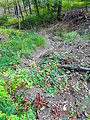
Tobelacherbach shortly before the confluence of the Bächlihaubach
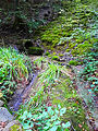
Tobelacherbach in front of the confluence of the Bergbach


Dorfbach

The Dorfbach is now dammed into a small pond after the confluence of the Hältebach and a little later, after the confluence of the Bäremattbach , a small part of the creek is diverted to the Müliweiher .
It now reaches the old village center of Spreitenbach, where it canalised but mostly flows openly. At the retirement and nursing home, a small part of the water is drained off again to feed the little duck pond.
Shortly afterwards it takes up the Wilenbach from the right , which drains the Egelsee and the Franzosenweiher and has a larger catchment area at the mouth. The village stream leaves the settlement area and is again accompanied by a forest line before it briefly follows the tracks of the Limmattal marshalling yard and finally crosses under it.
Only a little later it flows across from Oetwil on the Limmat at 380 m above sea level. M. from the left into the Limmat .
Its approximately 5.6 km long run ends approximately 334 meters below its source, so it has a mean bed gradient of approximately 60 ‰.
Catchment area
The 5.29 km² catchment area of the Dorfbach lies in the Swiss plateau and is drained to the North Sea via the Limmat, the Aare and the Rhine .
It borders
- to the east of the Reppisch , which flows into the Limmat
- in the southeast to that of the Reppisch tributary Dönibach
- to the southwest of the Junebachs that in the Reuss opens
- to the west to that of the Küntenerbach , which flows into the Alte Reuss, an oxbow lake of the Reuss
- and in the north to the catchment areas of the Dorfbach Killwangen and Hinterbergenbach , both tributaries of the Limmat.
Tributaries
- Mountain stream near its mouth


- Bächlihaubach and Heitersbergbach

Bächlihaubach before the mouth of the Heitersbergbach
Heitersbergbach shortly before its mouth


Direct and indirect tributaries of the Dorfbach with length:
- Dorfbach source ( 714 m above sea level )
- Moosmatt ( right ), 0.2 km
- Bächlihau ( left ), 0.1 km
- Mountain stream ( right ), 0.5 km
- Fegibach ( right ), 0.1 km
- Bächlihaubach ( left ), 1.3 km
- Buechetobel 1 ( left ), 0.1 km
- Buechetobel 2 ( left ), 0.1 km
- Heitersbergbach ( left ), 0.7 km
- Zelglibach ( left ), 0.2 km
- Lower half ( left ), 0.1 km
- Hältebach ( left ), 0.5 km
- Bäremattbach ( left ), 0.4 km
- Waldhausbach ( left ), 0.3 km
- Weidgangbach ( right ), 0.2 km
-
Wilenbach / Junkholzbach / Dietikerbach ( right ), 2.4 km
- Kindhauserbach / Dietikerbach ( left ), 1 km
- Quellenbach ( left ), 0.3 km
- Wilenbach ( left ), 0.6 km
- Lower Junkholzbach ( left ), 0.4 km
- Bollenhofbach ( left ), 0.4 miles
- Wilehaubach ( left ), 0.5 km
- Schänzibach ( left ), 0.4 km
- Schänzi ( left ), 0.1 km
- Grossmattenbach ( right ), 0.5 km
- Sandfelsbach ( left ), 0.2 km
- Chalberrütibach ( left ), 0.2 km
-
Egelseebach ( left ), 2.3 km
- Wallsflüehaubach ( left ), 0.2 km
- Furebach ( left ), 0.2 km
- Will ( right ), 0.1 km
- Buebach ( left ), 0.3 km
- Loorbehaubach ( right ), 0.5 km
- Dorfbach estuary ( 380 m above sea level )
Web links
Individual evidence
- ↑ a b individual records of the geographic information system of the canton of Aargau
- ↑ a b Geoserver of the Swiss Federal Administration ( information )