
Douglas (Isle of Man)
| Douglas ( Doolish ) | |||
|---|---|---|---|
|
|||
| Basic data | |||
| Region: | Isle of Man | ||
| Height : | 50 m ASL | ||
| Residents : | 27,938 (2011) | ||
| ZIP : | IM1 / IM2 | ||
| Area code : | 01624 | ||
| House of Keys : | 2 members each: Douglas North Douglas East Douglas South Douglas West |
||
| Website: | www.douglas.gov.im | ||
.jpg) |
|||

-GB.png)
Douglas [ dʊːɡlas ] ( Manx : Doolish [ ˈd̪uːlɪʃ ]) is the capital of the Isle of Man in the Irish Sea , at the mouth of the Douglas River. It has 27,938 inhabitants (as of 2011), which corresponds to a third of the population of the Isle of Man.
history
The town on the east coast of the island was a small fishing village until the 18th century. It flourished somewhat through smuggling. After the Dukes of Atholl, who previously owned the entire island, sold their sovereign rights to the British Crown, they acted as governors of Man and built the former Mona Castle as their residence in 1804 .
Douglas has been the island's capital and most important port since 1869.
In order to develop the recreation and entertainment area on the Douglas Head peninsula, a suspension bridge was planned in the 1890s. On the side facing the capital Douglas, construction of the Douglas Tower began in 1890 . For financial reasons, the project had to be discontinued three years later.
During the First and Second World Wars housed Douglas and other parts of the Isle of Man internment camp for " enemy aliens " ( " Enemy Aliens "). During the Second World War there were a total of ten camps, mostly in Douglas, including Hutchinson , Metropole, Central, Palace, Granville and Sefton Camp.
Economy and Infrastructure
The city expanded around the natural harbor, which has now been massively expanded. Douglas has ferry services to Heysham , Liverpool , Belfast , Dublin and Birkenhead . However, the main source of income for the city is tourism. There are also jobs in public administration and banking.
The Douglas Bay Horse Tramway , one of the last horse trams still in operation in the world, runs along the harbor promenade . At the north end of the promenade it has a connection to the Manx Electric Railway , which runs as an intercity tram from Douglas to Ramsey in the north of the island. The steam-powered Isle of Man Railway to Port Erin at the south end of the island begins on the western edge of the city center . From 1896 to 1929 the Douglas cable tram opened up the higher parts of the city north of the city center. Douglas is also a hub in the bus network of Bus Vannin , the island government's bus company.
name of the city
The city's name is derived from the Dhoo and Glass River , which flow into the sea at Douglas.
houses of Parliament
In Douglas is the Tynwald , the Isle of Man's parliament . It is considered to be the oldest continuously sitting parliament in the world.
Megalithic plant
The Cloven Stones (split stones) are a megalithic complex that has a certain resemblance to Scottish Clyde tombs. You are in Baldrine by Douglas.
sons and daughters of the town
- Peter Heywood (1772–1831), British naval officer
- Edward Forbes (1815–1854), British naturalist, co-founder of deep sea research
- Charles Duncan Cameron (1825–1870), British officer and consul in Abyssinia
- Patrick William Stuart-Menteath (1845–1925), British geologist, best known as a Pyrenees geologist
- The brothers and members of the Bee Gees :
- Barry Gibb (born 1946)
- Maurice Gibb (1949-2003)
- Robin Gibb (1949-2012)
- Gérard MacQuillan (* 1949), entrepreneur and racing car driver
- Dave Molyneux (* 1963), British motorcycle racer and designer
- Mark Cavendish (* 1985), British cyclist
- Peter Kennaugh (* 1989), British track and road cyclist
- Kieran Tierney (born 1997), Scottish football player

Location of Douglas on the Isle of Man
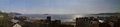
Douglas Bay

Douglas Bay

Douglas during the Tourist Trophy

Douglas waterfront


Web links
- Official website (English)
Individual evidence
Coordinates: 54 ° 9 ′ N , 4 ° 29 ′ W