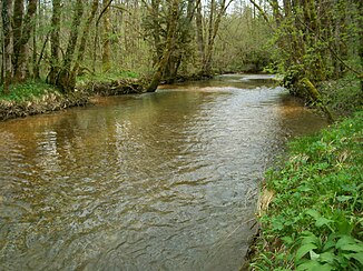
Drouvenant
| Drouvenant | ||
|
The Drouvenant between Clairvaux-les-Lacs and La Frasnée |
||
| Data | ||
| Water code | FR : V2300540 | |
| location | France , Bourgogne-Franche-Comte region | |
| River system | Rhône | |
| Drain over | Ain → Rhône → Mediterranean | |
| source | in the municipality of Châtel-de-Joux 46 ° 31 ′ 11 ″ N , 5 ° 47 ′ 34 ″ E |
|
| Source height | approx. 791 m | |
| muzzle | in the municipality of Patornay in the Ain coordinates: 46 ° 35 ′ 18 " N , 5 ° 41 ′ 54" E 46 ° 35 ′ 18 " N , 5 ° 41 ′ 54" E |
|
| Mouth height | approx. 435 m | |
| Height difference | approx. 356 m | |
| Bottom slope | approx. 20 ‰ | |
| length | 17.8 km | |
| Catchment area | 110 km² | |
| Left tributaries | Railette | |
| Right tributaries | Cressandon, Sirène | |
The Drouvenant is a flow in France , in the department of Jura in the region Bourgogne Franche-Comte runs and in the 17.8 km as right tributary Ain opens.
course
The Drouvenant rises in the Haut-Jura Regional Nature Park in the municipality of Châtel-de-Joux and flows first in a north-easterly direction. It crosses the center of Châtel-de-Joux and a little later enters the territory of the municipality of La Frasnée . From here it now flows mainly in a north-westerly direction through the municipalities of Clairvaux-les-Lacs , Vertamboz , Boissia and Charézier and finally flows into the Ain in Patornay . Its most important tributary is the Sirène , which flows into the Drouvenant at Vertamboz.
Web links
Individual evidence
- ↑ Source geoportail.gouv.fr
- ↑ estuary geoportail.gouv.fr
- ↑ a b Water information system Service d'Administration National des Données et Référentiels sur l'Eau (French) ( information ), accessed on August 21, 2014
