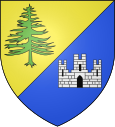
Châtel-de-Joux
| Châtel-de-Joux | ||
|---|---|---|

|
|
|
| region | Bourgogne-Franche-Comté | |
| Department | law | |
| Arrondissement | Saint-Claude | |
| Canton | Moirans-en-Montagne | |
| Community association | Jura Sud | |
| Coordinates | 46 ° 32 ' N , 5 ° 48' E | |
| height | 596-1,003 m | |
| surface | 14.13 km 2 | |
| Residents | 51 (January 1, 2017) | |
| Population density | 4 inhabitants / km 2 | |
| Post Code | 39130 | |
| INSEE code | 39118 | |
Châtel-de-Joux is a commune in the French department of Jura in the region Bourgogne Franche-Comté .
geography
Châtel-de-Joux is located at 756 m , about 16 kilometers north-northwest of the city of Saint-Claude (as the crow flies). The farming village extends in the Jura , in a depression in the headwaters of the Drouvenant, in the wooded area of the Forêt de la Joux in the western High Jura.
The area of the 14.13 km² municipality covers a section of the French Jura. The landscape is characterized by terrain structures such as ridges and hollows, which are oriented towards south-south-west-north-north-east in accordance with the direction of the fold of the Jura in this area. The basin layers often have no surface drainage, as the rainwater seeps into the porous calcareous subsoil. The only surface flowing water is the Drouvenant , which rises near the village and drains the area through a deep erosion valley northwards to the Ain .
The western boundary runs on the ridge of the Forêt de la Joux (up to 878 m ). From here the community area extends eastward over the longitudinal basin of Châtel-de-Joux, the ridge of the Forêt de la Crochère ( 832 m ) and another longitudinal basin to the adjacent wide ridge of the Forêt de Prénovel , the highest at 995 m Elevation of Châtel-de-Joux is reached. The municipality is part of the Upper Jura Regional Nature Park (French: Parc naturel régional du Haut-Jura ).
Neighboring municipalities of Châtel-de-Joux are Hautecour , La Frasnée and Saint-Maurice-Crillat in the north, Nanchez and Les Piards in the east, Étival and Meussia in the south and Thoiria , Soucia and Clairvaux-les-Lacs in the west.
history
The municipality of Châtel-de-Joux was already settled in prehistoric times and during Roman times. The place was first mentioned in the 13th century under the name castellum Jovis . Since the Middle Ages, Châtel-de-Joux has been under the rule of Clairvaux. Together with Franche-Comté , the village came to France with the Peace of Nijmegen in 1678.
Attractions
The Saint-Claude chapel dates from the 17th century; the bell tower was added in the 19th century. Ruins have been preserved from the medieval castle.
population
| Population development | |
|---|---|
| year | Residents |
| 1962 | 90 |
| 1968 | 72 |
| 1975 | 71 |
| 1982 | 66 |
| 1990 | 59 |
| 1999 | 48 |
| 2004 | 51 |
With 51 inhabitants (as of January 1, 2017), Châtel-de-Joux is one of the smallest communities in the Jura department. After the population in the first half of the 20th century had always been in the range of around 100 people, a continuous decline in population has been recorded since the early 1960s.
Economy and Infrastructure
Until well into the 20th century, Châtel-de-Joux was predominantly a village characterized by agriculture , especially cattle and dairy farming, and forestry. Even today, the residents live mainly from their work in the first sector. Outside the primary sector there are only a few jobs in the community, including in a sawmill.
The village is located off the major thoroughfares on a departmental road that leads from Clairvaux-les-Lacs to Saint-Lupicin . Another road connection is with Prénovel.
