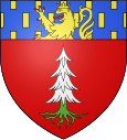
La Pesse
| La Pesse | ||
|---|---|---|

|
|
|
| region | Bourgogne-Franche-Comté | |
| Department | law | |
| Arrondissement | Saint-Claude | |
| Canton | Saint-Lupicine | |
| Community association | Haut-Jura Saint-Claude | |
| Coordinates | 46 ° 17 ' N , 5 ° 51' E | |
| height | 800-1,440 m | |
| surface | 24.26 km 2 | |
| Residents | 343 (January 1, 2017) | |
| Population density | 14 inhabitants / km 2 | |
| Post Code | 39370 | |
| INSEE code | 39413 | |
La Pesse is a commune in the French department of Jura in the region Bourgogne Franche-Comté .
geography
La Pesse is at 1160 m and is one of the highest municipalities in the Jura , about eleven kilometers south of the city of Saint-Claude (as the crow flies). The farming village extends in the High Jura, in a hollow on the plateau of the Hautes-Combes north of the Crêt de Chalam in the headwaters of the Semine .
The area of the 24.26 km² large municipality covers a section of the French Jura. The area lies almost exclusively on the plateau of the Hautes-Combes (on average at 1200 m ). The landscape is wavy and shows terrain structures such as ridges and hollows, which are oriented in a south-west-north-east direction according to the direction of the fold of the Jura in this area. The basin layers do not have any surface drainage, as the rainwater seeps into the porous calcareous subsoil. In places that are sealed by clay minerals , there are bog areas and small ponds. The only surface flowing water is the Semine , which rises near La Pesse and then flows southwest into a valley furrow.
To the west, the parish soil extends to the upper edge of the deeply cut valley of the Tacon ( Les Couloirs , 1240 m ). In the east, the municipal area extends over a series of parallel ridges that gradually increase in height up to the ridge that runs from the Crêt de Chalam to the northeast and forms the boundary to the valley of the Valserine . The highest point of La Pesse is reached on the Crêt au Merle at 1,440 m . The high plateau of the Hautes-Combes shows a loose structure of pastureland and forest. The municipality is part of the Upper Jura Regional Nature Park (French: Parc naturel régional du Haut-Jura ).
In addition to the actual village, La Pesse also includes various hamlets and farm groups, including:
- L'Embossieux ( 1170 m ) on the Hautes-Combes plateau
- L'Embouteilleux ( 1120 m ) in a depression on the Hautes-Combes
Neighboring municipalities of La Pesse are Coiserette and Les Moussières in the north, Bellecombe and Chézery-Forens in the east, Champfromier and Belleydoux in the south and Les Bouchoux in the west.
history
The place name Pesse is derived from the old French word pesse , meaning red fir ( Picea abies ) and is still used today in patois . Together with Franche-Comté , the village came to France with the Peace of Nijmegen in 1678. It was not until 1832 that the village was separated from Les Bouchoux and raised to an independent municipality, which at that time still bore the name Hautes-Molunes . In 1907 the parish was renamed La Pesse.
Attractions
The village church of La Pesse was built in the 19th century. In the local history museum, life and craftsmanship on the Hautes-Combes is shown.
population
| Population development | |
|---|---|
| year | Residents |
| 1962 | 324 |
| 1968 | 275 |
| 1975 | 210 |
| 1982 | 232 |
| 1990 | 245 |
| 1999 | 263 |
With 343 inhabitants (as of January 1, 2017), La Pesse is one of the small communities in the Jura department. After the population had decreased markedly in the first half of the 20th century (840 people were still counted in 1886), a significant increase in population has been recorded again since the mid-1970s.
Economy and Infrastructure
Until well into the 20th century, La Pesse was primarily a village characterized by agriculture , in particular cattle breeding and dairy farming, as well as forestry. In addition, there are now some local small businesses. Many workers are also commuters who work in the larger towns in the area.
As a resort in a popular excursion area in the High Jura, La Pesse today also benefits from tourism, especially from winter tourism when cross-country skiing can be practiced on the Hautes-Combes plateau. A ski lift is in operation on a slope near L'Embossieux in winter.
The village is located off the major thoroughfares on a departmental road that leads from Septmoncel to Belleydoux. Further road connections exist with Les Bouchoux and Champfromier.
