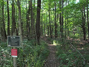
Dry Hill, Massachusetts
|
Dry Hill
|
||
|
Hiking trail in the protected area |
||
| location | Massachusetts , United States | |
| surface | 0.83 km² | |
| Geographical location | 42 ° 8 ′ N , 73 ° 14 ′ W | |
|
|
||
| Setup date | 2000 | |
| administration | The Trustees of Reservations | |
Dry Hill is a 206 acres (0.8 km² ) nature reserve around the 1,742 ft (531 m ) high mountain of the same name in the city of New Marlborough in the state of Massachusetts in the United States and is administered by The Trustees of Reservations .
history
Originally, today's reserve on the site of Agriculture and Forestry operated, and there were marble - quarries whose income was primarily used for the foundations of local buildings. At last there was a private school .
The protected area was created in 2000 through a donation to the trustees, who bought additional areas.
Protected area
The area known as Dry Hill is made up of rocky elevations and valleys and is part of a larger contiguous forest area that serves as an important habitat for large mammals as well as for many species of forest birds (here in particular the blue-backed warbler ).
A 1.5 mi (2.4 km ) circular trail leads through the reserve, past red maples , hemlocks and oak forests . Areas densely overgrown with heather alternate with open areas on which cultivated blueberries , borage , uvularia and shadow flowers, among other things , grow.
See also
Individual evidence
- ^ Property History. The Trustees of Reservations , accessed December 26, 2013 .
- ^ About Dry Hill. The Trustees of Reservations , accessed December 26, 2013 .


