Dunstable
Coordinates: 51 ° 53 ′ N , 0 ° 31 ′ W
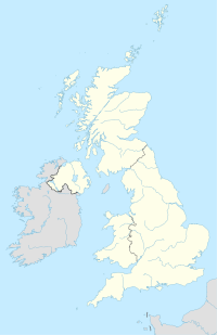
Dunstable [ ˈdʌnstəbəl ] is a town in Bedfordshire ( Central Bedfordshire ) in the south of England with 33,805 inhabitants (as of 2001). It is located on the eastern foothills of the Chiltern Hills . Their chalk mounds form steep edges that are visible from afar. Until 1974 Dunstable had the status of a Municipal Borough, since then it has been a civil parish in the district of Central Bedfordshire immediately west of Luton .
history
Dunstable is located at the intersection of two highways that were already in use in Roman times: Watling Street ( London - Wroxeter , the A5 expressway now follows its route) and Icknield Way (from Buckinghamshire to Norfolk ). The Romans called the place at this intersection Durocobrivis .
Since Dunstable is a day's ride from London, it was an ideal place to stay for travelers, so taverns and inns were built here. The old passages for carriages can still be seen in some pubs today. One of the oldest pubs in town is Saracens Head , the name of which is reminiscent of the crusader era and the floor of which is below street level, as the latter has gradually risen over the centuries due to new paving. The abbey church of St. Peter was built in 1132. In Dunstable there was a so-called Eleanor Cross , one of several stone crosses that King Edward I had erected in the 1290s in memory of his late wife Eleanor of Castile along the route along which her body had been returned to London. In 1531 King Henry VIII divorced his first wife Catherine of Aragon in St. Peter's Church in Dunstable ; as this divorce was not recognized by the Catholic Church in Rome, this divorce led to the formation of an independent Anglican Church. The first skirmishes between royalist and parliamentary troops in the English Civil War took place near Dunstable in 1642 .
In 1848 Dunstable was connected to the London and North Western Railway , and in 1858 a connection was added via Luton to Hatfield , operated by the Great Northern Railway . In 1965, British Rail closed Dunstable station to passenger traffic, making the city one of the largest towns in England without its own train station.
Dunstable was a major market town in Bedfordshire for a long time, but was gradually overtaken by neighboring Luton. In the 20th century, the printing trade and the automotive industry dominated the city's economy, but the closure of some companies at the end of the 20th century caused a difficult economic situation. The remaining operations are mainly concentrated in the Woodside industrial estate on the eastern outskirts. Dunstable is connected to the motorway network by the M1 motorway , which connects London with Leeds and passes Dunstable to the east, separating this city from Luton, with which Dunstable has otherwise grown together in the meantime.
Attractions
- Dunstable Downs , the cliffs of the Chiltern Hills popular with hang gliders
- Whipsnade Wildlife Park, an open-air enclosure
- Priory Church St. Peter, the old abbey church
- Waulud's Bank , a prehistoric henge in Leagrave Park in Luton
- Luton Museum & Art Gallery
Sports
Dunstable is the hometown of the football club Dunstable Town FC, which plays in the English Southern League. In addition, the Dunstablians (actually: Dunstablians Rugby Football Club) come from the city, a rugby club of the Midlands Division One, which plays its home games in Bidwell Park.
Personalities
- Gary Cooper (1901–1961), actor; grew up in Dunstable
- Una Stubbs (* 1937), actress and dancer
- Nikki Iles (* 1963), jazz pianist and accordionist
- Lisa Lomas (* 1967), table tennis player
- Spike Breakwell (born 1968), comedian
- Faye Tozer (* 1975), singer in the group Steps
Twin cities
- Bourgoin-Jallieu (France)
- Porz (Germany, since 1975 district of Cologne)
- Brive-la-Gaillarde (France)


