Ehrenberg (Rhenish Slate Mountains)
| Ehrenberg | ||
|---|---|---|
|
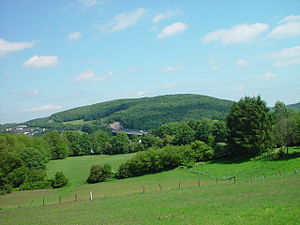
The Ehrenberg from Scharpenacker mountain seen |
||
| height | 345 m | |
| location | Wuppertal | |
| Mountains | Rhenish Slate Mountains | |
| Coordinates | 51 ° 15 '59 " N , 7 ° 15' 59" E | |
|
|
||
|
The surveys in Wuppertal |
||
The Ehrenberg is a 345 meter high ridge in the east of the city of Wuppertal and at the same time gives its name to the Ehrenberg residential area .
topology
The mountain is located in the easternmost Wuppertal district of Langerfeld-Beyenburg, right on the border with the neighboring town of Schwelm . The border between the Rhineland and Westphalia runs over it . It is bounded in the south and west by the Wupper , which here surrounds the mountain at an altitude of 183 to 160 meters.
The southern and western slopes of the Ehrenberg are steep and densely forested. In addition to a dairy farm with its own cheese dairy and farm shop, there are some farms, mostly surrounded by meadows, on which farms are only used as a sideline.
On the western and northern foothills, housing developments in the Langerfeld district have expanded in recent decades.
In the west of the mountain slope runs the Autobahn Bundesautobahn 1 (A 1); There is a game reserve in the south of the Ehrenberg.
history

The name Ehrenberg comes from the forest area Mehrenberger Mark , whose short form Im Mehrenberg was blurred to Im Ehrenberg . The later Markwald was part of a border forest between the settlement area of the Saxons and the Franks in the early Middle Ages . The Ehrenberg corridor of the same name near Schwelmer Winterberg also testifies to the extent of the Mehrenberger Mark .
During the time of territorial formation in the High Middle Ages, the Ehrenberg was part of the parish of Schwelm in the Electorate of Cologne and came into the possession of the Counts of the Mark by 1324 at the latest . The Wupper at the foot of the mountain now formed the border river between the county of Mark and the domain of the Bergische dukes , whose office Beyenburg was on the other side of the river. The Bergisch dukes also had the rights to ban wild animals in the forest area, so that the wood judge - although the territory of the Brandenburg region - was appointed by the Beyenburg bailiff .
The peasant usage and property rights of the Mehrenberger Mark ( Gerechtsame ) were listed in the Mehrenberger trademark register , which was kept in the small village of Weuste near Beyenburg, which was also the place of jurisdiction in the event of disputes.
In the 19th century, the Ehrenberg was part of the rural community Langerfeld , which was incorporated into Barmen in 1922 . The Ehrenberg came to Wuppertal in 1929, but the centuries-old border between the Rhineland and Westphalia also shifted from the Wupper to the ridge of the Ehrenberg, where it now runs through the incorporation into the Rhenish Barmen.
Even today there are some well-preserved tunnels in the Ehrenberg that used to supply part of the town of Schwelm with water.
literature
- Emil Böhmer: From the history of the Mehrenberger Mark . In: Contributions to the local history of the city of Schwelm and its surroundings ; Association for local history Schwelm eV; Part 1: Volume 12 (1962), Part 2: Volume 13 (1963), Part 3: Volume 14 (1964), Part 4: Volume 15 (1965)


