
Iron Hand (Frankfurt am Main)
| Iron hand | |
|---|---|
|
|
|
 |
|
| View to the northeast | |
| Basic data | |
| place | Frankfurt am Main |
| District | Northrend-West |
| Created | middle Ages |
| Connecting roads | Mittelweg (west) |
| Cross streets | Eckenheimer Landstrasse , Friedberger Landstrasse |
| Technical specifications | |
| Street length | 325 m |
The Iron Hand is a street in Frankfurt am Main .
Location and development
The Iron Hand runs in the Nordend district between Eckenheimer Landstrasse and Friedberger Landstrasse . Today it is a residential street with a few commercial buildings. You can no longer see their historical significance in the street.
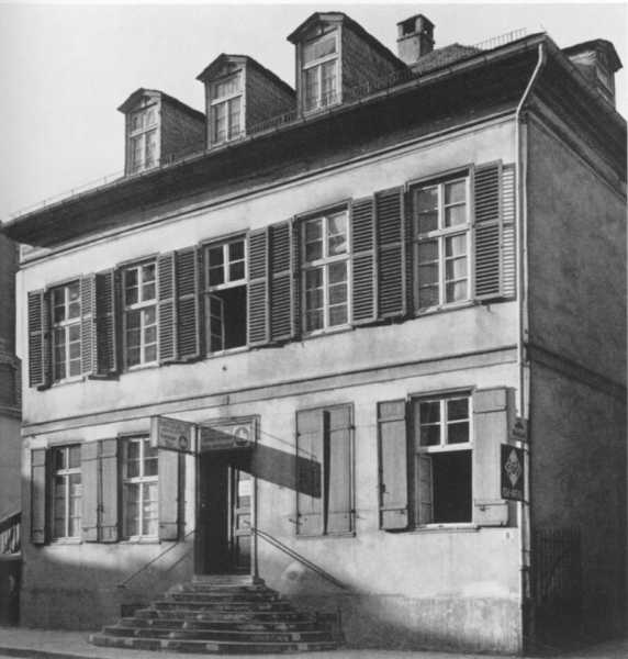
The current building dates partly from the period between 1865 and 1870 and can be assigned to late classicism , later neo-renaissance buildings were built during the founding period . The houses no. 7, 12 and 38 are under monument protection . The vacant lots resulting from the air raids on Frankfurt am Main were closed with sober functional buildings in the 1950s.
history
The Iron Hand takes its name from an old hallway name. Its emergence was a consequence of the city expansion, which Emperor Ludwig the Bavarian granted the city of Frankfurt am Main in 1333. Until then, the road connection ran from the Bornheimer Pforte in the direction of Bornheim , Vilbel and Friedberg via today's street Grosse Friedberger Straße , Vilbeler Straße and Friedberger Landstraße . With the city expansion approved by Emperor Ludwig the Bavarian in 1333 and the construction of a new city wall , the Friedberger Tor was moved to the north end of the Große Friedberger Straße, while the Vilbeler Straße became a dead end. In front of Friedberger Tor, the Eckenheimer Landstrasse began , which now became the most important traffic connection in the north-east.
In 1476, after long disputes, the city succeeded in gaining control over Bornheim . Immediately they started to secure the new acquisition by a Landwehr . This Bornheimer Landwehr ran a little south of a small wood , the Zeißel
A new road was built south of the Landwehr, branching off from Eckenheimer Landstrasse in an easterly direction and leading to Friedberger Landstrasse. An iron hand attached to a long pole served as a guide .
In 1607, Frankfurt's first water supply was established, which led daily up to 155 cubic meters of water from the sources of the Friedberger Feld on today's Weidenbornstrasse in wooden, later lead and from 1771 iron pipes to the water points in the city. Part of the water was directed towards the Eschenheimer Tor via the Iron Hand . An additional water pipe was only built from 1824 to 1834.
Even when the Frankfurt city fortifications were reinforced by a bastion at Friedberger Tor in 1626 and the gate was relocated to Vilbeler Straße, the Iron Hand remained an important transport link. To the north of it, the Eckenheimer Landstrasse was just a dirt road well into the 19th century, which only gained importance with the construction of the main cemetery in 1828 .
After that, the development of the garden plots on the Iron Hand began. Classicism had been prescribed as the architectural style since 1809 by the city architect Johann Georg Christian Hess . An example of the town houses that were built at that time was house no.8
In the 1850s, one of the few important industrial companies in the Free City of Frankfurt , the Dressler type foundry , was established at the Iron Hand . It was taken over by Heinrich Friedrich Gottlob Flinsch in 1859 and has been operating as the Flinsch type foundry since 1868 . As early as 1867, 250 workers and employees were producing around 2.5 million letters a week here.
The Iron Hand lost its importance as a traffic axis in the second half of the 19th century after the Nordend had been parceled out and covered with a network of streets that were quickly built on. The construction of a network of horse-drawn trams started in 1872 and operated by the Frankfurter Trambahn-Gesellschaft served to open up the new district with traffic . The important cross-connection between Bornheim and Eckenheimer Landstrasse that was established in 1879 did not go through the Iron Hand, but rather through the Bornheimer Landwehr - Koselstrasse - Hermannstrasse road a little to the north .
Its historical significance can only be recognized in the cityscape today by the fact that, unlike the other cross streets planned on the drawing board in the 19th century, it takes an arched course.
literature
- Eduard Pelissier , Die Frankfurter Landwehren , in: Heinrich Bingemer, Wilhelm Fronemann , Rudolph Wecker (eds.), Around Frankfurt , Frankfurt am Main 1924, Reprint Würzburg 1985, ISBN 3-8035-1276-X
- Günther Vogt, 19th Century Frankfurt Town Houses , Frankfurt am Main 1970
Web links
Individual evidence
- ↑ Stadtvermessungsamt Frankfurt am Main (ed.): Portal GeoInfo Frankfurt , city map
- ↑ See monument table
- ↑ Today's Zeißelstraße runs a few hundred meters north of the Iron Hand, also between Eckenheimer and Friedberger Landstraße.
- ↑ The escort card from 1572 shows the course of the Iron Hand.
- ↑ Iron Hand No. 8 , built in 1838 (not preserved)
- ↑ Volker Rödel, Factory architecture in Frankfurt am Main 1774-1924 , Societäts-Verlag, Frankfurt am Main 1985, ISBN 3-7973-0435-8
Coordinates: 50 ° 7 ′ 19 ″ N , 8 ° 41 ′ 15 ″ E