
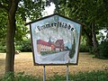
Emmerstedt
|
Emmerstedt
City of Helmstedt
|
|
|---|---|
 |
|
| Height : | 116 (111-126) m |
| Residents : | 2275 (Dec. 31, 2005) |
| Incorporation : | March 1, 1974 |
| Postal code : | 38350 |
| Area code : | 05351 |
Emmerstedt is one of the four districts of the Lower Saxony district town of Helmstedt in Germany .
geography
Emmerstedt is located in Lower Saxony on the border with Saxony-Anhalt, between Braunschweig and Magdeburg near exit 61 of federal motorway 2 . The local area extends over 1299 hectares and is divided into three districts: the core village (the oldest part and new development areas), the Rottensiedlung (west of the core village) and the Windmühlenberg .
In 2005 Emmerstedt had around 2275 inhabitants.

coat of arms

Church of St. Petri
Old place name sign


Local division
Emmerstedt is divided into three districts:
- Kerndorf (the oldest part and new development areas)
- Rottensiedlung (west of the core village)
- Windmühlenberg
history
The place was first mentioned in 1186.
On March 1, 1974 Emmerstedt was incorporated into the district town of Helmstedt.
Prehistory and early history
Finds of fireplaces from the Middle Stone Age after the end of the Ice Age are the oldest traces that prove a settlement in the district of Emmerstedt. They are around 6,000 to 8,000 years old. The people of this time still lived exclusively from hunting, fishing and collecting natural food. The finds point to former camp sites of these groups of hunters. Around 5000 BC BC, in the Neolithic Age, the first arable farmers and cattle farmers immigrated to the Emmerstedt area. Not until 3500 BC In several places around the world, settlements were created by Stone Age farmers. It was the same people who erected the monumental large stone graves Lübbensteine at the borders of their field marks with the simplest of technical means . From the immigration of the Indo-Europeans in the late Neolithic around 2800 BC. Chr. Individual finds of stone battle axes attest.
The settlement of the district during the Bronze Age did not begin until late, around 1200 BC. Chr., A. A settlement and urn graves in at least two places, one of which is still in the burial mound, can be identified from a more recent period of the Bronze Age (between 1000 and 700 BC). During this time the transition from the body to the cremation custom took place. In the Iron Age, the settlement seemed to continue continuously, as evidenced by at least two urn cemeteries - one of them even with a burial mound. An associated settlement is also known. At least the urn cemetery at Schützenplatz was in use until the early Germanic period between 500 and 300 BC. Further documented. The people who settled here were Suebian tribes, i.e. Teutons from the Elbe area, perhaps even Longobards.
Since around 200 AD there have been traces of settlement both by a settlement and by burial urns, although the settlement may have been established as early as the 1st century. Both end at the beginning of the 5th century. At that time Emmerstedt was in the border area between the Longobards and the early Thuringians. Up until the re-establishment of the present-day place, presumably in the early Middle Ages, there was then a demonstrable settlement of the district. In the Emmerstedt local museum on Leineweberstrasse , numerous finds from prehistoric times are on display, some as replicas.
About the Middle Ages to Modern Times
In a document dated April 9th, 1186, in which Bishop Dietrich von Halberstadt donated the tithes of the village to the newly founded Premonstrate Monastery of St. Thomas in Halberstadt, the village of Emerstide is mentioned for the first time. The origin of the place name, which could be traced back to a water body name ( Emer ) or to a personal name, is not certain . Since 1197 there are different spellings such as Emerstede , Emerstide , later also Emberstede , Emberstidde and Emmerstidde - the latter is still the dialect today.
In 1338 an independent parish church of St. Petri is mentioned. In 1539 there were 50 fireplaces, which means 50 men. The first school was established in the middle of the 17th century. Both the Thirty Years' War and severe fires caused lasting damage to the village. In 1661, with 26 farmsteads, half of the total stock burned down. The village developed on both sides of the old west-east trade route between Braunschweig and Helmstedt , which originally ran from Königslutter via Schickelsheim - Süpplingenburg - Emmerstedt and after 1500 shifted further south to the route of today's Bundesstraße 1 . A document from 1186 mentions the village of Ofeld , which was located in today's Emmerstedt corridor. In 1422 it was already referred to as " desert ". Field names such as Ofeldwiese or Am Offelwege indicate the former location south of the Heidberg . A dispute between the Mariental monastery and the Johanniter-Kommende Süpplingenburg over the tithe was decided in 1452 to the effect that the monastery owned the Ovelt with all its fruits.
It is not clear whether Ofeld was on the western slope of the Heidberg or on the opposite side of the Lange Welle creek . A memorial stone has been reminding of the former village site since 1991. It bears the inscription “Village Ofeld once located on the Heidberg, disappeared without a trace in the darkness of history. First mentioned in writing in 1186 together with Emmerstedt ”. For the sake of completeness, the village of Hohnstedt should also be mentioned, located in the very south-west and outside the Emmerstedt district. Probably only fallen into desolation in the 16th century, the location north of the Elzes was roughly where the district road 15 from Emmerstedt joins the B 1 . Today part of the Helmstedt municipality, Emmerstedt farmers had arable land in Hohnstedt in the Middle Ages. A field name - Im Hohnstedter Winkel - also reminds us of this former home.
At the instigation of the then sovereign, Duke Carl I (1735–1780), an inventory was made in the state of Braunschweig. The general survey from 1752 shows a field size of 3294 acres (823.5 ha) of cultivated land for Emmerstedt. A year later, the fire insurance company, the forerunner of the Braunschweig public insurance , was launched. All houses with associated farm buildings were given an insurance number (Assecuranznummer, Ass.-Nr. for short), which was subsequently also used as a house number. This assignment ended only with the introduction of street names and the consecutive numbering of the adjacent rows of houses in the mid-1960s. In 1774, 440 people lived in Emmerstedt at 74 fireplaces. House and courtyard shapes were Central German with stone gate entrances and two-story half-timbered houses. Most of the buildings came from the first half of the 19th century after severe fires between 1817 and 1830, and there were hardly any older buildings left. In 1837 Emmerstedt received a new church (pastorate from 1903). In 1896 Emmerstedt received a train station on the Helmstedt – Oebisfelde line .
Lignite mining at the Emma mine
A milestone in the local history was the opening of the brown coal mines between Barmke and Emmerstedt. As early as the middle of the 18th century , peat was cultivated in the so-called Pieperschen Moor on the site of today's Emmateich , the subsidence area created by lignite mining . The files do not provide any information about the beginning of the peat cutting. They begin in 1744 and end in 1807 (Wolfenbüttel State Archives, FindNr. 50, Neu4, No. 8582). In 1749 a peat store was set up, in 1763 consideration was given to draining further areas of the peat bog in order to expand the peat digging there because of the increased peat consumption of the Schöningen salt works.
In 1794, the theology student and later entrepreneur Johann Moritz Friedrich Koch submitted a request to the Braunschweig Duke Carl Wilhelm Ferdinand to be allowed to dig brown and earth coals in the Emmerstedt field, where the Helmstedt potters got their clay. Meant are the area Am Schwarzen Berg and today's residential area Tonwerke / Windmühlenberg.
In 1806 Koch bought the Piepersche Torfmoor on the Sachtleben in order to use the peat and the underlying alum earth for vitriol production . The purchase of the nearby Brunsohle , an old lonely country inn, the buildings of which were already very damaged and threatened to collapse, failed because the purchase price was too low. The buildings went to the Mariental Monastery, the innkeeper Schmidt became the tenant.
In the meantime, the duchy was part of the Kingdom of Westphalia (1807-1813) and nothing is known about the activities in Pieperschen Moor during this time. However, it seems that Koch continued the mining, because in 1815 he was initially forbidden to continue boiling vitriol with the restriction of using up existing supplies. In 1816 Koch again received a two-year contract in which the entire production of the vitriol was purchased from the Ducal Chamber at a price of 2 rt (Reichsthalern) 8 gg (Gutegroschen) per hundredweight (at 114 pounds).
It has not yet been possible to precisely determine how long the Vitriolhütte has been producing for. In any case, Koch died on September 22, 1856 in Helmstedt. Some of the buildings of the Vitriolhütte have remained, in the meantime as Gut Emma and still used for agriculture by the new owner today. The term Hüttenweg has also remained for the extension of Emmastraße from the location to the buildings mentioned.
When the merchant Wilhelm Suder began mining lignite between Emmerstedt and Barmke in the early 1860s, he also bought the vitriol huts and built open pit pits and an underground mine on the Emma field next door. As early as 1852/53 it is in the Emmerstedt fire register under Ass. 84 registered as an assessor.
A power plant, connected with the establishment of the Überland-Zentrale Helmstedt AG (ÜZH), was built in 1905. From 1906, both the city of Helmstedt and the surrounding towns such as Emmerstedt were supplied with electricity.
- "[...] and so on April 25th electric lights were on for the first time on the village streets [...]"
- - Quote from the church chronicle
From 1905 to 1912, steam turbines with an output of 3700 kW (= 3.7 MW) were put into operation in several expansion stages. For comparison: the Buschhaus power plant has an installed net capacity of 350 MW, almost a hundred times that. The electricity from the socket brought great advantages to the predominantly agricultural villages: greater safety thanks to the electric light bulb instead of the open light from kerosene lamps, the use of electrically operated machines on the farms and in the workshops of the craft businesses. In particular, lathes, driven by large electric motors, brought noticeable relief for the farmers - and extreme loads for the electricity producers at peak demand, according to reports.
In February 1914, the Braunschweigischen Kohlen-Bergwerke AG (BKB) bought the entire block of shares in the ÜZH and at the same time became the owner of the consolidated Suderschen brown coal works.
Until 1924, coal was mined at the Emma mine and the power station operated. The technical progress in power plant development has been remarkable since then; In those early years of power generation, around five kilograms of lignite were required for one kilowatt hour, today around one kilogram is sufficient for this in modern power plants.
Traces of this three-quarters of a century mining activity can still be found today in the district of Emmerstedt: the breakthroughs in the forest areas of Lohen and Wittenberg , the aisle of the former cable car at the northeastern foot of the Wittenberg to the loading station on the B 244 (later the Forsthaus cable car, broken off for the Helmstedt West motorway junction), the former site of the power plant with the cooling tower base and the machine house as well as smaller opencast mining holes and ponds near Barmke and around the Emma pit area and the Emmateich, resting and breeding area for numerous water birds.
The Emma pit became known as the setting for the 1973 feature film Zero Hour , which after the end of World War II deals with the entry of the Soviet army into Saxony after the Americans left. Some extras from Emmerstedt also worked here.
With the sale of the former plant and land by E.ON in 2007, the history of coal mining in the Emmerstedter Flur came to an end. The considerations of the BKB for an opencast mine in Emmerstedt, which had given rise to numerous protest actions in the 1980s, were finally given up in 1997.
However, a piece of Emmerstedt's mining tradition has recently returned to the village. The club flag of the miners' club Vereinsglück der Grube Emma and Grube Berta , founded in 1892, was given to the local museum at the Christmas market in 2009 from the fund of the former BKB and was seen at the parade in 2011. How long the miners' association existed is not known.
Mining certainly also influenced the plans for the Helmstedt – Oebisfelde railway line at the end of the 19th century, with which the upper Allertal and its quarries were to be developed. The railroad offered an inexpensive alternative for the sale of lignite, especially since the sugar factory in Weferlingen , owned by Wilhelm Suder, was on the same railway line. Originally, a route through the Helmstedt Brunnental via Beendorf to Weferlingen was also planned.
The local people are said to have prevented the route from going through the village of Emmerstedt. Their fears that the railway noise would "impair the milk yield of the cows and the pigs' appetite" - according to the Emmerstedt barber, who was appointed as an expert - should then have given rise to the route north of the locality. The danger of "getting sick from respiratory, nerve and digestive disorders as well as influenza" ultimately led to the decision to build the Emmerstedt train station on Helmstedter Grund. (These "expert" statements, however, must not be taken so seriously).
First World War
In 1914 the First World War broke out. Pastor Schattenberg describes the consequences, also for the people at home, in his church chronicle.
- “[…] As a result of the blockade by England, food is gradually decreasing and has to be rationed. The bread came first. [...] «
- - Pastor Schattenberg, quote from the church chronicle, 1914
On February 25, 1916, the Protestant Women's Aid was founded and on April 6 of the same year summer time was introduced for the first time. The year 1917 hit the church: if the pewter-cast prospect pipes were initially drawn in, a short time later it was the large church bell, the metal of which was used for war purposes.
- »[…] This year was a special year of need for the fatherland because of the scarcity of food and raw materials. Not only bread and flour, but also meat (100 g per person per week, butter 50 g), milk, sugar, soap, etc. were only given on cards. Sunflowers were grown and [...] the beechnuts, which had grown in abundance, were collected to produce oil [...] «
- - Quote from the church chronicle, 1918
Until the end of the war in 1918 and beyond that until the end of inflation in November 1923, people had to endure times of hardship.
- »[…] Since November 6th, I have been driving into the Emma mine 5 times a week as a miner and can now feed my family of six again. [...] My work in the pit, as angry as it gets for me sometimes, also has the advantage that I get closer to a large part of the community in this way than would otherwise have been possible. [...] «
- - Pastor Schattenberg, quote from the church chronicle
A pleasant event that was repeated in 2011 was the consecration of the bells in the St. Petri Church . In 1923, the money for two new steel bells was raised, and after another 88 years, two bronze bells replaced these "iron ladies" in the spring of 2011. On August 5, 1928, a war memorial was inaugurated, dedicated to the dead of the First World War. From 1931 National Socialism established itself with its groups in Emmerstedt and new calamities are brewing.
Second World War
Everyone who lived through the bad years of this war - in Emmerstedt, at the front, in the bombed cities in the west or in the lost homeland in the east - had their own experiences. Much has been written down, told or just lives on in memory. With the beginning of the Second World War, people had to limit themselves again, had to make sacrifices, especially those who had ended up in Emmerstedt from afar. Emmerstedt became their new home, they had become Emmerstedt without forgetting that their home was once in the coal pot, in East Prussia, Pomerania or Silesia.
- “[…] Since our church bells are made of iron, we didn't need to deliver them and they still ring in our services. [...] After we had already given 13 kg of metal to the Hermann Göring meeting, we also took stock of metal objects in the church. We gave the pewter baptismal and communion implements from 1838 to the large chandelier and two altar candlesticks made of brass, a baptismal jug and a baptismal font made of nickel silver, but the latter are of art historical value. [...] On Sunday, d. February 20 at noon around 1 a.m., several squadrons of enemy planes flew over our village and our Feldmark. They attacked our neighboring town of Helmstedt [...] [...]. About 150 people were killed. Among those killed were three Emmerstedt residents [...]. Bombs fell several times in the Feldmark without hitting anyone. A single bomb fell next to the community bakery and destroyed the gable wall of the stable. [...] «
- - Pastor Wandersleb, quote from the church chronicle, 1942
post war period
With the end of the Second World War - Germany capitulated on May 8, 1945 - numerous people had to find a new home in Emmerstedt. The population rose from 1322 in 1939 to 2300 in 1946. When the remaining Reich territory was divided into four occupation zones in 1945, Emmerstedt was divided into the British zone, in 1947 into the Bi-Zone and from March 17, 1948 through the accession of the French moved into the tri-zone. With the introduction of the D-Mark, the beginning of the economic miracle was also heralded. In 1949 the Federal Republic of Germany was founded and, associated with it, there was a significant improvement in people's living conditions. A year later, all goods could be bought freely, the last rationings (food stamps) were lifted on May 1, 1950.
To remedy the prevailing housing shortage, the Rottensiedlung building area with 25 so-called agricultural part-time settlements for refugees was created from 1954. This form of settlement was supposed to secure the basic needs of the settlers by leasing two acres of arable land. The standardized house also included an outbuilding for keeping pigs and small animals. A start. Many people were now able to create their own home, and so, in addition to the Rottensiedlung, other building areas were created in Emmerstedt. Lively construction activities on what was once Emmerstedter Flur - today the Helmstedt urban area - have greatly changed the image and character of the village, caused by its proximity to the city center.
While the Blumensiedlung and Vogelsiedlung building areas - officially Emmerstedt Nord - and the industrial area Emmerstedt Ost were in the process of being, a lot has been created after the anniversary year of 1986 that will be briefly highlighted here.
Rottlands
In 1998 the city administration decided to develop a new building area in the north of the Emmerstedt location and to offer around 50 building sites to new residents willing to build. The street names Haspelweg and Spindelweg were intended to remind of the old linen weaver tradition, which at the time enabled numerous residents in the village to have a modest income. The field name Im Rottlande, which gave the ring road in this building area its name, refers to the clearing of the forest (Stühholz) that originally existed here, which in the distant past reached as far as the northern local border and was probably also used as the Hudewald Fewelsberg corridor to the north of Lüneburger Heerstraße , which corresponds to this meaning. A former orchard, now designated as a green area, and a children's playground on the shooting range previously located here offer the young generation leisure opportunities away from the main roads.
Kreipke
In the mid-1980s, planning began for this building area west of the Mensch company. The name of the residential street Kreipke also corresponds to the old field name and is derived from the term Kreike, a small type of plum, also creeping plum, here again derived from Low German kreipen / kruupen = crawl. In 1993 the development was largely completed.
On the Black Mountain
This area lies northwest of Helmstedt and east of the Tonwerke settlement. On Schwarzen Berg, Fassweg and Quittenweg are the street names of this youngest residential area in the Emmerstedt district. They are reminiscent of the field names of the construction area, the former presence of a barrel factory at the clay works and the quince as a wild fruit that is often found here.
On the flower
Derived from the once well-known restaurant of the same name, a small building area was built behind this property. As early as the end of 1979, the first plots were sold in preparation for the planned residential construction. Road construction began in July 1980, and the building plots were then developed from June 1981.
Between Steinberg - at 143.5 m the highest point in the Emmerstedter Flur - and the residential area Windmühlenberg, an industrial area was developed from 1994 onwards. The street names Am Lohen, Steinbergstraße and Kaisergraben are related to the adjacent field names.
Origin of the place name
The church village of Emmerstedt, once Filia von Marienberg, is mentioned in a document as early as 1186 as Emerstide . In 1224 they wrote Emmerstide , 1232 Emmerstede and then 1360 Emberstidde . The first syllables of the place come from the person Emher , the last syllable -stedt is in Old High German -stat , which means something like place or place.
Incorporation
On March 1, 1974 Emmerstedt was incorporated into the district town of Helmstedt .
present
Since 1990, residents of the village have received the Emmerstedt sign of thanks for outstanding performance in the sporting field and for community care. In 2011 an idea of the local council was put into practice with the help of all associations, and a maypole was erected for the first time.
Population development
| year | Residents |
|---|---|
| 1905 | 1,229 |
| 1939 | 1,322 |
| 1945 | 2,636 |
| 1974 | 2,045 |
| 1986 | 1,890 |
| 1996 | 2,261 |
| 1999 | 2,265 |
| 2000 | 2,363 |
| 2001 | 2,346 |
| 2002 | 2,312 |
| 2003 | 2,269 |
| 2004 | 2,286 |
| 2005 | 2,275 |
| 2006 | 2,265 |
| 2007 | 2,247 |
| 2008 | 2,215 |
| 2009 | 2,155 |
| 2010 | 2.129 |
Culture
The "Museumshof Emmerstedt" presents agriculture and local handicrafts of the past. The local history of Emmerstedt is also presented.
politics
Local council
The local council of Emmerstedt has nine members. The distribution of seats since the last local election on September 11, 2016 is as follows:
| Parties and constituencies |
% 2016 |
Seats 2016 |
% 2011 |
Seats 2011 |
% 2006 |
Seats 2006 |
|
| SPD | Social Democratic Party of Germany | 51.20 | 5 | 56.51 | 5 | 53.18 | 5 |
| CDU | Christian Democratic Union of Germany | 35.60 | 3 | 32.58 | 3 | 36.28 | 3 |
| NPD | National Democratic Party of Germany | 10.10 | 1 | 7.27 | 1 | 10.54 | 1 |
| LEFT | The left | 3.10 | - | 3.65 | - | ||
| total | 100 | 9 | 100 | 9 | 100 | 9 | |
| Voter turnout in% | 61.22% | 53.36% | |||||
mayor
The local mayor is Hans-Jürgen Schünemann ( SPD ).
Ofeld
About two kilometers south of Emmerstedt is the Heidberg, on which a memorial stone can be found. Ofeld Avelda was first mentioned there as a settlement around 963, Avelde around 1160 and Ovelde 1422. This settlement then burned down later and was built elsewhere (current location of Emmerstedt).
Brunsole
Brunsole is a residential area belonging to Emmerstedt , on the road from Emmerstedt to Barmke. The Zur Brunsole inn used to be located there .
traffic
Emmerstedt is located on the Helmstedt – Oebisfelde railway line, which is only used by freight trains .
Web links
Individual evidence
- ↑ a b Federal Statistical Office (ed.): Historical municipality register for the Federal Republic of Germany. Name, border and key number changes in municipalities, counties and administrative districts from May 27, 1970 to December 31, 1982 . W. Kohlhammer, Stuttgart / Mainz 1983, ISBN 3-17-003263-1 , p. 272 .
- ↑ a b c d e f g h i j k l m n o p q r s t u v w x y z aa ab ac ad ae af ag ah ai aj ak al am an Sabine Burchardt, Katja Diedrich, Gerhard Kaminski, Gerhard Loos, Irena Tarant: Emmerstedt in the past and present - a commemorative publication for the 825th anniversary of 2011. January 2011.
- ↑ Blickpunkte - Ostfalen Magazin, Henning Schwannecke (Ed.): Die Heimatseite - Emmerstedt Helmstedt, Edition 2/2016, pp. 18-19.
Bad Helmstedt | Barmke | Büddenstedt | Emmerstedt | Helmstedt (city center) | Mocking life | Offleben | Reinsdorf