Finnberg
| Finnberg | ||
|---|---|---|
|
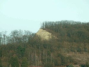
The former quarry on the western edge of the Finnberg |
||
| height | 332.4 m | |
| location | Sömmerda district , Thuringia | |
| Mountains | Finne , part of the Unteren Unstrut mountain and hill country | |
| Coordinates | 51 ° 13 '22 " N , 11 ° 19' 21" E | |
|
|
||
| rock | Shell limestone | |
The Finnberg is a 332.4 m high mountain of the Finns in the district of Sömmerda in northeast Thuringia , Germany .
Geographical location
The Finnberg is the northwesternmost branch of the Finns and borders directly on the Thuringian Basin . It is located in the northeastern part of the Sömmerda district between the towns of Großmonra in the southwest and Burgwendi in the west. The district town of Sömmerda is about 13 kilometers to the south-west.
nature
Geologically, the completely forested Finnberg belongs to the Finns Fault , where shell limestone with its steeply rising layers emerges, while the landscapes to the east consist of red sandstone . At its northwestern end, a former quarry has exposed its rock formations. The mountain is part of the Finnberg nature reserve with 72.7 hectares. Various hiking trails lead over the ridge, from where there are wide views of the Thuringian Basin.
Individual evidence
- ↑ Map services of the Federal Agency for Nature Conservation ( information )
-
^ Walter Hiekel, Frank Fritzlar, Andreas Nöllert and Werner Westhus: The natural spaces of Thuringia . Ed .: Thuringian State Institute for Environment and Geology (TLUG), Thuringian Ministry for Agriculture, Nature Conservation and Environment . 2004, ISSN 0863-2448 . → Natural area map of Thuringia (TLUG) - PDF; 260 kB → Maps by district (TLUG)


