Fischbach (Nahe)
|
Fischbach Asbach, Hammerbach |
||
|
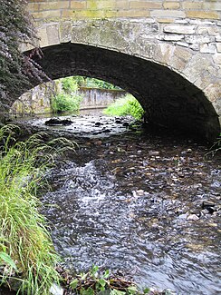
The Asbach in Herrstein |
||
| Data | ||
| Water code | DE : 25418 | |
| location | Germany | |
| River system | Rhine | |
| Drain over | Nahe → Rhine → North Sea | |
| source | west of Schauren 49 ° 48 ′ 40 ″ N , 7 ° 12 ′ 14 ″ E |
|
| Source height | approx. 632 m above sea level NHN | |
| muzzle | near Fischbach in the Nahe coordinates: 49 ° 44 ′ 25 ″ N , 7 ° 24 ′ 18 ″ E 49 ° 44 ′ 25 ″ N , 7 ° 24 ′ 18 ″ E |
|
| Mouth height | approx. 212 m above sea level NHN | |
| Height difference | approx. 420 m | |
| Bottom slope | approx. 20 ‰ | |
| length | 21.3 km | |
| Catchment area | 97.648 km² | |
| Discharge at the Gerach 2 A Eo gauge : 62.5 km². Location: 3.5 km above the mouth |
NNQ (08/04/1995) MNQ 1979/2016 MQ 1979/2016 Mq 1979/2016 MHQ 1979/2016 HHQ (01/23/1995) |
11 l / s 58 l / s 682 l / s 10.9 l / (s km²) 9.04 m³ / s 32.9 m³ / s |
The Fischbach is a 21.3 km long, left tributary of the Nahe in the southern Hunsrück in Rhineland-Palatinate ( Germany ). In the upper reaches, the river is also called Hammerbach and Asbach in sections . The latter name is used by the Rhineland-Palatinate water management authority as a name for the river.
geography
course
The Fischbach rises on the southeast flank of the central Idarwald , about 2.4 km west of Schauren am Steingerüttelkopf at an altitude of 632 m above sea level. NHN . In the upper reaches some smaller brooks that also flow off the south-eastern flank of the Idarwald. The 1.6 km long spring stream is worth mentioning here . The use of water power by mills begins below the estuary. In the further course the Fischbach flows mainly to the southeast.
First the stream reaches the Hammerbirkenfeld residential area , which is on the left bank. From Hammerbirkenfeld the stream is called Hammerbach . The Mombach flows a little below . On the following stretch of the river, several smaller streams flow from the Mörschieder Forest from the south. Among them the Kempfelder Bach and the Schwarzborner Graben . Then the stream reaches the Harfenmühle and to Asbach belonging Asbacherhütte . From here the river is called Asbach . The Ebesbach, coming from the north, flows below the Weidener Mühle . From this confluence, the river is now called Fischbach again.
A few kilometers further downriver, the river reaches Herrstein and then Niederwörresbach . The Wörresbach, coming from the northwest, flows here on the right . In the following stretch of water, the Wahlenbach , Tiefenbachsgraben and Seitzenbach coming from the southwest also flow on the right , before the Fischbach reaches the Fischbach town of the same name . The Hosenbach flows here on the left , which is 13.5 km in length and is the most important tributary of the Fischbach. From the southwest the Fischbach then flows to the Atelbach , before it rises to 212 m above sea level. NHN flows into the Nahe .
On its 21.3 km long path, the Fischbach overcomes a height difference of 420 m, which corresponds to an average bed gradient of 19.7 ‰. It drains a catchment area of 97.648 km².
Tributaries
In the following, the tributaries of the Fischbach are named, starting from the source. The length of the tributary, the location and the size of the catchment area are also given.
- Springbach - 1.6 km long left tributary (catchment area: 2,615 km²)
- Mombach - 2.1 km long left tributary (catchment area: 2.703 km²)
- Kempfelder Bach - 1.7 long right tributary (catchment area: 2.233 km²)
- Schwarzborner Graben - 2.2 km long right tributary (catchment area: 1.172 km²)
- Ebesbach - 5.2 km long left tributary (catchment area: 15.118 km²)
- Wörresbach - 5.3 km long right tributary (catchment area: 8.328 km²)
- Wahlenbach - 1.8 km long right tributary (catchment area: 2.848 km²)
- Tiefenbachsgraben - 2.6 km long right tributary (catchment area: 2.814 km²)
- Seitzenbach - 2.0 km long right tributary (catchment area: 1.288 km²)
- Hosenbach - 13.5 km long left tributary (catchment area: 27.701 km²)
- Atelbach - 1.6 km long right tributary (catchment area: 0.666 km²)
Towns on the river
environment
fauna
Gray herons and mallards are the most common water birds in the Bachtal, and the dipper and kingfisher also have their habitat on the fast-flowing water.
flora
The Fischbach initially flows through the Idarwald, later through extensively used valley meadows. Willows and alders are mainly found on the bank , which are hardly used economically today.
Water quality
The Fischbach is a coarse material rich, silicate low mountain range. Its water structure is classified as significantly changed over long stretches. However, longer sections in the middle and lower reaches have been greatly or completely changed. The water quality is consistently classified as slightly polluted.
