Friesenbach (Red Main)
| Friesenbach | ||
|
The Friesenbach in Hutschdorf |
||
| Data | ||
| Water code | DE : 24128 | |
| location |
Franconian Switzerland
|
|
| River system | Rhine | |
| Drain over | Red Main → Main → Rhine → North Sea | |
| source | Friesenquelle near Kasendorf 50 ° 1 '54 " N , 11 ° 20' 34" E |
|
| Source height | approx. 410 m above sea level NN | |
| Spring discharge |
MQ |
400 l / s |
| muzzle | at Neudrossenfeld -Dreschen in the Rote Main Coordinates: 50 ° 3 '25 " N , 11 ° 26' 54" E 50 ° 3 '25 " N , 11 ° 26' 54" E |
|
| Mouth height | approx. 300 m above sea level NN | |
| Height difference | approx. 110 m | |
| Bottom slope | approx. 12 ‰ | |
| length | 8.9 km | |
| Catchment area | 41 km² | |
| Right tributaries | Aubach | |
|
Runoff from the Frisian spring |
||
The Friesenbach is a left, around 9 km long tributary of the Red Main on the edge of the Franconian Alb in Bavaria .
geography
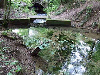
Friesenquelle

The Friesenquelle ( 410 m above sea level ) is located southwest of Kasendorf . It is a typical karst spring ; With a very constant average discharge of 400 liters per second, it is one of the strongest springs in Upper Franconia . It does not dry up even in dry seasons. After the snow has melted or after heavy precipitation , the bed of the bed of the strata increases significantly. The spring water then has a deep brown color and comes from a very large catchment area that extends over the surrounding towns of Reuth, Azendorf and Welschenkahl. It emerges from caves and underground lakes . The Friesenquelle has been designated as a natural monument and by the Bavarian State Office for the Environment as geotope 477Q002. See also the list of geotopes in the district of Kulmbach .
course
Shortly after its source, the Friesenbach operates the Friesenmühle. At the powder mill in Döllnitz it takes its largest tributary, the Aubach flowing down from Thurnau . Across from Threschen it flows into the Red Main .
Tributaries
- Dietzbach ( left ), 2.2 km, 4.03 km²
- Aubach ( right ), 6.5 km, 18.0 km²
- Stegersgraben ( right ), 0.6 km
Red Main river system
Web links
- The Friesenbach - Homepage of the municipality of Kasendorf
- Friesenquelle water management office in Hof
Individual evidence
- ↑ a b Information sign at the Friesenquelle
- ↑ Flood Action Plan Main
- ↑ Geotope: Friesenquelle near Kasendorf (accessed on September 4, 2013; PDF; 192 kB)
- ↑ Self-measurement on BayernAtlas

