Woerthbach
| Woerthbach | ||
|
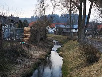
Right upper course Friesenrieder Bach of the Wörthbach in Friesenried |
||
| Data | ||
| Water code | EN : 11642 | |
| location |
Pre-alpine hills and moorland
|
|
| River system | Danube | |
| Drain over | Flossach → Mindel → Danube → Black Sea | |
| source | east of Wenglingen (municipality Aitrang , Ostallgaeu) in Hollenbach forest 47 ° 50 '22 " N , 10 ° 33' 57" O |
|
| Source height | a little over 820 m above sea level. NN | |
| muzzle | north of Unter rammingen from the left into the smaller Flossach Coordinates: 48 ° 5 ′ 5 ″ N , 10 ° 35 ′ 0 ″ E 48 ° 5 ′ 5 ″ N , 10 ° 35 ′ 0 ″ E |
|
| Mouth height | approx. 582 m above sea level NN | |
| Height difference | approx. 238 m | |
| Bottom slope | approx. 6.9 ‰ | |
| length | 34.5 km with OL Friesenrieder Bach |
|
| Catchment area | 133.97 km² | |
The Wörthbach (from the source to Eggenthal also called Friesenrieder Bach ) is a left tributary of the Flossach . About this and the Mindel it is an indirect right tributary of the Danube in Bavaria . Its noticeably larger right upper course is the Friesenried Bach .
Friesenrieder Bach
The source of the main stream upper course Friesenrieder Bach is located in the Hollenwald a good kilometer east of the village Wenglingen in the municipality of Aitrang in the Ostallgäu district . From there, the small stream runs westwards and swings in the open corridor around Wenglingen on an approximately north-northwest course. It flows through the forest tip around the Königsberger Moos and the villages of Salenwang and Friesenried. In Blöcktach it unites with the Mühlbach coming from the southwest to form the Wörthbach.
The stream section called Friesenrieder Bach is 8.6 km long and drains an area of 36.2 km², while the left upper reaches of Mühlbach is 5.7 km long and has a catchment area of only 7.5 km².
Course of the Wörthbach
The Wörthbach then runs north to Eggenthal, where the more important left tributary Röhrwanger Mühlbach joins from the south-southwest, after which the Wörthbach continues for a long time in its direction and crosses Baisweil. In the following town of Bad Wörishofen he switched back to the northern course. After he and Under the Ober- almost lying on the left bank Rammingen has passed through, it flows from the left in the here only 3.3 km long Flossach whose catchment area includes km² above only 26.6, while that of the Wörth Bach km² 134 large and together with the Friesenrieder Bach it reaches a length of 34.5 km.
Tributaries
From the source to the mouth. Selection.
- Friesenrieder Bach, right and south-eastern main line upper course to Blöcktach, 8.6 km and 36.2 km²
- Mühlbach , left and southwest side branch upper reaches to Blöcktach, 5.6 km and 7.5 km²
- Schwarzer Graben , from the right and southeast through Romatsried
- Hochstetter Bächle, from the left and south at the beginning of Eggenthal
- Röhrwanger Mühlbach , from the left and south-southwest in Eggenthal, 11.4 km and 16.5 km²
- Schleifbach, from the right and south-southeast
- Riedbach or perhaps Osterbach, from the right and south-southwest near Großried, 6.8 km and 11.0 km².
- Fehlbach, left branch to Bad Wörishofen
- Stutweidbach , from left to Bad Wörishofen, 4.6 km and 8.1 km²
- Haldenbach , from the left and west near Kirchdorf
- Klausenbach , from the left and west through Oberrammingen
See also: List of waters in the Mindel river system
Localities
Places along the Friesenrieder-Bach- and Wörthbach-Lauf from the source to the mouth:
- Aitrang municipality
- Wenglingen (village, left at the Friesenrieder Bach)
- Community Friesenried
- Salenwang (village, on the Friesenried Bach)
- Friesenried (parish village, mostly on the right at the Friesenried Bach)
- Blöcktach (parish village)
- Community Eggenthal
- Romatsried (village, right)
- Eggenthal (parish village, mostly on the left)
- community Baisweil
- Baisweil (parish village, mostly on the right)
- Großried (hamlet, right)
- City of Bad Wörishofen
- Bad Wörishofen (main town)
- Kirchdorf (Kirchdorf, a short distance to the left)
- Rammingen municipality
- Oberrammingen (parish village, almost only on the left)
- Unterrammingen (Kirchdorf, almost only on the left)
Individual evidence
- ↑ a b c d Length and catchment area according to: List of brook and river areas in Bavaria - Danube river area from source to Lech, page 38 of the Bavarian State Office for the Environment, as of 2016 (PDF; 2.3 MB)
- ↑ Contrary to the official name on the left upper and lower reaches of the Riedbach, the Riedbach is perhaps called Osterbach after the presumably then also called right upper course, which is the larger upper course in terms of length and catchment area.
