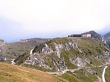
GR 52A
The GR 52A , Le Sentier Panoramique du Mercantour , is a French long-distance hiking trail ( GR = Sentier de Grande Randonnée). It runs around the inner zone of the Parc National du Mercantour , created in 1979 , and connects the Col de Tende in the Alpes-Maritimes department with Colmars-les-Alpes in the Alpes-de-Haute-Provence department over a distance of around 220 km . Well-trained mountain hikers complete the path, which has to be climbed around 1,000 m ascent and descent per day, in 12 days. As the peripheral zone of the national park is populated, accommodation for several stages is available.
Route information
- Distance: approx. 220 km
- Lowest point: 290 m ( Breil-sur-Roya )
- Highest point: 2045 m ( Col des Champs )
- Marking: white-red
Places on the GR 52A
- Col de Tende , 1871 m
- Tende , 820 m (starting point for hikes to the Vallée des Merveilles ("Valley of the Miracles") and Vallée de Fontanalbe . Together, both valleys represent the second largest site of prehistoric engravings ( Bronze Age ) in the entire Alpine region.)
- La Brigue , 770 m
- Saorge , 520 m
- Breil-sur-Roya , junction of the Tendabahn and various roads, 290 m
- Sospel , 350 m, from here it shares a path with the blue Via Alpina path
- Col de Turini , 1603 m
- Belvédère , 830 m
- Saint-Martin-Vésubie , 965 m
- Saint-Dalmas de Valdeblore , 1290 m
- Saint-Saveur-sur-Tinée , 496 m, up to this point shared with the blue path of the Via Alpina
- Beuil , 1450 m
- Valberg , 1669 m
- Chateauneuf d'Entraunes , 1293 m
- Entraunes , 1251 m
- Col des Champs , 2045 m
- Colmars-les-Alpes , 1269 m
mark
All major long-distance hiking trails ( GR = Sentier de Grande Randonnée) in France are marked by the responsible Fédération française de la randonnée pédestre (FFRP) using a red and white crossbar.
literature
- Topo-Guide GR 52A, Fédération Française de la Randonnée Pédestre (FFRP), Ref. 500, ISBN 2-85699-934-4
- GR 52A by Sabine Bade, Wolfram Mikuteit, Fernwege-Verlag, 3rd edition 2010. [1]
- Rother hiking guide, Reinhard Scholl, French Maritime Alps Alpes-Maritimes: Mercantour - Merveilles, ISBN 978-3-7633-4146-7


