Gadenweith (municipality of Weissenbach an der Triesting)
|
Gadenweith ( Rotte ) locality cadastral community Gadenweith |
||
|---|---|---|
|
|
||
| Basic data | ||
| Pole. District , state | Baden (BN), Lower Austria | |
| Judicial district | to bathe | |
| Pole. local community | Weissenbach an der Triesting | |
| Coordinates | 47 ° 59 ′ 0 ″ N , 16 ° 4 ′ 15 ″ E | |
| Residents of the village | 53 (January 1, 2020) | |
| Building status | 15 (2001) | |
| Area d. KG | 3.11 km² | |
| Statistical identification | ||
| Locality code | 03438 | |
| Cadastral parish number | 04310 | |
| Counting district / district | Schwarzensee (30645 002) | |
| Source: STAT : index of places ; BEV : GEONAM ; NÖGIS | ||

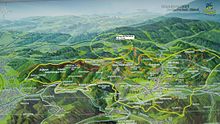
Alland hiking area map Weissenbach
The houses rotte Gadenweith , cadastral community of Weissenbach an der Triesting , with about 100 inhabitants is located north of Weissenbach in a blind valley in the Vienna Woods , which can only be reached via the Schwarzenseer Straße from Neuhaus or Schwarzensee . The Pecherhof is an inn for hikers, cyclists and horse riders in this remote part of the Vienna Woods. The annual Triestingtal rallye leads over Gadenweith because of the nearby gravel road. A riding stable offers the possibility of western riding and trail riding. A construction company and a gravel works are also located here.


