Alland
|
market community Alland
|
||
|---|---|---|
| coat of arms | Austria map | |
|
|
||
| Basic data | ||
| Country: | Austria | |
| State : | Lower Austria | |
| Political District : | to bathe | |
| License plate : | BN | |
| Surface: | 68.5 km² | |
| Coordinates : | 48 ° 3 ' N , 16 ° 5' E | |
| Height : | 331 m above sea level A. | |
| Residents : | 2,589 (Jan 1, 2020) | |
| Postcodes : | 2500, 2532, 2533, 2534, 2565 | |
| Area code : | 0 2258 | |
| Community code : | 3 06 01 | |
| NUTS region | AT127 | |
| Address of the municipal administration: |
Main street 176 2534 Alland |
|
| Website: | ||
| politics | ||
| Mayor : | Ludwig Köck ( ÖVP ) | |
|
Municipal Council : ( 2020 ) (21 members) |
||
| Location of Alland in the Baden district | ||
 Alland from the west |
||
| Source: Municipal data from Statistics Austria | ||
Alland is a municipality with 2589 inhabitants (as of January 1, 2020) in the Baden district in Lower Austria , about 20 km southwest of Vienna .
geography
The market town of Alland is located on the upper reaches of the Schwechat , in the western part of the Helenental and the industrial area . The valley basin around Alland forms the center of the Wienerwald recreation area on the Vienna outer ring motorway (A 21). The highest mountain is the Hohe Lindkogel at 834 m .
Community structure
The municipality includes the following ten localities (population in brackets as of January 1, 2020):
- Alland (1481)
- Glassworks (108)
- Groisbach (233)
- Felling (55)
- Maria Raisenmarkt (169)
- Mayerling (273)
- Rohrbach (52)
- Schwechatbach (105)
- Untermeierhof (85)
- Windhaag (28)
The municipalities of Alland and Raisenmarkt were merged in 1972 to form the large municipality of Alland , which was elevated to a market municipality in 2002 by the Lower Austrian Landtag under Governor Erwin Pröll .
Until then, the municipality of Alland comprised the cadastral municipalities
The Raisenmarkt community comprised the cadastral communities
- Raisenmarkt with the villages of Maria Raisenmarkt , Untermeierhof and Holzschlag
- Rohrbach
- Schwechatbach
- Inner Kaltenbergerforst
- Outer Kaltenbergerforst
The market town of Alland thus covers 68.5 km² and, with its twelve cadastral communities, is the largest in terms of area in the Baden district.
Localities
|
structure
|
||||||
Neighboring communities

- in the Baden district
- Klausen-Leopoldsdorf
- Heiligenkreuz with the villages of Sattelbach, Siegenfeld and Preinsfeld
- Altenmarkt with the villages of Thenneberg , Nöstach , Hafnerberg , Klein-Mariazell and St. Corona
- Weissenbach with the villages of Neuhaus , Schwarzensee and Gadenweith
- Bad Vöslau
- Sooss
- to bathe
- in the Mödling district
- Vienna Woods with the villages: Grub , Dornbach, Sittendorf and Sulz in the Vienna Woods
history
The 1000-year-old, rural, wooded Alland was owned by the Babenbergs in the 12th century and was a royal hunting ground during the Habsburg era . The place name is derived from the designation Adelathe or adel achte - which means noble property .
The predominantly Catholic area became independent around 1850 and in 1972 the current structure of the community was created through the incorporation of twelve villages and a few house rots . Crown Prince Rudolf died in Mayerling , a district of Alland, in 1889 . In the fin de siècle the place became a popular summer resort and health resort , mainly the Viennese , in the Vienna Woods .
Residents and houses
With the exception of around 30 owner-occupied and communal apartments, people in the community only live in one or two-family houses.
In the municipality of Alland, 2487 people (2011) live with their main residence and around 600 people with secondary residence, a total of around 3000 people in 1000 houses with 1200 regular households.
Before 1919 there were 229 houses in Alland. By 1960 the number rose to 360, by 1980 the number rose to 653 - also due to the consolidation of municipalities in 1972 - and in 1991 there were 852 houses.
The population in 1900 totaled 2285 people, decreased due to the war to 1867 by 1961 and has increased steadily since then. The motorway connection in particular - since the 1970s - has encouraged the influx from Vienna.
politics
The municipal council has 21 members.
- mayor
- until 2013 Johann Grundner (ÖVP)
- since 2013 Ludwig Köck (ÖVP)
Culture and sights
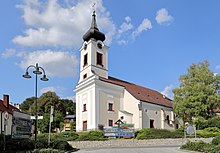
- Catholic parish church Alland Sts. Georg and Margareta: The original parish of the Vienna Woods hides a legendary tombstone, which shows the image of a dog lying on its back from which a lily grows.
- Pilgrimage church Maria Raisenmarkt
- The Allander Rundwanderweg - with its numerous wayside shrines and martyrs - is equipped with many information boards about the historical background.
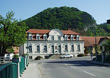
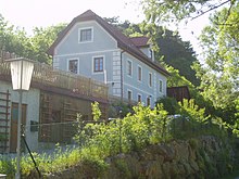
- The Babenbergerhaus, Alland No. 33 (probably that was the dairy) and the manor house of the Babenberger, No. 32 - Friedrich I of Baden , the son of Hermann VI, was born here. von Baden and Gertrud von Babenberg , the niece of Duke Frederick the Warrior of Austria, the last ruler of the Babenberg family, born in 1249. Right next to it is the
- Bridge over the Schwechat from 1745, and that
- Schlucker monument in the community park opposite the pharmacy reminds of the poor Schlucker .
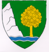
- Alland stalactite cave in Buchberg (the Alland coat of arms) with the skeleton of a 10,000 year old bear.
- The plague column with the mass grave of plague victims on Wagenhofstrasse (see also: History of Alland ).
- The Turkish hazel - a natural monument and also Alland's coat of arms - is evidence of a slaughter of the population. The approx. 450 year old tree is on Weißenweg.
- The old forest office is right next to it.
- The historic building of the former lung sanatorium (1896: hospital for breast patients ) - now the rehabilitation center of the pension insurance institution - in Groisbach .
- The Mayerling Castle in Mayerling.
traffic
- By car via the Allander Autobahn (Wiener Außenring Autobahn, A 21) from the west and south autobahns (approx. 20 minutes from Vienna), on federal and state roads from Mödling , Baden , Altenmarkt im Triestingtal and Klausen-Leopoldsdorf.
- There are bus connections from all of the cities mentioned and a stop for the Wieselbus .
- For hikers and trekkers there are long-distance hiking trails to Alland: Via Sacra , Beethoven long-distance hiking trail , Wegerl im Helenental , Niederösterreichische Barockstraße.
economy
- Agriculture and Forestry
Agriculture was very important, but it is declining. In 1980 there were 105 farms, in 1990 there were only 99 farms and this number is falling. There are only 13 full-time farmers left, while there are still 76 part-time farmers. Following the latest trends, farmers are increasingly relying on horses and riding, trying to set up a network of bridle paths and some of them are practicing organic farming. The yard sale has gained in importance in recent years.
The long forestry tradition goes back to the Babenbergs. A forestry office was first mentioned in 1396, where the Vienna Woods were divided into several forestry offices. Around 1500 the forestry of the area of the Vienna Woods was reorganized and five "Waldereiturigen" were divided into Klosterneuburg , Breitenfurt , Purkersdorf , Wiener Neustadt and Alland. The "Waldamt Alland" was built around 1700 and served the forest administration as a place of work until 1997. The Forestry Office has been closed since 1997 and the Allander Bundesforste are administered from Breitenfurt.
There are no cooperatives in Alland. There is the agricultural community of Allander Urhausowners , which has 27 members. The Untermeierhof agricultural community has five members.
- Banks, post office
There has been a Post Office Savings Bank in Alland since 1883. Since the branch was closed in October 2010, there has been a “Post Partner” branch on the main square.
There are two financial institutions in Alland: the Volksbank and the Raiffeisenkasse . The Raiffeisenkasse Alland (branch of the Raiffeisenkasse Guntramsdorf since 1991 ) has existed since 1894, the Volksbank since 1962.
- Trade, industry, doctors
Basically, the municipality of Alland has always been oriented towards agriculture and forestry. Nevertheless, there have been various trades in history that have disappeared again. For example the glassworks and cement production, the lime kilns, the mills and the forges.
Not only in Alland, but also in Maria Raisenmarkt there was a sawmill and in Maria Raisenmarkt there was also a stick production facility. In the past, gypsum and coal were mined, but without sustainable success.
Today (2002) 68 small and very small businesses present themselves in Alland. The most important are:
- The two state operations road maintenance and bridge maintenance in Alland look after the A 21, the state roads in the municipality and the bridges to Schwechat (approx. 75 employees).
- The sanatorium rehabilitation center Alland - formerly tuberculosis or lung sanatorium - in Groisbach of the pension insurance institution (approx. 100 employees).
There is no industrial enterprise in the municipality of Alland.
- gastronomy
Around 1950 there were 19 inns in Alland, today there are still 13 restaurants, some of which rent out rooms. By far the most popular is the motorway service station on the A 21 Vienna outer ring motorway, which was opened in 1991.
Alland has been part of the tourist municipality category since 1972. There are a total of ten room landlords, two of which are private room landlords, one bed and breakfast and one vacation on the farm .
The occupancy rate is mainly in summer due to the season, but relatively low at 20%. The number of overnight stays in the community is increased by the values of the war victims' home in Helenental with 108 beds and the Franciscan convalescent home in Mayerling. In these homes, an occupancy rate of almost 50% is achieved.
Statistically, about 30,000 overnight stays are counted in Alland per year.
Nevertheless, most of the visitors to Alland are day-trippers, bikers and vintage car fans who visit the hilly, winding roads and the twelve marked hiking trails, the cultural hiking trail to Baden, the Beethoven long-distance hiking trail or the Wegerl in Helenental . In addition to the internationally known cultural sites in Mayerling, the stalactite caves in Alland's Buchberg are particularly attractive for guests .
The Via Sacra , the Holy Road , an old pilgrimage route to Mariazell , is of increasing importance . The communities of Alland, Altenmarkt an der Triesting, Gaaden, Heiligenkreuz and Kaumberg have merged and revitalized the Via Sacra . An event calendar is regularly published and a series of concerts is organized.
Clubs, sports, events
- The Schwechat is a popular sport fishing area and offers several bathing areas both in Alland and in the Helenental.
- Festsaal der Gemeinde Alland (err. 1988) - offers space for around 120 people and is used for exhibitions, lectures, concerts, the Advent market and theater performances.
- Football club SC Alland: The football club was founded in 1947 and plays in the 2nd class Triestingtal championship and particularly promotes youth work. The club colors are green and white due to the good connection between the founders and SK Rapid Wien . The best placements of the club in 1977 and 1991 were the championship title in the 2nd class East Central. In 2009 a U-23, a U-16, a U-12, a U-10 and a U-8 play alongside the combat team . The SC Alland football field has a main field and a training field.
- Six riding stables in Glashütten, Alland, Maria Raisenmarkt and Zobelhof.
- Tennis court at Marienhof (formerly Hotel-Restaurant “Hanner”) in Mayerling.
- Sauna Alland in the basement of the main school Alland.
- There are four choirs in Alland.
- Voluntary fire brigades in Alland, Groisbach and Maria Raisenmarkt.
- Red Cross Alland - Rescue Service
Church, schools, kindergarten
According to tradition, there was already a wooden church in Alland in the 8th century, which was built in stone in the 11th century. The current church is a three-aisled hall church with late Gothic shapes, consecrated to St. George and St. Margaret. Alland is one of the three original parishes of the southeastern Vienna Woods , together with Mödling and Traiskirchen . Alland is older than Heiligenkreuz Abbey , which it acquired soon after 1133. In 1253 the monastery had the right of patronage over the parish of Alland, and in 1380 it was incorporated into the monastery. At that time the north nave and choir were being built. The southern ship was added around 1500. 1529/1683 were destroyed as a result of the Ottoman burglaries .
There has been a school in Alland since 1726.
- Alland secondary school (built in 1973): The school district includes the communities of Alland, Heiligenkreuz and Klausen-Leopoldsdorf . Occasionally, the Alland secondary school is attended by pupils from the communities of Gaaden, Altenmarkt an der Triesting or Altlengbach. An indoor swimming pool was opened in the building of the secondary school in 1980, which was completely destroyed by the devastating flood in July 1997. Since the lack of space in the secondary school was very acute, the premises of the former indoor pool in the basement were converted into classrooms. The plan meant huge savings for the school community. In 2002, 165 students attended the school and were taught by 16 teachers in eight classes.
- The elementary school Alland was (built in 1902) destroyed during the war, rebuilt in 1950 and expanded in 1995 with a modern gym. In 2010, 82 pupils were taught by five teachers in four classes in the primary school and the music school is housed.
- The kindergarten in Alland is a private foundation of Baron Max von Vittinghoff-Schell , who spent his youth in Glashütten , and his wife Countess Maria Belcredi on the occasion of the 40th anniversary of the reign of Emperor Franz Josef. In 1889, the Sisters of Charity of Saint Vincent de Paul , who were entrusted with running the kindergarten, started running it until 1999. Since then, it has been run as a state kindergarten . In 2003 the new building of the Nö. State kindergarten on the historic site ended and put into operation.
Personalities
- Philipp Schlucker (1748–1820), "Waldamts Baumeister", the poor Schlucker .
- Leopold Schrötter von Kristelli (1837–1908), doctor and social medicine specialist , founded the world's first laryngological clinic and the Alland pulmonary hospital.
literature
- Erich Dorffner, Christl Dorffner: All sorts of things about Alland. A colorful foray through the past and present of the Wienerwald community . Self-published, Alland 1989, ISBN 3-900724-00-8 .
gallery
Web links
- 30601 - Alland. Community data, Statistics Austria .
- Old views of Alland and the surrounding area
- The state parliament resolution on the Allands market community survey in the original Word format
Individual evidence
- ↑ Statistics Austria: Population on January 1st, 2020 by locality (area status on January 1st, 2020) , ( CSV )
- ^ Correspondences. Alland. The same festival of the sanatorium for breast patients .. In: Badener Bezirks-Blatt , October 28, 1896, p. 4 (Online at ANNO ).
- ^ Choirs and ensembles in the Baden district, Alland
- ↑ Dehio, Lower Austria south of the Danube , (Horn 2003), pp. 20-25.
- ↑ Maximilian von Vittinghoff-Schell on the ÖCV portal from July 1, 2013, accessed on November 1, 2018.


