
Mitterndorf an der Fischa
|
Mitterndorf an der Fischa
|
||
|---|---|---|
| coat of arms | Austria map | |
 |
|
|
| Basic data | ||
| Country: | Austria | |
| State : | Lower Austria | |
| Political District : | to bathe | |
| License plate : | BN | |
| Surface: | 10.78 km² | |
| Coordinates : | 48 ° 0 ′ N , 16 ° 28 ′ E | |
| Height : | 186 m above sea level A. | |
| Residents : | 2,889 (January 1, 2020) | |
| Population density : | 268 inhabitants per km² | |
| Postcodes : | 2440, 2441 | |
| Area code : | 02234 | |
| Community code : | 3 06 21 | |
| NUTS region | AT127 | |
| Address of the municipal administration: |
Hauptstrasse 21 2441 Mitterndorf ad Fischa |
|
| Website: | ||
| politics | ||
| Mayor : | Thomas Jechne ( SPÖ ) | |
|
Municipal Council : ( 2020 ) (21 members) |
||
| Location of Mitterndorf an der Fischa in the Baden district | ||
  |
||

|
||
| Source: Municipal data from Statistics Austria | ||

|
Mitterndorf an der Fischa ( village ) locality ( capital of the municipality ) cadastral municipality Mitterndorf an der Fischa |
|
|---|---|
| Basic data | |
| Pole. District , state | Baden (BN), Lower Austria |
| Judicial district | Ebreichsdorf |
| Pole. local community | Mitterndorf an der Fischa |
| Coordinates | 47 ° 59 ′ 51 ″ N , 16 ° 28 ′ 14 ″ E |
| height | 186 m above sea level A. |
| Residents of the village | 2889 (January 1, 2020) |
| Building status | 500 (2013, addresses, approx.) |
| Area d. KG | 107.69 km² |
| Post Code | 2441 Mitterndorf an der Fischa |
| Statistical identification | |
| Locality code | 03400 |
| Cadastral parish number | 04104 |
| Districts in Gramatneusiedl , Moosbrunn (district Bruck an der Leitha) Source: STAT : Local directory ; BEV : GEONAM ; NÖGIS |
|
| Mitterndorf an der Fischa ( village ) | |
|---|---|
| Basic data | |
| Pole. District , state | Baden (BN (old: WU)), Lower Austria |
| Judicial district | Schwechat |
| Pole. local community | Gramatneusiedl |
| Coordinates (K) | 48 ° 0 ′ 3 " N , 16 ° 28 ′ 16" E |
| Building status | 65 (2013, addresses, approx.) |
| Post Code | 2441 Mitterndorf an der Fischa |
| Statistical identification | |
| Counting district / district | Gramatneusiedl (32405 000) |
| Districts in the municipality of Mitterndorf (Baden district) and Moosbrunn Source: STAT : Local directory ; BEV : GEONAM ; NÖGIS ;
(K) Coordinate not official
|
|
| Mitterndorfsiedlung ( settlement ) | |
|---|---|
| Basic data | |
| Pole. District , state | Bruck an der Leitha (BL (old: WU)), Lower Austria |
| Judicial district | Schwechat |
| Pole. local community | Moosbrunn |
| Coordinates | 48 ° 0 ′ 4 " N , 16 ° 28 ′ 13" E |
| Building status | 65 (2013, addresses, approx.) |
| Post Code | 2441 Mitterndorf an der Fischa |
| Statistical identification | |
| Counting district / district | Moosbrunn (32413 000) |
| Place in the municipality of Mitterndorf (Baden district) and Gramatneusiedl Source: STAT : Directory of places ; BEV : GEONAM ; NÖGIS |
|
Mitterndorf an der Fischa is a municipality in the Baden district in Lower Austria , with 2889 inhabitants (as of January 1, 2020).
geography
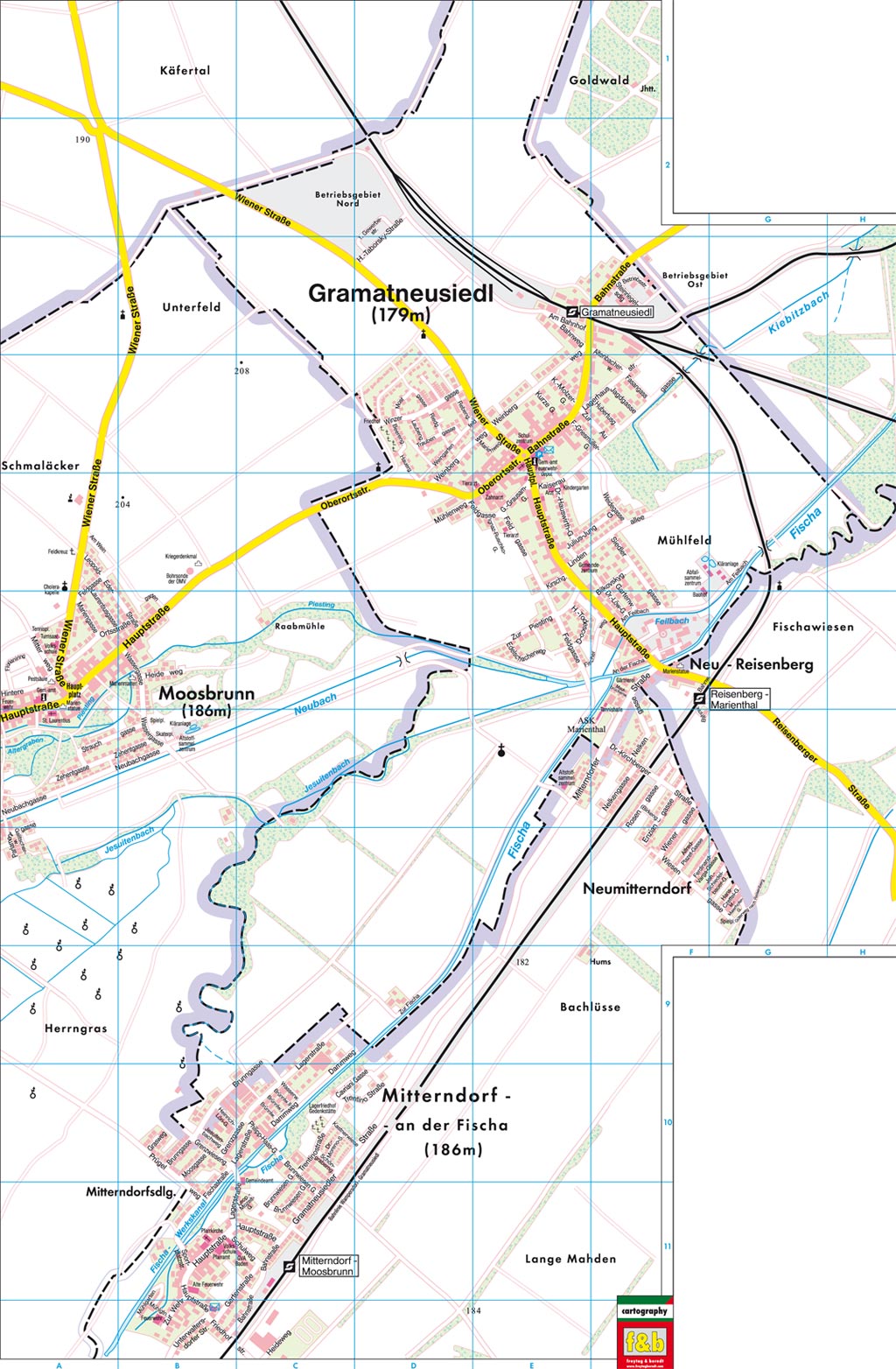
The village of Mitterndorf an der Fischa has grown together with the Mitterndorfsiedlung , which belongs to Moosbrunn , so that the municipal boundary runs through the common settlement area. A district of the municipality of Gramatneusiedl , which already belongs to the Bruck an der Leitha district, is part of the common settlement area and is also called Mitterndorf an der Fischa . On the other hand, the Neumitterndorf settlement , which belongs to the Mitterndorf an der Fischa community, is directly connected to the Gramatneusiedl settlement area.
The municipality of Mitterndorf an der Fischa is located in the Baden district, in south-east Lower Austria, around 20 kilometers south-east of the Vienna city limits.
Mitterndorf an der Fischa has a community area of around 10.77 km² , 4.27% of which is forest. As the name of the place suggests, the Fischa River flows through the village .
The place is in the Mitterndorfer Senke , a sand gravel trough sunk to a depth of 150 m in a very young (Ice Age) fracture system in the Vienna Basin , which runs in a south-west-north-east direction from the Neunkirchen area via Wiener Neustadt, Ebreichsdorf, Mitterndorf to Fischamend and represents an important groundwater reservoir .

The Fischa

A nutria in the Fischa


Community structure
The only cadastral municipality and locality is Mitterndorf an der Fischa .
The only other place is the Neumitterndorf settlement in the north, which already borders on Gramatneusiedl and Neu-Reisenberg (municipality of Reisenberg ).
|
structure
|
||||||
|
Legend for the breakdown table
|
Neighboring communities
| Moosbrunn ( district Bruck an der Leitha ) | Gramatneusiedl ( Bruck an der Leitha district ) | |
.svg)
|
Reisenberg ( Baden district ) | |
| Ebreichsdorf ( district of Baden ) |
Main town Mitterndorf an der Fischa with Mitterndorfsiedlung
The main town of the municipality, the village of Mitterndorf an der Fischa , is located on the municipality border. The districts in the northwest - also classified as a village - belong to the municipality of Gramatneusiedl . The Mitterndorfsiedlung in the west lies in the municipality of Moosbrunn . Mitterndorf is one of the few places in Austria that is located in three municipalities , and is also spread over two political districts. As a result, settlement in legal matters also falls into two judicial districts , Baden for Mitterndorf, and Schwechat for the other two communities.
The main part of the village is located to the right (east) of the Fischa, but a few houses on the left bank also belong to the Mitterndorfer municipality. The municipal boundaries run through the village in such a way that even streets are divided ( Lagerstraße Mitterndorf and Gramatneusiedl, Brunngasse Gramatneusiedl and Moosbrunn - the former are even in two districts). In total, the place has around 650 addresses, of which the majority in the Mitterndorf community, around 70 properties in the Gramatneusiedler area, and around the same number in the Moosbrunn Mitterndorfsiedlung (as of 2013). The common postcode of the entire settlement unit is 2441 Mitterndorf an der Fischa .
The place has been growing steadily in all three communities over the past few years.
history

Mitterndorf an der Fischa was first mentioned in a document in 1160 as "mittendorf", where a certain Luitpold is named as the landlord.
The foundation of this settlement probably goes back to the Babenbergs. In the following centuries Mitterndorf was alternately deserted, extinct or devastated. The owners of the estate changed frequently in the beginning.
The topographer Franz Schweickhardt suspected in 1831 that the name was given to the place because "it is located in the middle of a large area and is, so to speak, enclosed on all sides by villages."
In 1325 a chapel was donated by the rulers, first as a branch church of the Unterwaltersdorf parish, from 1407 as a separate parish church. In 1505 Mitterndorf and its parish were reintegrated into the Unterwaltersdorf rulership.
From 1613 until the abolition of the manorial power in 1848, Mitterndorf was owned by the Cavriani family. Named after the castle of the Cavriani family in Unterwaltersdorf, Mitterndorf was given the nickname "Schöngrabern" in order to document that Mitterndorf belonged to the manor. The black and silver family coat of arms of the Cavriani still forms the background of the coat of arms of Mitterndorf today.
In 1773 Mitterndorf becomes an independent parish again. The church consecrated to St. Catherine will be fundamentally renovated and will get its current appearance.
In the first half of the 19th century the industrialization of the place began with the establishment of a damask weaving mill on the Fischa. In the 1990s the last factories are closed for good.
In 1871 the railway line from Gramatneusiedl to Wiener Neustadt and the Mitterndorf-Moosbrunn station on the route are opened as part of the "Pottendorfer Line".

During the First World War, war refugees are housed in a disused factory in Mitterndorf. In the following months, a barracks camp was set up, temporarily accommodating up to 13,000 people - mainly from Italian-speaking Welschtirol (Trentino). In 1919 the barrack camp was closed again.
In 1917 the place got the official name "Mitterndorf an der Fischa".
In 1938 the city of Vienna is enlarged to the municipal boundary of Mitterndorf under the name "Greater Vienna". The neighboring communities of Moosbrunn and Gramatneusiedl were part of the newly founded 23rd district of Vienna until 1945.
At the end of the 1930s, the Neu-Mitterndorf district was built.
In 1943, during a training flight, two double-deckers collide over Mitterndorf and crash into the tobacco shop. There are several dead.
In 1982 Mitterndorf an der Fischa was awarded its own coat of arms: "A shield that is divided three times from silver to black and covered with a gold band on a black shuttle."
In 1998 a memorial was built on the site of the former cemetery of the barracks camp.

In 2011 the community center will be built right next to the church - consisting of the community office, cultural hall, doctor's office and Café Trentino.
The town, which has expanded significantly in the north-east and south-west direction in recent years, has around 2,700 inhabitants as of 2019 and today presents itself as a modern, yet rural town on the outskirts of Vienna.
Population development
| census | Residents |
|---|---|
| 2011 | 2.113 |
| 2001 | 1,448 |
| 1991 | 1,055 |
| 1981 | 893 |
| 1971 | 863 |
Source: Population development of Mitterndorf an der Fischa. (PDF) Statistics Austria
Culture and sights
.JPG)
- Catholic parish church Mitterndorf an der Fischa hl. Catherine
- Automobil- und Motorradmuseum Austria: The museum shows the history of motorization in five halls, from the beginnings to the present, using over 200 vehicles, from bicycles to stock buses, etc. a. also the oldest surviving Steyr automobile and numerous film props. The automobile museum is located in the district of Mitterndorf an der Fischa, which belongs to Gramatneusiedl.
- The song "We stand up (Mitterndorf)" is about the town of Mitterndorf an der Fischa. The five stanzas tell of geography, old and young history, the present and customs. The refrain tells about the people in Mitterndorf. In addition to the classic song version, there is also a dance remix.
politics

- Mayor is Thomas Jechne.
- Municipal council: In the last municipal council elections in 2015 , 2025 citizens were entitled to vote. The SPÖ got 705 votes, or 59.54% and thus 13 seats. The ÖVP list received 194 votes, that is 16.39% of all valid votes and thus three seats. The Pro Mitterndorf citizen list also achieved three seats with 168 votes (14.19%). The FPÖ received two mandates with 117 votes, equivalent to 9.88% of the valid votes.
coat of arms
Community partnerships
-
Vallarsa , Italy . In the First World War, a part of the population was out of time to Austria-Hungary belonging Trentino community in the refugee camp Mitterndorf housed.

Personalities
- Franz Hums (1937–2015), politician
photos

Automobile museum

The mansion
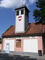
The old fire station (today friends of children)
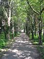
Alley at the cemetery


Josephine land recordings
- Mitterndorf an der Fischa and its surroundings around 1873 (record sheets of the state survey )

Mitterndorf an der Fischa is shown at the bottom left of the map

Mitterndorf an der Fischa is shown on the top left of the map


Web links
- Community website
- Entry on Mitterndorf an der Fischa in the Austria Forum (in the AEIOU Austria Lexicon )
- 30621 - Mitterndorf an der Fischa. Community data, Statistics Austria .
Individual evidence
- ↑ 32405 - Gramatneusiedl. Community data, Statistics Austria .
- ↑ 32413 - Moosbrunn, Germany. Community data, Statistics Austria .
- ↑ compare the local map of Gramatneusiedl (jpg, gramatneusiedl.at), which is already clearly out of date.
- ↑ We stand up (Mitterndorf) , on YouTube
- ↑ We stand up (Mitterndorf) Dance Remix , on YouTube
- ^ Election results for the 2015 municipal council election in Mitterndorf an der Fischa. Office of the Lower Austrian State Government, December 1, 2015, accessed on March 3, 2019 .

Alland | Altenmarkt an der Triesting | Bad Vöslau | Bathing | Berndorf | Blumau-Neurißhof | Ebreichsdorf | Enzesfeld-Lindabrunn | Furth an der Triesting | Günselsdorf | Heiligenkreuz | Hernstein | Hirtenberg | Klausen-Leopoldsdorf | Kottingbrunn | Leobersdorf | Mitterndorf an der Fischa | Oberwaltersdorf | Pfaffstätten | Pottendorf | Pottenstein | Reisenberg | Schönau an der Triesting | Seibersdorf | Sooss | Tattendorf | Teesdorf | Traiskirchen | Trumau | Weissenbach an der Triesting

Cadastral municipality and locality: Gramatneusiedl
Market place: Gramatneusiedl | Village: Mitterndorf an der Fischa | Other locations: Marienthal
Counting district: Gramatneusiedl-Nord | Gramatneusiedl-Süd

Cadastral municipality and locality: Moosbrunn
Village: Moosbrunn | Settlement: Mitterndorfsiedlung
Counting district: Moosbrunn