
Gramatneusiedl
|
market community Gramatneusiedl
|
||
|---|---|---|
| coat of arms | Austria map | |
 |
|
|
| Basic data | ||
| Country: | Austria | |
| State : | Lower Austria | |
| Political District : | Bruck an der Leitha | |
| License plate : | BL (since 2017; old: WU) | |
| Surface: | 6.73 km² | |
| Coordinates : | 48 ° 1 ' N , 16 ° 30' E | |
| Height : | 179 m above sea level A. | |
| Residents : | 3,612 (January 1, 2020) | |
| Postcodes : | 2440, 2441 | |
| Area code : | 02234 | |
| Community code : | 3 07 31 | |
| NUTS region | AT127 | |
| UN / LOCODE | AT GRL | |
| Address of the municipal administration: |
Bahnstrasse 2a 2440 Gramatneusiedl |
|
| Website: | ||
| politics | ||
| mayor | Thomas Schwab ( SPÖ ) | |
|
Municipal Council : ( 2020 ) (21 members) |
||
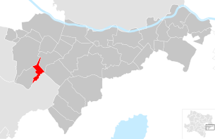
| Location of Gramatneusiedl in the Bruck an der Leitha district | ||
  |
||
| Source: Municipal data from Statistics Austria | ||

Gramatneusiedl is a market town with 3612 inhabitants (as of January 1, 2020) in the Bruck an der Leitha district in Lower Austria .
geography
Gramatneusiedl is located in the industrial district in Lower Austria south of Vienna on the Fischa in the Vienna Basin . The area of the market town covers 6.73 square kilometers, three percent of the area is forested.
Community structure
The only cadastral community and locality is Gramatneusiedl . The only other place is Mitterndorf an der Fischa in the far south, which has grown together with the municipality of the same name Mitterndorf an der Fischa .
Counting districts of the community are Gramatneusiedl-Nord (Gramatneusiedl) and Gramatneusiedl-Süd (locations along Bahnhofstrasse , Marienthal and Mitterndorf).
Neighboring communities
- and places
|
|
Ebergassing | |
.svg)
|
||
| Moosbrunn |
Mitterndorf an der Fischa (district of Gramatneusiedl, and district of Mitterndorf adFischa, district of Baden ) |
Neu-Reisenberg (Gem. Reisenberg ) |
history

In ancient times the area was part of the province of Pannonia . In 1120 the place is first mentioned in a document Gezenniusidelen .
Until around 1520, Gramatneusiedl was owned by several ruling families (Laaer, Ebersdorfer, Ladendorfer), the Viennese patrician family Tirna and, since 1398, also the Metropolitan Chapter (Vienna Cathedral Chapter) of Sankt Stephan. From 1520 to 1840 the rule of Gramatneusiedl is in the sole possession of the metropolitan chapter in Vienna, with the exception of 1621 to 1668 (Bonacina, since 1642 Hartmann V. Prince of Lichtenstein ). The place is devastated by the two Turkish Wars in 1529 and 1683 and by the Kuruzzen in 1704 .
In 1751 the old shop mill was renewed by Ignaz Osmann, who had a second mill (Theresienmühle) built from 1771–1774. From 1820 this Theresienmühle was expanded into the first Marienthal textile factory . In 1846 the railway line Vienna - Bruck an der Leitha (today Ostbahn ) is put into operation.
In 1840 the community bought the manor from the Vienna Cathedral Chapter for 60,000 guilders and has since called itself "Free Community Gramatneusiedl". After Austria was annexed to the Third Reich in 1938, the place was incorporated into Greater Vienna as part of the newly created 23rd district of Schwechat . The municipality became independent again in 1954 when it separated from Vienna.
In 1995 the place was raised to a market town.
From 1954 until its dissolution on January 1, 2017, Gramatneusiedl was part of the Vienna area .
Population development
According to the results of the 2001 census , there were 2243 inhabitants. In 1991 the market town had 2176 inhabitants, in 1981 2071 and in 1971 2048 inhabitants.
Culture and sights


- Catholic parish church Gramatneusiedl Hll. Peter and Paul
- Marienthal : Historic workers' settlement. In the Marienthal workers' settlement, the sociologists Marie Jahoda , Paul Felix Lazarsfeld and Hans Zeisel examined the consequences of unemployment. Her research work " The Unemployed von Marienthal " was published in 1933 and is today considered a milestone in sociology.
- Oldtimermuseum Gramatneusiedl: on approximately 12,000 m² automobile, sports and exclusive car exhibition etc.
Economy and Infrastructure
In 2001 there were 87 non-agricultural workplaces, agricultural and forestry operations 20 according to the 1999 survey. According to the 2001 census, the number of people in employment at the place of residence was 1041. In 2001, the employment rate was 47 percent.
traffic
- Rail: The place is on the Ostbahn and is therefore connected to both Vienna and Bruck an der Leitha . At the Gramatneusiedl station , the connection to Wiener Neustadt branches off via Pottendorf . The route was discontinued for passenger traffic a few years ago. Only freight trains run now.
- Road: The road connection to Vienna runs via Mannersdorfer Straße B 15, which passes three kilometers northeast of the village.
- Factory traffic: A regular shuttle bus runs between the train station and Seibersdorf .
politics
Mayor of the market town is Thomas Schwab.
In the market town council there are a total of 21 seats after the municipal elections of 26 January 2020 the following distribution of seats:
Personalities
- Josef Bilkovsky (1871–1940), weaver and mayor
- Hans Fryba (1899–1986), composer and double bass virtuoso
- Klaus Soukup (* 1936), bank clerk and mayor
Web links
- 30731 - Gramatneusiedl. Community data, Statistics Austria .
- Entry on Gramatneusiedl in the Austria Forum (in the AEIOU Austria Lexicon )
- Community website
Individual evidence
- ↑ Gramatneusiedl's first documentary mention in four documents, issued by Ulrich von Hoeft, Bishop of Passau since 1092 , agso.uni-graz.at
- ↑ Small chronicle of Gramatneusiedl, Marienthal and Neu-Reisenberg , agso.uni-graz.at
- ↑ Statistics Austria: dissolutions or associations of municipalities from 1945

Au am Leithaberge | Bad Deutsch-Altenburg | Mountain | Bruck an der Leitha | Ebergassing | Enzersdorf an der Fischa | Fischamend | Göttlesbrunn-Arbesthal | Götzendorf an der Leitha | Gramatneusiedl | Hainburg an der Donau | Haslau-Maria Ellend | Himberg | Hof am Leithaberge | Höflein | Hundsheim | Klein-Neusiedl | Lanzendorf | Leopoldsdorf | Mannersdorf am Leithagebirge | Maria-Lanzendorf | Moosbrunn | Petronell-Carnuntum | Prellenkirchen | Rauchwarth | Rohrau | Scharndorf | Schwadorf | Schwechat | Summer one | Trautmannsdorf an der Leitha | Wolfsthal | Twelve axing
Cadastral municipality and locality: Gramatneusiedl
Market place: Gramatneusiedl | Village: Mitterndorf an der Fischa | Other locations: Marienthal
Counting district: Gramatneusiedl-Nord | Gramatneusiedl-Süd