
Rauchwarth
|
Rauchwarth
|
||
|---|---|---|
| coat of arms | Austria map | |
 |
|
|
| Basic data | ||
| Country: | Austria | |
| State : | Lower Austria | |
| Political District : | Bruck an der Leitha | |
| License plate : | BL (since 2017; old: WU) | |
| Surface: | 13.49 km² | |
| Coordinates : | 48 ° 5 ' N , 16 ° 32' E | |
| Height : | 206 m above sea level A. | |
| Residents : | 772 (January 1, 2020) | |
| Postal code : | 2320 | |
| Area code : | 02230 | |
| Community code : | 3 07 38 | |
| NUTS region | AT127 | |
| Address of the municipal administration: |
Kirchenplatz 1 2320 Rauchwarth |
|
| Website: | ||
| politics | ||
| Mayor : | Ernst Schüller ( ÖVP ) | |
|
Municipal Council : ( 2020 ) (15 members) |
||
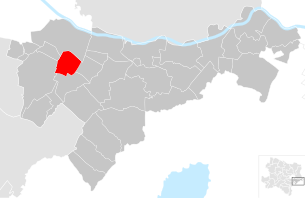
| Location of Rauchwarth in the Bruck an der Leitha district | ||
  |
||
 The municipal office of Rauchwarth |
||
| Source: Municipal data from Statistics Austria | ||

Rauchwarth is a municipality with 772 inhabitants (as of January 1, 2020) in the district of Bruck an der Leitha in Lower Austria .
geography
Rauchwarth is located in the industrial district in Lower Austria. The area of the municipality covers 13.49 square kilometers, around three percent of the area is forested.
There are no other cadastral communities apart from Rauchwarth.
history
In ancient times the area was part of the province of Pannonia . In a deed of sale from 1493 it was attested that Wolfgang Grastenwerder zu Obergassling sold the village to the St. Dorothea Abbey .
After the connection of Austria to the Third Reich in 1938, the town was part of the newly created District 23 Schwechat Greater Vienna incorporated. The municipality became independent again in 1954 when it separated from Vienna.
From 1954 until its dissolution on January 1, 2017, Rauchwarth was part of the Vienna-Umgebung district .
Population development

politics
The mayor of the community is Ernst Schüller. After the 2020 municipal council elections, there will be the following distribution of mandates in the municipal council:
- ÖVP 11
- SPÖ 4
Culture and sights

In 1652 a spring rises in a forest west of the village, the water of which was said to have healing properties. In the years that followed, it became a place of pilgrimage. A chapel was built on site in 1718 and a church in 1772.
Economy and Infrastructure
In 2001 there were 21 non-agricultural workplaces, and according to the 1999 survey there were 38 in agriculture and forestry. The number of people in work at home was 287 according to the 2001 census. In 2001, the employment rate was 48.5 percent.
sons and daughters of the town
- Josef Pflug (1869–1937), politician (CSP) and farmer
Web links
- 30738 - Rauchwarth. Community data, Statistics Austria .

Au am Leithaberge | Bad Deutsch-Altenburg | Mountain | Bruck an der Leitha | Ebergassing | Enzersdorf an der Fischa | Fischamend | Göttlesbrunn-Arbesthal | Götzendorf an der Leitha | Gramatneusiedl | Hainburg an der Donau | Haslau-Maria Ellend | Himberg | Hof am Leithaberge | Höflein | Hundsheim | Klein-Neusiedl | Lanzendorf | Leopoldsdorf | Mannersdorf am Leithagebirge | Maria-Lanzendorf | Moosbrunn | Petronell-Carnuntum | Prellenkirchen | Rauchwarth | Rohrau | Scharndorf | Schwadorf | Schwechat | Summer one | Trautmannsdorf an der Leitha | Wolfsthal | Twelve axing